Oceanographic Time Series Data: Northeast Atlantic Outer Continental Shelf, Gulf of Maine and Georges Bank Marine Sanctuary

Metadata also available as - [Outline] - [Parseable text] - [XML]

Frequently anticipated questions:


What does this data set describe?

Title:
Oceanographic Time Series Data: Northeast Atlantic Outer Continental Shelf, Gulf of Maine and Georges Bank Marine Sanctuary
Abstract:
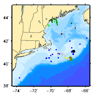
Time-series oceanographic data for the Northeast Atlantic outer continental shelf, Gulf of Maine and Georges Bank collected by the U.S. Geological Survey (USGS) or used in conjunction with USGS projects. These data are stored as NetCDF files using conventions developed by National Oceanic and Atmospheric Administration (NOAA) Pacific Marine Environmental Laboratory (PMEL) lab to be compatible with their EPIC system.
Variables present in the files include: ocean current, temperature, pressure, conductivity, light transmission (beam attenuation) and others.
Supplemental_Information:
Available data sets for the Gulf of Maine region: * Argo Merchant Experiment (Mar-Apr 1977) * Ecology of Harmful Algal Blooms I (ECOHAB) (Mar-Sep 1993 and 1994) * Ecology of Harmful Algal Blooms II (ECOHAB) (Mar-Sep 1998 and 2000) * Georges Bank (May 1975- Sep 1984) * GLOBEC Georges Bank (Mar-Aug 1999) * GLOBEC Great South Channel (Jan-Aug 1997) * Gulf of Maine (Jul 1975 - Feb 1987) * Lydonia Canyon (Oct 1980 - Nov 1982) * Oceanographer Canyon (Jan 1982 - Jul 1982)
  1. How might this data set be cited?
    U.S. Geological Survey (USGS), 2007, Oceanographic Time Series Data: Northeast Atlantic Outer Continental Shelf, Gulf of Maine and Georges Bank Marine Sanctuary.

    Online Links:

    Other_Citation_Details:
    The work is attributed to U.S. Geological Survey (USGS) / Woods Hole Science Center (WHSC) investigator.
  2. What geographic area does the data set cover?
    West_Bounding_Coordinate: -71.31
    East_Bounding_Coordinate: -66.74
    North_Bounding_Coordinate: 47.67
    South_Bounding_Coordinate: 42.85
  3. What does it look like?
    https://stellwagen.er.usgs.gov/graphics/Gulf_maine.gif (GIF)
    Map showing mooring locations for the Gulf of Maine Region
  4. Does the data set describe conditions during a particular time period?
    Beginning_Date: 1975
    Ending_Date: 2000
    Currentness_Reference:
    ground condition
  5. What is the general form of this data set?
  6. How does the data set represent geographic features?
    1. How are geographic features stored in the data set?
    2. What coordinate system is used to represent geographic features?
  7. How does the data set describe geographic features?

Who produced the data set?

  1. Who are the originators of the data set? (may include formal authors, digital compilers, and editors)
    • U.S. Geological Survey (USGS)
  2. Who also contributed to the data set?
  3. To whom should users address questions about the data?
    ELLYN T. MONTGOMERY
    U.S. Geological Survey
    TECHNICAL CONTACT
    384 Woods Hole Rd
    Woods Hole, MA
    USA

    508-548-8700 x2356 (voice)
    508-457-2310 (FAX)
    emontgomery@usgs.gov

Why was the data set created?

To describe and quantify oceanographic processes and how they effect sediment transport and biologic productivity

How was the data set created?

  1. From what previous works were the data drawn?
  2. How were the data generated, processed, and modified?
    Date: 31-Jan-2019 (process 1 of 3)
    Fixed broken links. Linked to the stellwagen experiments page instead of to the DoDs server (original link http://stellwagen.er.usgs.gov/cgi-bin/nph-dods/DATAFILES/ was broken). Person who carried out this activity:
    U.S. Geological Survey
    Attn: VeeAnn A. Cross
    Marine Geologist
    384 Woods Hole Road
    Woods Hole, MA

    508-548-8700 x2251 (voice)
    508-457-2310 (FAX)
    vatnipp@usgs.gov
    Date: 27-Nov-2019 (process 2 of 3)
    Added USGS Thesaurus terms. Fixed errors flagged by MP - logical consistency and completeness report. Updated metadata date. Person who carried out this activity:
    U.S. Geological Survey
    Attn: VeeAnn A. Cross
    Marine Geologist
    384 Woods Hole Road
    Woods Hole, MA

    508-548-8700 x2251 (voice)
    508-457-2310 (FAX)
    vatnipp@usgs.gov
    Date: 30-Sep-2021 (process 3 of 3)
    Added keywords section with USGS persistent identifier as theme keyword, 2020908. Modified the originator from U.S. Geological Survey (USGS) / Woods Hole Science Center (WHSC) investigators to U.S. Geological Survey and placed the original information in other citation details, 20210930. Person who carried out this activity:
    U.S. Geological Survey
    Attn: VeeAnn A. Cross
    Marine Geologist
    384 Woods Hole Road
    Woods Hole, MA

    508-548-8700 x2251 (voice)
    508-457-2310 (FAX)
    vatnipp@usgs.gov
  3. What similar or related data should the user be aware of?

How reliable are the data; what problems remain in the data set?

  1. How well have the observations been checked?
  2. How accurate are the geographic locations?
  3. How accurate are the heights or depths?
  4. Where are the gaps in the data? What is missing?
    Information not available from original data record.
  5. How consistent are the relationships among the observations, including topology?
    Information not available from original metadata record.

How can someone get a copy of the data set?

Are there legal restrictions on access or use of the data?
Access_Constraints none
Use_Constraints Public domain data from the U.S. Government are freely redistributable with proper metadata and source attribution. Please recognize the U.S. Geological Survey as the originator of the dataset.
  1. Who distributes the data set? (Distributor 1 of 1)
    U.S. Geological Survey
    Attn: ELLYN T. MONTGOMERY
    DATA CENTER CONTACT
    384 Woods Hole Rd
    Woods Hole, MA
    USA

    508-548-8700 x2356 (voice)
    508-457-2310 (FAX)
    emontgomery@usgs.gov
  2. What's the catalog number I need to order this data set? Downloadable Data: New England Oceanographic Data
  3. What legal disclaimers am I supposed to read?
    Although these data have been used by the U.S. Geological Survey (USGS), U.S. Department of the Interior (DOI), no warranty expressed or implied is made by the U.S. Geological Survey as to the accuracy of the data. The act of distribution shall not constitute any such warranty, and no responsibility is assumed by the USGS in the use of these data or related materials.
    Any use of trade, product, or firm names is for descriptive purposes only and does not imply endorsement by the U.S. Government.
  4. How can I download or order the data?

Who wrote the metadata?

Dates:
Last modified: 07-Jul-2022
Metadata author:
Ellyn Montgomery
U.S. Geological Survey
DATA CENTER CONTACT
384 Woods Hole Road
Woods Hole, MA
USA

508-548-8700 x2356 (voice)
508-457-2310 (FAX)
whsc_data_contact@usgs.gov
Contact_Instructions:
The metadata contact email address is a generic address in the event the metadata contact is no longer with the USGS or the email is otherwise invalid.
Metadata standard:
FGDC Content Standards for Digital Geospatial Metadata (FGDC-STD-001-1998)

This page is <https://cmgds.marine.usgs.gov/catalog/whcmsc/stellwagen/NE-DODS.faq.html>
Generated by mp version 2.9.51 on Thu Jul 14 11:37:40 2022