U.S. Geological Survey Oceanographic Time Series Data Collection

Metadata also available as - [Questions & Answers] - [Parseable text] - [XML]

Metadata:

Identification_Information:
Citation:
Citation_Information:
Originator: Ellyn T. Montgomery
Originator: U.S. Geological Survey
Publication_Date: 2008
Title:
U.S. Geological Survey Oceanographic Time Series Data Collection
Other_Citation_Details:
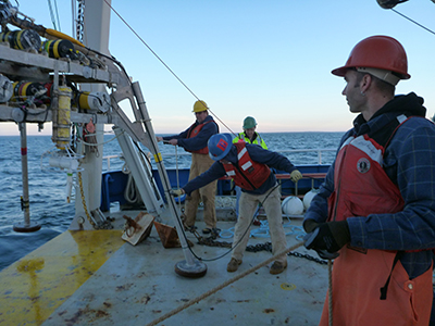
U.S. Geological Survey approved online database web interface. As of 2016, the database contains about 5,000 files, which include observations of current velocity, wave statistics, ocean temperature, conductivity, pressure, and light transmission at one or more depths over some period of time. The work is attributed to U.S. Geological Survey (USGS) / Woods Hole Coastal and Marine Science Center (WHCMSC) sediment transport group investigators
Online_Linkage: http://stellwagen.er.usgs.gov/
Description:
Abstract:
The oceanographic time series data collected by U.S. Geological Survey scientists and collaborators are served in an online database at http://stellwagen.er.usgs.gov/index.html. These data were collected as part of research experiments investigating circulation and sediment transport in the coastal ocean. The experiments (projects, research programs) are typically one month to several years long and have been carried out since 1975. New experiments will be conducted, and the data from them will be added to the collection. As of 2016, all but one of the experiments were conducted in waters abutting the U.S. coast; the exception was conducted in the Adriatic Sea. Measurements acquired vary by site and experiment; they usually include current velocity, wave statistics, water temperature, salinity, pressure, turbidity, and light transmission from one or more depths over a time period. The measurements are concentrated near the sea floor but may also include data from the water column. The user interface provides an interactive map, a tabular summary of the experiments, and a separate page for each experiment. Each experiment page has documentation and maps that provide details of what data were collected at each site. Links to related publications with additional information about the research are also provided. The data are stored in Network Common Data Format (netCDF) files using the Equatorial Pacific Information Collection (EPIC) conventions defined by the National Oceanic and Atmospheric Administration (NOAA) Pacific Marine Environmental Laboratory. NetCDF is a general, self-documenting, machine-independent, open source data format created and supported by the University Corporation for Atmospheric Research (UCAR). EPIC is an early set of standards designed to allow researchers from different organizations to share oceanographic data. The files may be downloaded or accessed online using the Open-source Project for a Network Data Access Protocol (OPeNDAP). The OPeNDAP framework allows users to access data from anywhere on the Internet using a variety of Web services including Thematic Realtime Environmental Distributed Data Services (THREDDS). A subset of the data compliant with the Climate and Forecast convention (CF, currently version 1.6) is also available.
Purpose:
To provide public access to measurements acquired by U.S. Geological Survey investigators that describe and quantify oceanographic processes and how they affect sediment transport and biologic productivity.
Supplemental_Information:
Datasets are organized by experiment; a tabular list the experiment names, the principal investigators, when and where the experiments were conducted is available at http://stellwagen.er.usgs.gov/experiments.html. The links take you to the individual experiment pages with more detailed explanation, data summaries and access. These pages may also be used to explain the content of the top-level THREDDS catalog links provided in the data distribution section.
Time_Period_of_Content:
Time_Period_Information:
Range_of_Dates/Times:
Beginning_Date: 1975
Ending_Date: present
Currentness_Reference:
ground condition of data acquisition. In this instant, present refers to 2016, but new experiments will be conducted and added to the dataset in future.
Status:
Progress: In work
Maintenance_and_Update_Frequency: As needed
Spatial_Domain:
Bounding_Coordinates:
West_Bounding_Coordinate: -160
East_Bounding_Coordinate: 13
North_Bounding_Coordinate: 44
South_Bounding_Coordinate: 16
Keywords:
Theme:
Theme_Keyword_Thesaurus: USGS Metadata Identifier
Theme_Keyword: USGS:cd2c4288-56f3-46ec-ab12-734c435bf349
Theme:
Theme_Keyword_Thesaurus: Global Change Master Directory (GCMD) SCIENCE PARAMETERS
Theme_Keyword: ATMOSPHERIC PRESSURE MEASUREMENTS
Theme_Keyword: SEA LEVEL PRESSURE
Theme_Keyword: SURFACE PRESSURE
Theme_Keyword: AIR TEMPERATURE
Theme_Keyword: SURFACE AIR TEMPERATURE
Theme_Keyword: SURFACE WINDS
Theme_Keyword: OXYGEN
Theme_Keyword: OCEAN CURRENTS
Theme_Keyword: ATTENUATION/TRANSMISSION
Theme_Keyword: SEA LEVEL PRESSURE
Theme_Keyword: WATER PRESSURE
Theme_Keyword: WATER TEMPERATURE
Theme_Keyword: WAVE HEIGHT
Theme_Keyword: WAVE SPEED DIRECTION
Theme_Keyword: SURFACE WINDS
Theme_Keyword: CONDUCTIVITY
Theme_Keyword: DENSITY
Theme_Keyword: SALINITY
Theme_Keyword: POTENTIAL DENSITY
Theme:
Theme_Keyword_Thesaurus: Global Change Master Directory (GCMD) INSTRUMENT
Theme_Keyword: ANEMOMETERS
Theme_Keyword: BAROMETERS
Theme_Keyword: CONDUCTIVITY METERS
Theme_Keyword: CONDUCTIVITY, TEMPERATURE, DEPTH
Theme_Keyword: CURRENT METERS
Theme_Keyword: INCLINOMETERS
Theme_Keyword: PRESSURE GAUGES
Theme_Keyword: PRESSURE TRANSDUCERS
Theme_Keyword: SALINITY, TEMPERATURE, DEPTH
Theme_Keyword: THERMISTORS
Theme_Keyword: THERMOMETERS
Theme_Keyword: TRANSMISSOMETERS
Theme_Keyword: WIND VANES
Theme:
Theme_Keyword_Thesaurus: Global Change Master Directory (GCMD) PROJECT
Theme_Keyword: DODS > DISTRIBUTED OCEANOGRAPHIC DATA SYSTEM
Theme_Keyword: ESIP > EARTH SCIENCE INFORMATION PARTNERS PROGRAM
Theme_Keyword:
OPENDAP > OPEN-SOURCE PROJECT FOR A NETWORK DATA ACCESS PROTOCOL
Theme_Keyword: GOMODP > GULF OF MAINE OCEAN DATA PARTNERSHIP
Theme_Keyword: GLOBEC > GLOBAL OCEAN ECOSYSTEM DYNAMICS, IGBP
Theme_Keyword: IGBP > INTERNATIONAL GEOSPHERE-BIOSPHERE PROGRAMME
Theme:
Theme_Keyword_Thesaurus: none
Theme_Keyword: U.S. Geological Survey
Theme_Keyword: USGS
Theme_Keyword: Coastal and Marine Geology Program
Theme_Keyword: CMGP
Theme_Keyword: Woods Hole Coastal and Marine Science Center
Theme_Keyword: WHCMSC
Theme_Keyword: Air Temperature
Theme_Keyword: Average Burst Pressure
Theme_Keyword: Beam Attenuation
Theme_Keyword: Current Direction (t)
Theme_Keyword: Current Speed
Theme_Keyword: Oxygen
Theme_Keyword: Salinity
Theme_Keyword: Sea Surface Temperature
Theme_Keyword: Dissolved Oxygen
Theme_Keyword: Turbidity
Theme_Keyword: PAR
Theme_Keyword: pH
Theme_Keyword: Sigma Theta
Theme_Keyword: Temperature (c)
Theme_Keyword: Vertical Velocity
Theme_Keyword: Wave Height
Theme_Keyword: Wave Period
Theme_Keyword: Wind Direction
Theme_Keyword: Wind Speed
Theme_Keyword: Meteorology
Theme:
Theme_Keyword_Thesaurus: ISO 19115 TOPIC CATEGORY
Theme_Keyword: oceans
Theme_Keyword: geoscientificInformation
Theme:
Theme_Keyword_Thesaurus: USGS Thesaurus
Theme_Keyword: ocean sciences
Theme_Keyword: sedimentology
Theme_Keyword: marine geology
Place:
Place_Keyword_Thesaurus: None
Place_Keyword: North America
Place_Keyword: Atlantic Ocean
Place_Keyword: Pacific Ocean
Place_Keyword: Gulf of Mexico
Place_Keyword: Gulf of Maine
Place_Keyword: Georges Bank, ME
Place_Keyword: Rachel Carlson National Wildlife Refuge, ME
Place_Keyword: Massachusetts Bay, MA
Place_Keyword: Buzzard's Bay, MA
Place_Keyword: Martha's Vineyard, MA
Place_Keyword: Hudson Shelf Valley, NY
Place_Keyword: Fire Island, NY
Place_Keyword: Barnegat Bay, NJ
Place_Keyword: Chincoteague Bay, MD and VA
Place_Keyword: Blackwater National Wildlife Refuge, MD
Place_Keyword: Cape Hatteras, NC
Place_Keyword: South Atlantic Bight
Place_Keyword: Dauphin Island, LA
Place_Keyword: Chandeleur Islands, LA
Place_Keyword: Monterrey Bay, CA
Place_Keyword: Seal Beach, Pt. Mugu, CA
Place_Keyword: Palos Verdes Shelf, CA
Place_Keyword: Hawaiian waters
Place_Keyword: Adriatic Sea
Access_Constraints: none
Use_Constraints:
Public domain data from the U.S. Government are freely redistributable with proper metadata and source attribution. Please recognize the U.S. Geological Survey as the originator of the dataset.
Point_of_Contact:
Contact_Information:
Contact_Person_Primary:
Contact_Person: Ellyn T. Montgomery
Contact_Organization: U.S. Geological Survey
Contact_Position: Technical Contact
Contact_Address:
Address_Type: Mailing and Physical Address
Address: 384 Woods Hole Rd
City: Woods Hole
State_or_Province: MA
Postal_Code: 02543-1598
Country: USA
Contact_Voice_Telephone: 508-548-8700 x2356
Contact_Facsimile_Telephone: 508-457-2310
Contact_Electronic_Mail_Address: stellwagen_manager@usgs.gov
Browse_Graphic:
Browse_Graphic_File_Name: http://stellwagen.er.usgs.gov/images/deplQuadMVCO-sm.jpg
Browse_Graphic_File_Description:
at sea preparing to deploy instrumented platforms off Martha's Vineyard, MA
Browse_Graphic_File_Type: JPEG
Cross_Reference:
Citation_Information:
Originator: Ellyn T. Montgomery
Originator: Marinna A. Martini
Originator: Frances L. Lightsom
Originator: Bradford Butman
Publication_Date: 2016
Title:
Documentation of the U.S. Geological Survey Oceanographic Time-Series Measurement Database Edition: 2
Series_Information:
Series_Name: Open-File Report
Issue_Identification: 2007-1194
Publication_Information:
Publication_Place: Reston, VA
Publisher: U.S. Geological Survey
Other_Citation_Details:
This report describes the instrumentation and platforms used to make the oceanographic time series measurements; the methods used to process, apply quality-control criteria, and archive the data; the data storage format, and how the data are released and distributed. The report also includes instructions on how to access the data from the online database at http://stellwagen.er.usgs.gov/.
Online_Linkage: http://dx.doi.org/10.3133/ofr20071194
Data_Quality_Information:
Logical_Consistency_Report:
The data accessible on this server have been reviewed and passed the criteria for the Best Basic Version as described in the "Data Quality" section of http://dx.doi.org/10.3133/ofr20071194.
Completeness_Report:
In this collection of data acquired for research, each experiment has its own page on the website. The completeness of each experiment is described on its page. The website is updated as data from new experiments are released.
Positional_Accuracy:
Horizontal_Positional_Accuracy:
Horizontal_Positional_Accuracy_Report:
Locational accuracy is dependent on the accuracy of the navigational technique from the individual data sources and may vary widely (e.g., from 0.005km usingdifferential GPS in more recent surveys to greater than 2 km based on radar, Loran, or dead reckoning in older surveys.) Users of the data should use their own criteria for assessing the accuracy of the locations.
Vertical_Positional_Accuracy:
Vertical_Positional_Accuracy_Report:
Vertical accuracy is dependent on the accuracy of the individual water depth measurement at each deployment site. Platforms supporting sensors are deployed on the seafloor, and the heights of the sensors on the platform are accurate to 5 cm, but the measurement of the depth at which the platform is deployed is nominal. The source of the water depth may be from a ship's fathometer, chart or visible estimate in shallow water. The depth does not include a tidal correction, and has not been referenced to a datum. For measurements made before 2000 and in water deeper than 50m, the vertical accuracy is 2-10m. In shallower environments, the accuracy approaches 5-10 cm. Users of the data should use their own criteria for assessing the vertical accuracy of the water depth.
Lineage:
Process_Step:
Process_Description:
Each type of data accessible on this server has been processed as described in the "Data Processing" sections of Montgomery and others, 2016 (http://dx.doi.org/10.3133/ofr20071194).
Process_Date: Not complete
Process_Step:
Process_Description:
Added keywords section with USGS persistent identifier as theme keyword, 20200908. Modified an originator name from U.S. Geological Survey (USGS) / Woods Hole Coastal and Marine Science Center (WHCMSC) sediment transport group investigators to U.S. Geological Survey. Also added the original information to other citation details, 20210924.
Process_Date: 20210924
Process_Contact:
Contact_Information:
Contact_Organization_Primary:
Contact_Organization: U.S. Geological Survey
Contact_Person: VeeAnn A. Cross
Contact_Position: Marine Geologist
Contact_Address:
Address_Type: Mailing and Physical
Address: 384 Woods Hole Road
City: Woods Hole
State_or_Province: MA
Postal_Code: 02543-1598
Contact_Voice_Telephone: 508-548-8700 x2251
Contact_Facsimile_Telephone: 508-457-2310
Contact_Electronic_Mail_Address: vatnipp@usgs.gov
Distribution_Information:
Distributor:
Contact_Information:
Contact_Organization_Primary:
Contact_Organization: U.S. Geological Survey
Contact_Person: Ellyn T. Montgomery
Contact_Position: Data Center Contact
Contact_Address:
Address_Type: Mailing and Physical Address
Address: 384 Woods Hole Rd
City: Woods Hole
State_or_Province: MA
Postal_Code: 02543-1598
Country: USA
Contact_Voice_Telephone: 508-548-8700 x2356
Contact_Facsimile_Telephone: 508-457-2310
Contact_Electronic_Mail_Address: stellwagen_manager@usgs.gov
Resource_Description:
User interface containing text information about experimental programs and links to downloadable files and access via THREDDS Data in the U.S. Geological Survey Oceanographic Time-Series Data Collection
Distribution_Liability:
Although these data have been used by the U.S. Geological Survey (USGS), U.S. Department of the Interior (DOI), no warranty expressed or implied is made by the U.S. Geological Survey as to the accuracy of the data. The act of distribution shall not constitute any such warranty, and no responsibility is assumed by the USGS in the use of these data or related materials. Any use of trade, product, or firm names is for descriptive purposes only and does not imply endorsement by the U.S. Government.
Standard_Order_Process:
Digital_Form:
Digital_Transfer_Information:
Format_Name: netCDF/OPeNDAP
Format_Version_Date: 2006
Format_Specification: EPIC
Digital_Transfer_Option:
Online_Option:
Computer_Contact_Information: Access_Instructions:
Data may be accessed and downloaded through the THREDDS server. This link takes the user to the top level catalog of data, containing folders representing individual experiments using abbreviations of the experiment name. The table at http://stellwagen.er.usgs.gov/experiments.html may help determine the content of the folders. The NetCDF files contained in these folders conforms to the EPIC conventions.
Digital_Form:
Digital_Transfer_Information:
Format_Name: netCDF/OPeNDAP
Format_Version_Number: 1.6
Format_Specification: CF
Digital_Transfer_Option:
Online_Option:
Computer_Contact_Information: Access_Instructions:
Data may be accessed and downloaded through THREDDS server. This link takes the user to the top level catalog of data contained in folders representing individual experiments using abbreviations of the experiment name. The table at http://stellwagen.er.usgs.gov/experiments.html may help determine the content of the folders. The NetCDF files contained in these folders conforms to the CF conventions.
Fees: None
Metadata_Reference_Information:
Metadata_Date: 20210924
Metadata_Contact:
Contact_Information:
Contact_Person_Primary:
Contact_Person: Ellyn T. Montgomery
Contact_Organization: U.S. Geological Survey
Contact_Position: Data Center Contact
Contact_Address:
Address_Type: mailing and physical address
Address: 384 Woods Hole Road
City: Woods Hole
State_or_Province: MA
Postal_Code: 02543-1598
Country: USA
Contact_Voice_Telephone: 508-548-8700 x2356
Contact_Facsimile_Telephone: 508-457-2310
Contact_Electronic_Mail_Address: stellwagen_manager@usgs.gov
Metadata_Standard_Name: FGDC Content Standards for Digital Geospatial Metadata
Metadata_Standard_Version: FGDC-STD-001-1998
Metadata_Time_Convention: local time
Metadata_Access_Constraints: None
Metadata_Use_Constraints: None

This page is <https://cmgds.marine.usgs.gov/catalog/whcmsc/stellwagen/stellwagen_database.html>
Generated by mp version 2.9.50 on Wed Sep 29 18:05:33 2021