Coastal Storm Modeling System (CoSMoS): Salish Sea
Summary
The Coastal Storm Modeling System (CoSMoS) makes detailed predictions (meter-scale) over large geographic scales (100s of kilometers) of storm-induced coastal flooding and erosion for both current conditions and long-term future hazard scenarios. CoSMoS additionally aggregates additional products such as long-term shoreline change, cliff retreat, groundwater hazards, observational data, and many other products. Resulting projections for future scenarios (storms and sea-level change) provide emergency responders and coastal planners with critical storm-hazards information that can be used to increase public safety and mitigate physical damages to reduce risk, and more effectively manage and allocate resources to increase resilience in response to storm hazards within complex coastal settings.
CoSMoS has been implemented in a variety of locations and for a general overview of the project see: https://cmgds.marine.usgs.gov/data-releases/community/cosmos/
Data for the various CoSMoS implementations and supporting investigations are available for download through the links here. Additional platforms for visualizing the data and analyses include the USGS Hazard Exposure and Reporting Analytics Tool (HERA, https://www.usgs.gov/apps/hera/), and the USGS Multi-hazard Viewer (https://www.usgs.gov/apps/hera/multiHazardsTool.php). See links below and associated items for details.
County Flood Hazard Products
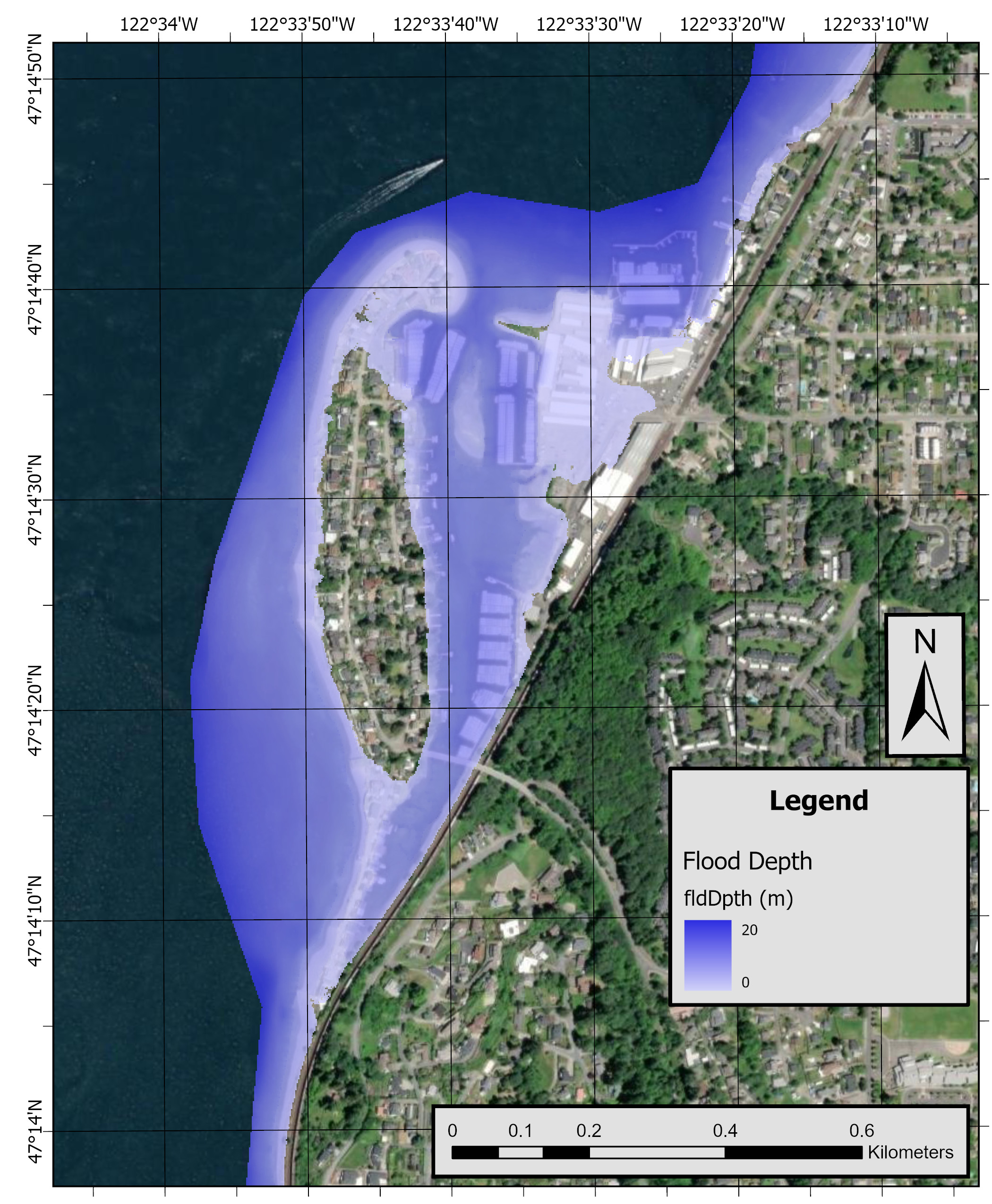
Flood hazard maps from compound coastal hazards—specifically sea-level rise (SLR), projected coastal storms, and streamflow.
CoSMoS (Coastal Storm Modeling System) modeled flood hazards for King County, Washington
CoSMoS (Coastal Storm Modeling System) modeled flood hazards for Pierce County, Washington
Puget Sound Groundwater Hazard Products
Coastal water table response to sea-level rise (SLR) in coastal areas around Puget Sound, Washington
Future coastal groundwater hazards in the Puget Sound region, Washington, U.S.A.
Purpose
These data are intended for policy makers, resource managers, science researchers, students, and the general public. These data can be used with geographic information systems or other software to identify and assess possible areas of vulnerability. These data are not intended to be used for navigation. This work is part of on-going modeling efforts. For more information on CoSMoS implementation, see https://www.usgs.gov/centers/pcmsc/science/coastal-storm-modeling-system-cosmos.
Rights
Inundated areas shown should not be used for navigation, regulatory, permitting, or other legal purposes. The U.S. Geological Survey provides these data as is for a quick reference, emergency planning tool but assumes no legal liability or responsibility resulting from the use of this information. The suggestions and illustrations included in these data are intended to improve coastal-flood awareness and preparedness; however, they do not guarantee the safety of an individual or structure. The contributors and sponsors of this product do not assume liability for any injury, death, property damage, or other effects of coastal flooding.
Overview Images
Contacts
Related Resources
CoSMoS community data release page
Washington Coastal Hazards Resilience Network CoSMoS webpage