Topobathymetric digital elevation models – coastal Alaska (ver. 2.0, March 2026)
By Alex L. Nereson, Ann E. Gibbs, and Li H. Erikson
https://doi.org/10.5066/P13BXTXV
Dates
Published: July 8, 2025
Last Revised: March 13, 2026 (ver. 2.0)
Summary
This data release consists of a series of seamless topobathymetric digital elevation models (TBDEMs) for coastal Alaskan communities. Each TBDEM was assembled from best available, multi-source topographic and bathymetric elevation data collected at the time of processing. These products were created to support the development of dynamic flood models, but are also intended for reuse by scientists, managers, and the general public.
Digital Elevation Model (DEM) Data
-
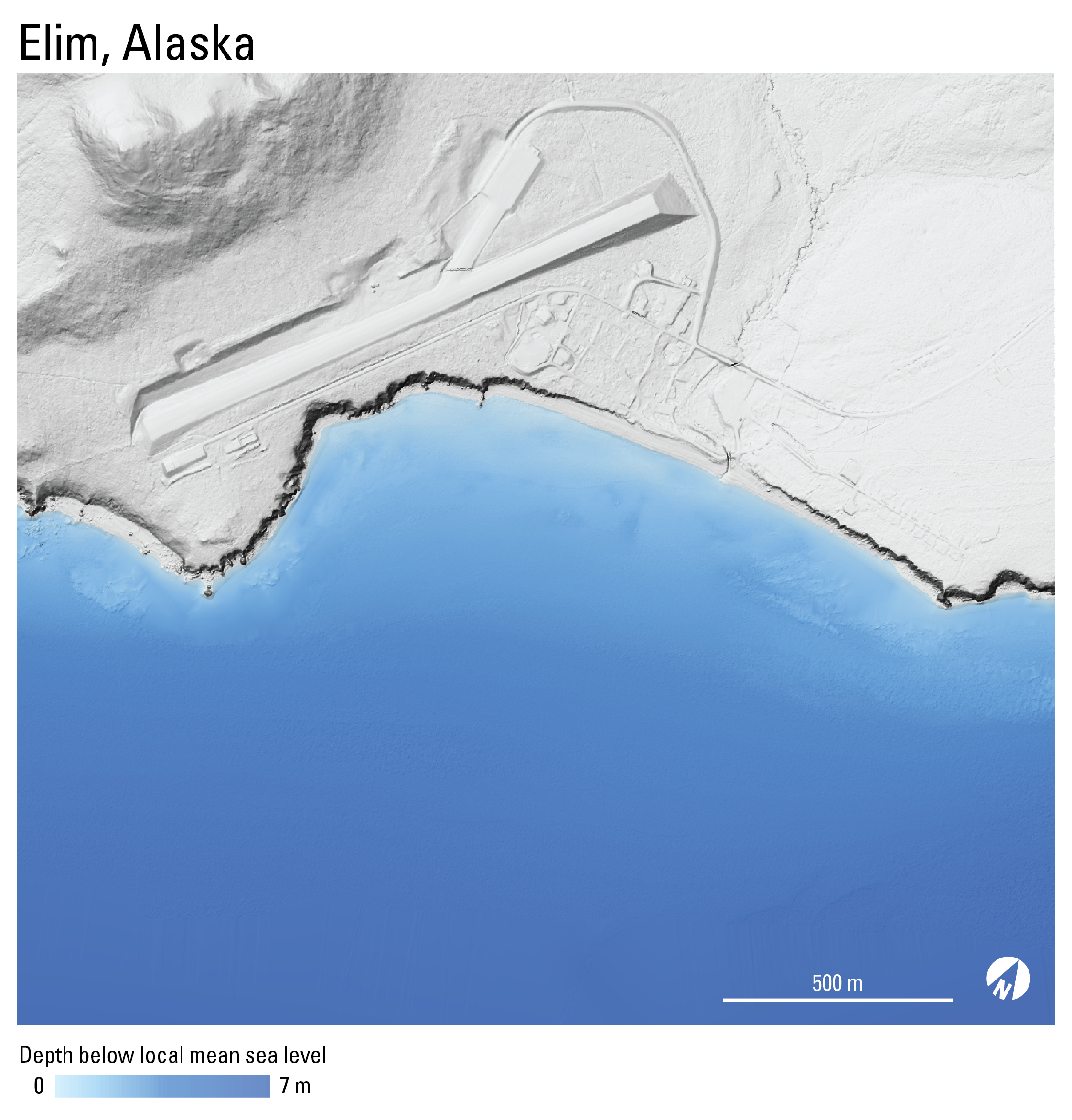
Topobathymetric digital elevation model of Elim, Alaska, 2015 to 2019
This dataset contains a 1-meter resolution, seamless topobathymetric digital elevation model (TBDEM) and associated spatial metadata for Elim, Alaska. The TBDEM contains best available multi-source topographic and bathymetric elevation data collected between the years 2015 and 2019. Processing was done by the U.S. Geological Survey (USGS), Pacific Coastal and Marine Science Center (PCMSC) and results are provided as a Cloud Optimized GeoTIFF (COG).
Data Files
elim_tbdem_1m_2015_to_2019.tif - 25.7 MB - MD5:a9c1e1310e51f8a0ec7cf2a8170e54b1
Metadata Files
elim_tbdem_1m_2015_to_2019_metadata.xml - 28.6 KB
elim_tbdem_1m_2015_to_2019_metadata.txt - 27.9 KB
Support Files
elim_tbdem_1m_2015_to_2019_spatial_metadata.gdb.zip - 414.2 KB
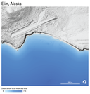 Quick view image of seamless topobathymetric digital elevation model for Elim, Alaska.
 -
Topobathymetric digital elevation model of Elim, Alaska, 2019 to 2021
This dataset contains a 1-meter resolution, seamless topobathymetric digital elevation model (TBDEM) and associated spatial metadata for Elim, Alaska. The TBDEM contains best available multi-source topographic and bathymetric elevation data collected between the years 2019 and 2021. Processing was done by the U.S. Geological Survey (USGS), Pacific Coastal and Marine Science Center (PCMSC) and results are provided as a Cloud Optimized GeoTIFF (COG).
Data Files
elim_tbdem_1m_2019_to_2021.tif - 21.2 MB - MD5:0ad0dfc7c6a38262e42d2114c593dc9b
Metadata Files
elim_tbdem_1m_2019_to_2021_metadata.xml - 28.4 KB
elim_tbdem_1m_2019_to_2021_metadata.txt - 27.7 KB
Support Files
elim_tbdem_1m_2019_to_2021_spatial_metadata.gdb.zip - 75.9 KB
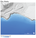 Quick view image of seamless topobathymetric digital elevation model for Elim, Alaska.
 -
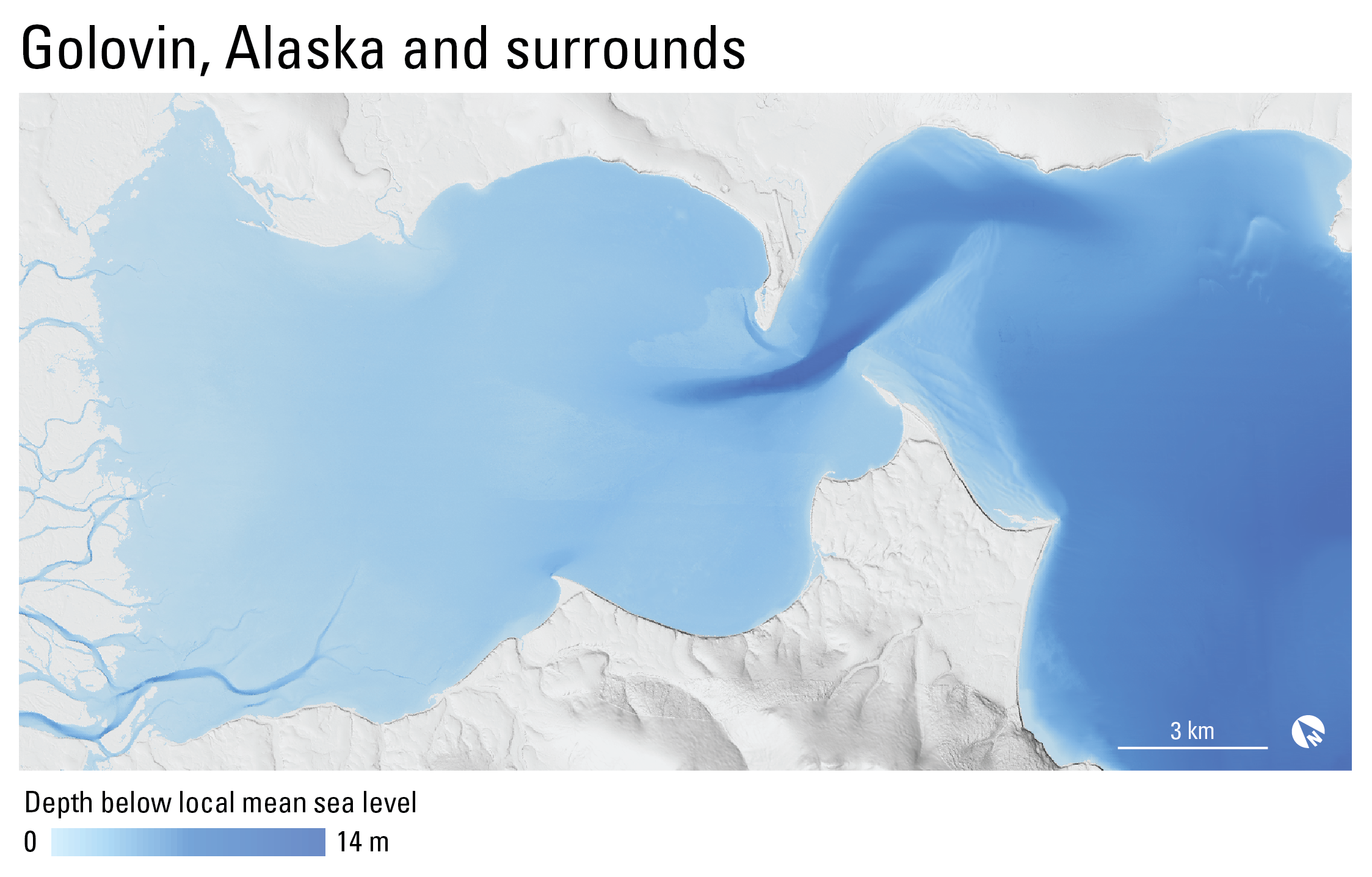
Topobathymetric digital elevation model of Golovin, Alaska, 2012 to 2024
This dataset contains a 1-meter resolution, seamless topobathymetric digital elevation model (TBDEM) and associated spatial metadata for Golovin, Alaska. The TBDEM contains best available multi-source topographic and bathymetric elevation data collected between the years 2012 and 2024. Processing was done by the U.S. Geological Survey (USGS), Pacific Coastal and Marine Science Center (PCMSC) and results are provided as a Cloud Optimized GeoTIFF (COG).
Data Files
golovin_tbdem_1m_2012_to_2024.tif - 1.9 GB - MD5:c66250d62ae3c8428574332441172e70
Metadata Files
golovin_tbdem_1m_2012_to_2024_metadata.xml - 33.2 KB
golovin_tbdem_1m_2012_to_2024_metadata.txt - 32.3 KB
Support Files
golovin_tbdem_1m_2012_to_2024_spatial_metadata.gdb.zip - 4.2 MB
 Quick view image of seamless topobathymetric digital elevation model for Golovin, Alaska.
 -
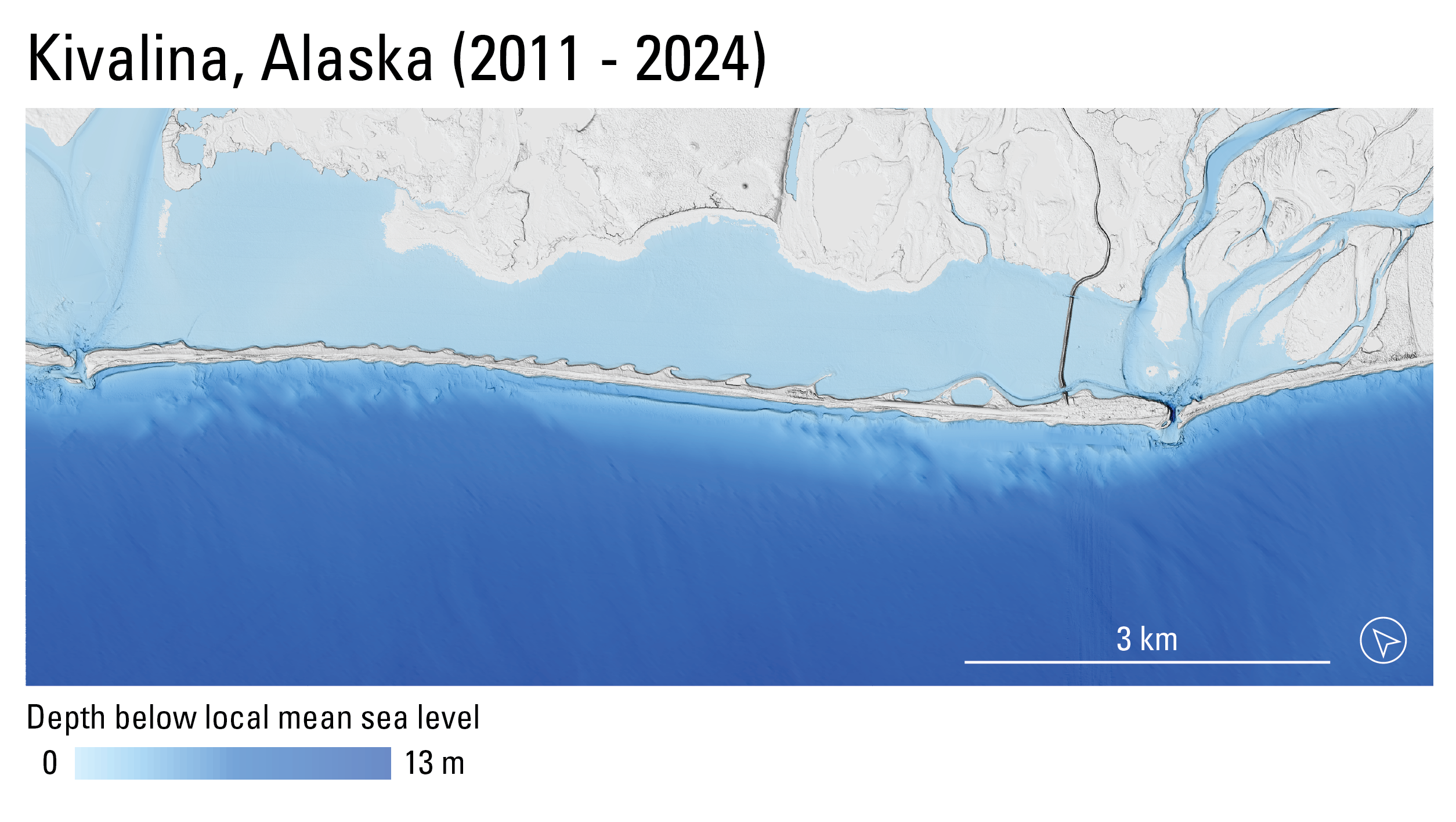
Topobathymetric digital elevation model of Kivalina, Alaska, 2011 to 2024
This dataset contains a 1-meter resolution, seamless topobathymetric digital elevation model (TBDEM) and associated spatial metadata for Kivalina, Alaska. The TBDEM contains best available (at the time of processing) multi-source topographic and bathymetric elevation data collected between the years 2011 and 2024. Processing was done by the U.S. Geological Survey (USGS), Pacific Coastal and Marine Science Center (PCMSC) and results are provided as a Cloud Optimized GeoTIFF (COG).
Data Files
kivalina_tbdem_1m_2011_to_2024.tif - 263.2 MB - MD5:b56eb8110f717a53a9806d011dd347ab
Metadata Files
kivalina_tbdem_1m_2011_to_2024_metadata.xml - 30.0 KB
kivalina_tbdem_1m_2011_to_2024_metadata.txt - 29.2 KB
Support Files
kivalina_1m_tbdem_2011_to_2024_spatial_metadata.gdb.zip - 711.3 KB
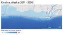 Quick view image of seamless topobathymetric digital elevation model for Kivalina, Alaska.
 -
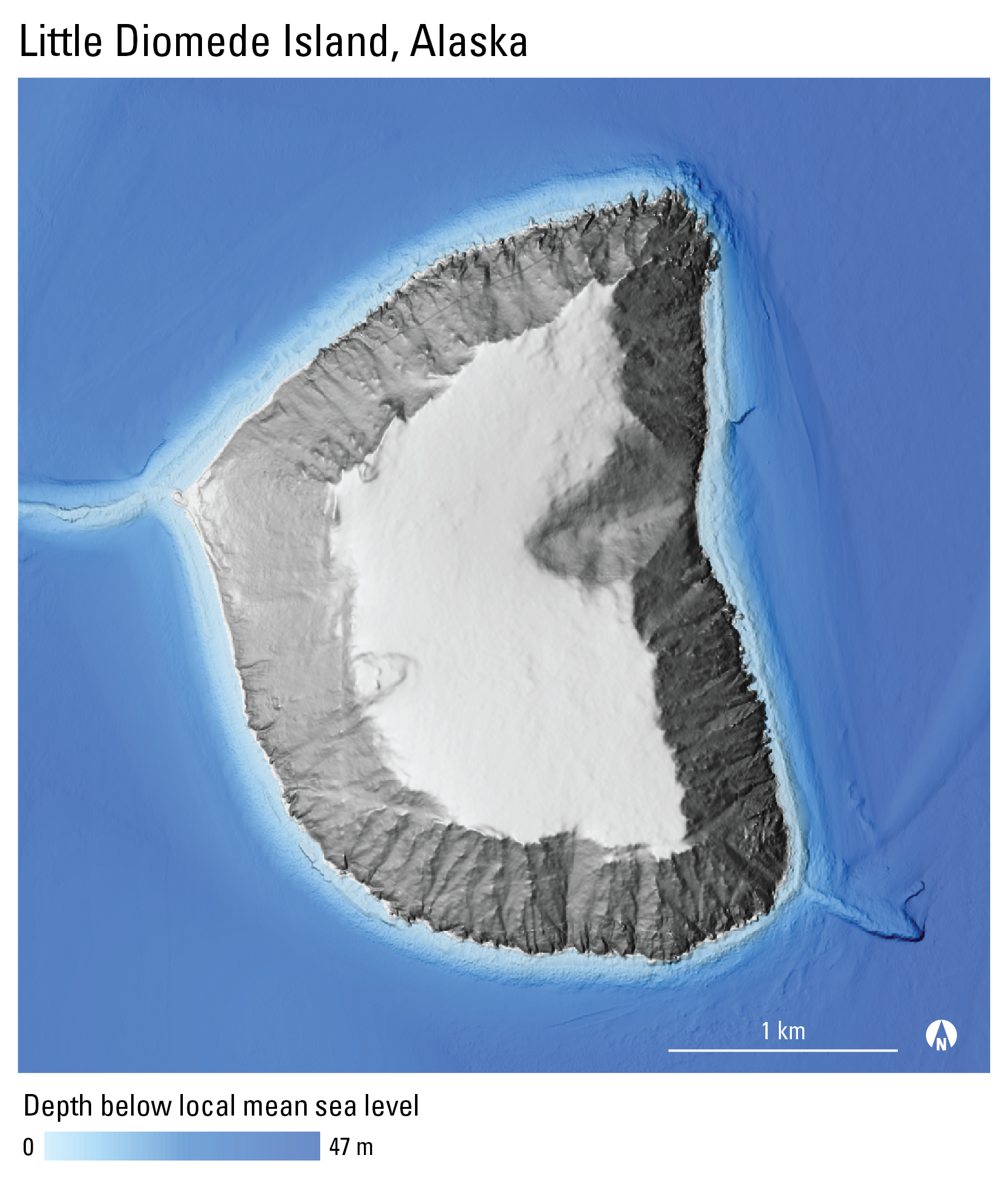
Topobathymetric digital elevation model of Little Diomede Island, Alaska, 2010 to 2021
This dataset contains a 1-meter resolution, seamless topobathymetric digital elevation model (TBDEM) and associated spatial metadata for Little Diomede Island, Alaska. The TBDEM contains best available multi-source topographic and bathymetric elevation data collected between the years 2010 and 2021. Processing was done by the U.S. Geological Survey (USGS), Pacific Coastal and Marine Science Center (PCMSC) and results are provided as a Cloud Optimized GeoTIFF (COG).
Data Files
diomede_tbdem_1m_2010_to_2021.tif - 50.0 MB - MD5:1ce47fd1798246cc18583acd3a62e69f
Metadata Files
diomede_tbdem_1m_2010_to_2021_metadata.xml - 30.2 KB
diomede_tbdem_1m_2010_to_2021_metadata.txt - 29.4 KB
Support Files
diomede_tbdem_1m_2010_to_2021_spatial_metadata.gdb.zip - 207.7 KB
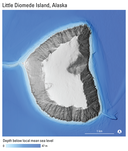 Quick view image of seamless topobathymetric digital elevation model for Little Diomede Island, Alaska.
 -
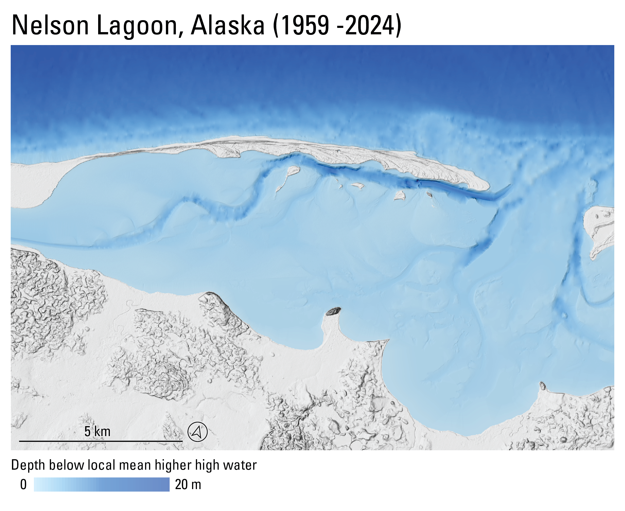
Topobathymetric digital elevation model of Nelson Lagoon, Alaska, 1959 to 2024
This dataset contains a 1-meter resolution, seamless topobathymetric digital elevation model (TBDEM) and associated spatial metadata for Nelson Lagoon, Alaska. The TBDEM contains best available (at the time of processing) multi-source topographic and bathymetric elevation data collected between the years 1959 and 2024. Processing was done by the U.S. Geological Survey (USGS), Pacific Coastal and Marine Science Center (PCMSC) and results are provided as a Cloud Optimized GeoTIFF (COG).
Data Files
nelsonlagoon_tbdem_1m_1959_to_2024.tif - 1.1 GB - MD5:76185fd8276d8bd19babc0169ba3cf14
Metadata Files
nelsonlagoon_tbdem_1m_1959_to_2024_metadata.xml - 29.4 KB
nelsonlagoon_tbdem_1m_1959_to_2024_metadata.txt - 28.7 KB
Support Files
nelsonlagoon_tbdem_1m_1959_to_2024_spatial_metadata.gdb.zip - 1.1 MB
 Quick view image of seamless topobathymetric digital elevation model for Nelson Lagoon, Alaska.
 -
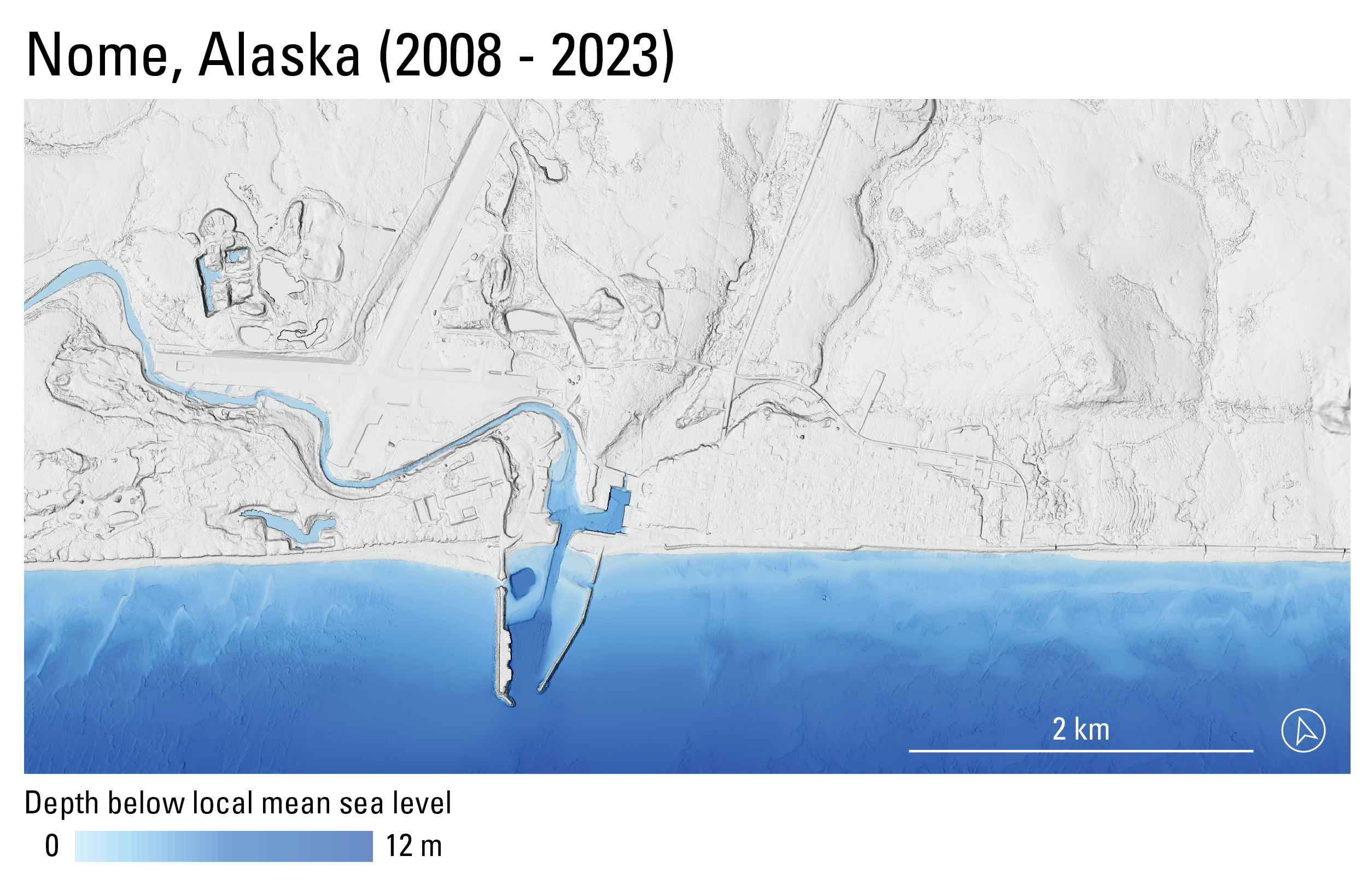
Topobathymetric digital elevation model of Nome, Alaska, 2008 to 2023
This dataset contains a 1-meter resolution, seamless topobathymetric digital elevation model (TBDEM) and associated spatial metadata for Nome, Alaska. The TBDEM contains best available (at the time of processing) multi-source topographic and bathymetric elevation data collected between the years 2008 and 2023. Processing was done by the U.S. Geological Survey (USGS), Pacific Coastal and Marine Science Center (PCMSC) and results are provided as a Cloud Optimized GeoTIFF (COG).
Data Files
nome_tbdem_1m_2008_to_2023.tif - 154.5 MB - MD5:83e2ef5c49cac45261bc3d7a789f6c7c
Metadata Files
nome_tbdem_1m_2008_to_2023_metadata.xml - 32.2 KB
nome_tbdem_1m_2008_to_2023_metadata.txt - 31.4 KB
Support Files
nome_tbdem_1m_2008_to_2023_spatial_metadata.gdb.zip - 522.1 KB
 Quick view image of seamless topobathymetric digital elevation model for Nome, Alaska.
 -
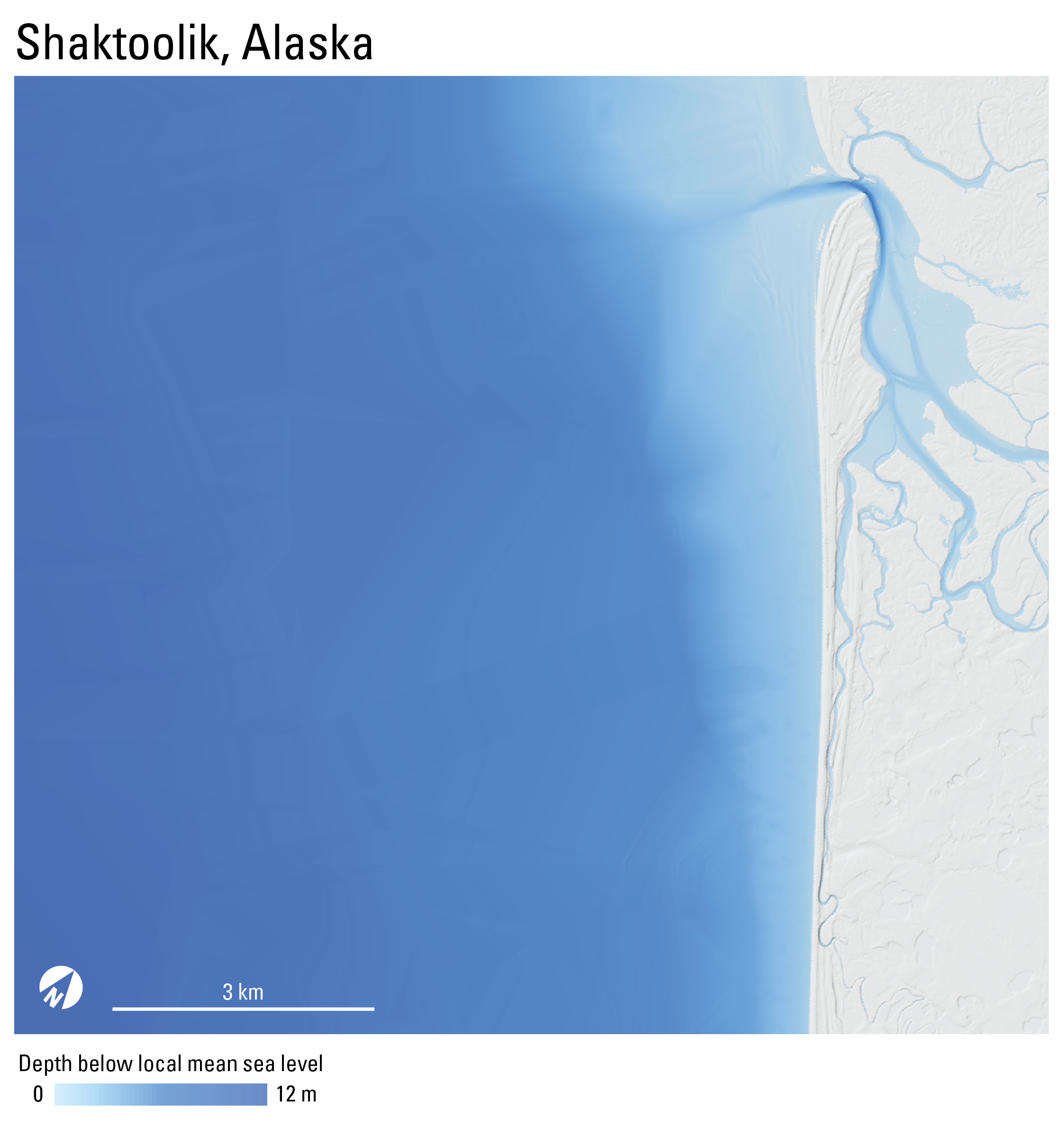
Topobathymetric digital elevation model of Shaktoolik, Alaska, 1900 to 2021
This dataset contains a 1-meter resolution, seamless topobathymetric digital elevation model (TBDEM) and associated spatial metadata for Shaktoolik, Alaska. The TBDEM contains best available multi-source topographic and bathymetric elevation data collected between the years 1900 and 2021. Processing was done by the U.S. Geological Survey (USGS), Pacific Coastal and Marine Science Center (PCMSC) and results are provided as a Cloud Optimized GeoTIFF (COG).
Data Files
shaktoolik_tbdem_1m_1900_to_2021.tif - 440.9 MB - MD5:4f136a0dfdb7a68be16b1900be1ef73c
Metadata Files
shaktoolik_tbdem_1m_1900_to_2021_metadata.xml - 31.0 KB
shaktoolik_tbdem_1m_1900_to_2021_metadata.txt - 30.2 KB
Support Files
shaktoolik_tbdem_1m_1900_to_2021_spatial_metadata.gdb.zip - 496.7 KB
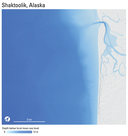 Quick view image of seamless topobathymetric digital elevation model for Shaktoolik, Alaska.
 -
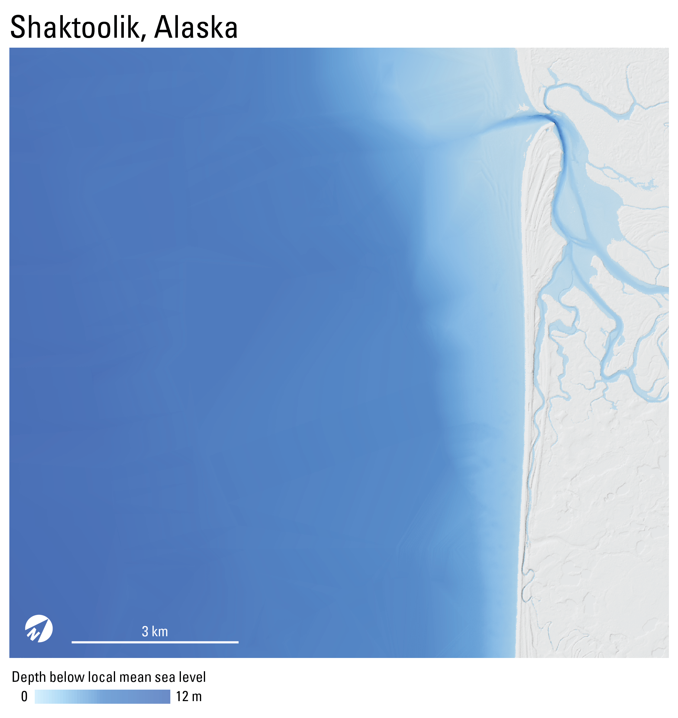
Topobathymetric digital elevation model of Shaktoolik, Alaska, 1900 to 2022
This dataset contains a 1-meter resolution, seamless topobathymetric digital elevation model (TBDEM) and associated spatial metadata for Shaktoolik, Alaska. The TBDEM contains best available multi-source topographic and bathymetric elevation data collected between the years 1900 and 2022. Processing was done by the U.S. Geological Survey (USGS), Pacific Coastal and Marine Science Center (PCMSC) and results are provided as a Cloud Optimized GeoTIFF (COG).
Data Files
shaktoolik_tbdem_1m_1900_to_2022.tif - 596.4 MB - MD5:4c7ef315be936a1dff629c621c0cd3ab
Metadata Files
shaktoolik_tbdem_1m_1900_to_2022_metadata.xml - 31.7 KB
shaktoolik_tbdem_1m_1900_to_2022_metadata.txt - 30.9 KB
Support Files
shaktoolik_tbdem_1m_1900_to_2022_spatial_metadata.gdb.zip - 1.6 MB
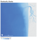 Quick view image of seamless topobathymetric digital elevation model for Shaktoolik, Alaska.
 -
Topobathymetric digital elevation model of Teller, Brevig Mission, and Port Clarence, Alaska, 1900 to 2023
This dataset contains a 1-meter resolution, seamless topobathymetric digital elevation model (TBDEM) and associated spatial metadata for Teller, Brevig Mission, and Port Clarence, Alaska. The TBDEM contains best available multi-source topographic and bathymetric elevation data collected between the years 1900 to 2023. Processing was done by the U.S. Geological Survey (USGS), Pacific Coastal and Marine Science Center (PCMSC) and results are provided as a Cloud Optimized GeoTIFF (COG).
Data Files
teller_brevigmission_portclarence_tbdem_1m_1900_to_2023.tif - 6.4 GB - MD5:f6c67adccd67ef406820a4053b5d9956
Metadata Files
teller_brevigmission_portclarence_tbdem_1m_1900_to_2023_metadata.xml - 31.5 KB
teller_brevigmission_portclarence_tbdem_1m_1900_to_2023_metadata.txt - 30.7 KB
Support Files
teller_brevigmission_portclarence_tbdem_1m_1900_to_2023_spatial_metadata.gdb.zip - 3.7 MB
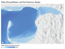 Quick view image of seamless topobathymetric digital elevation model for Teller, Brevig Mission, and Port Clarence, Alaska.
 -
Topobathymetric digital elevation model of Unalakleet, Alaska, 1900 to 2019
This dataset contains a 1-meter resolution, seamless topobathymetric digital elevation model (TBDEM) and associated spatial metadata for Unalakleet, Alaska. The TBDEM contains best available multi-source topographic and bathymetric elevation data collected between the years 1900 and 2019. Processing was done by the U.S. Geological Survey (USGS), Pacific Coastal and Marine Science Center (PCMSC) and results are provided as a Cloud Optimized GeoTIFF (COG).
Data Files
unalakleet_tbdem_1m_1900_to_2019.tif - 397.7 MB - MD5:f01b4e01694669abbdfb85c1a07e6bff
Metadata Files
unalakleet_tbdem_1m_1900_to_2019_metadata.xml - 28.6 KB
unalakleet_tbdem_1m_1900_to_2019_metadata.txt - 27.9 KB
Support Files
unalakleet_tbdem_1m_1900_to_2019_spatial_metadata.gdb.zip - 958.0 KB
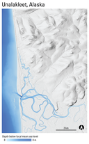 Quick view image of seamless topobathymetric digital elevation model for Unalakleet, Alaska.
 -
Topobathymetric digital elevation model of Utqiaġvik, Alaska, 1945 to 2022
This dataset contains a 1-meter resolution, seamless topobathymetric digital elevation model (TBDEM) and associated spatial metadata for Utqiaġvik, Alaska. The TBDEM contains best available (at the time of processing in 2023) multi-source topographic and bathymetric elevation data collected between the years 1945 and 2022. Processing was done by the U.S. Geological Survey (USGS), Pacific Coastal and Marine Science Center (PCMSC) and results are provided as a Cloud Optimized GeoTIFF (COG).
Data Files
utqiagvik_tbdem_1m_1945_to_2022.tif - 526.7 MB - MD5:3194a0167d0a759aa413c3c4d09079e1
Metadata Files
utqiagvik_tbdem_1m_1945_to_2022_metadata.xml - 36.5 KB
utqiagvik_tbdem_1m_1945_to_2022_metadata.txt - 35.6 KB
Support Files
utqiagvik_tbdem_1m_1945_to_2022_spatial_metadata.gdb.zip - 602.1 KB
 Quick view image of seamless topobathymetric digital elevation model for Utqiaġvik, Alaska.
 -
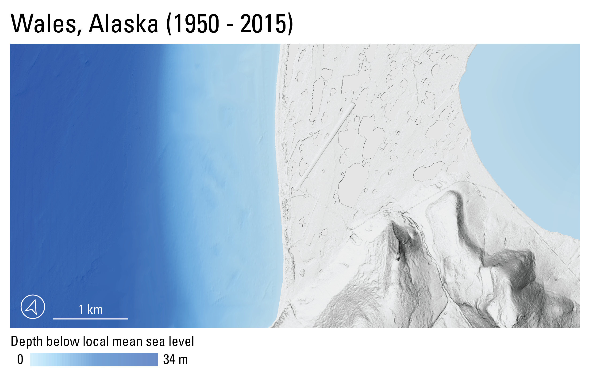
Topobathymetric digital elevation model of Wales, Alaska, 1950 to 2015
This dataset contains a 1-meter resolution, seamless topobathymetric digital elevation model (TBDEM) and associated spatial metadata for Wales, Alaska. The TBDEM contains best available (at the time of processing) multi-source topographic and bathymetric elevation data collected between the years 1950 and 2015. Processing was done by the U.S. Geological Survey (USGS), Pacific Coastal and Marine Science Center (PCMSC) and results are provided as a Cloud Optimized GeoTIFF (COG).
Data Files
wales_tbdem_1m_1950_to_2015.tif - 144.1 MB - MD5:a931ae2b28d9ab51272bea781c1dce8b
Metadata Files
wales_tbdem_1m_1950_to_2015_metadata.xml - 30.8 KB
wales_tbdem_1m_1950_to_2015_metadata.txt - 30.1 KB
Support Files
wales_tbdem_1m_1950_to_2015_spatial_metadata.gdb.zip - 386.5 KB
 Quick view image of seamless topobathymetric digital elevation model for Wales, Alaska.


Supplemental Files
- VersionHistory_P13BXTXV.txt - 1015 bytes
Suggested Citation
Nereson, A.L., Gibbs, A.E., and Erikson, L.H., 2025, Topobathymetric digital elevation models – coastal Alaska (ver. 2.0, March 2026): U.S. Geological Survey data release, https://doi.org/10.5066/P13BXTXV.
Revision History
First release: 2025
Revised: March 2026 (ver. 2.0)
Changes in Version 2.0
New datasets will be added to this data release. No revisions are planned for the existing published datasets.