Time-series measurements of oceanographic data collected in the nearshore zone offshore of Marconi Beach, Wellfleet, MA, December 9, 2024 to March 10, 2025
By Olivia A. De Meo, Steven E. Suttles, Eric D. Marsjanik, Robert D. Bales, and Christopher R. Sherwood
https://doi.org/10.5066/P13KF7UW
Dates
Published: Jan. 8, 2026
Summary
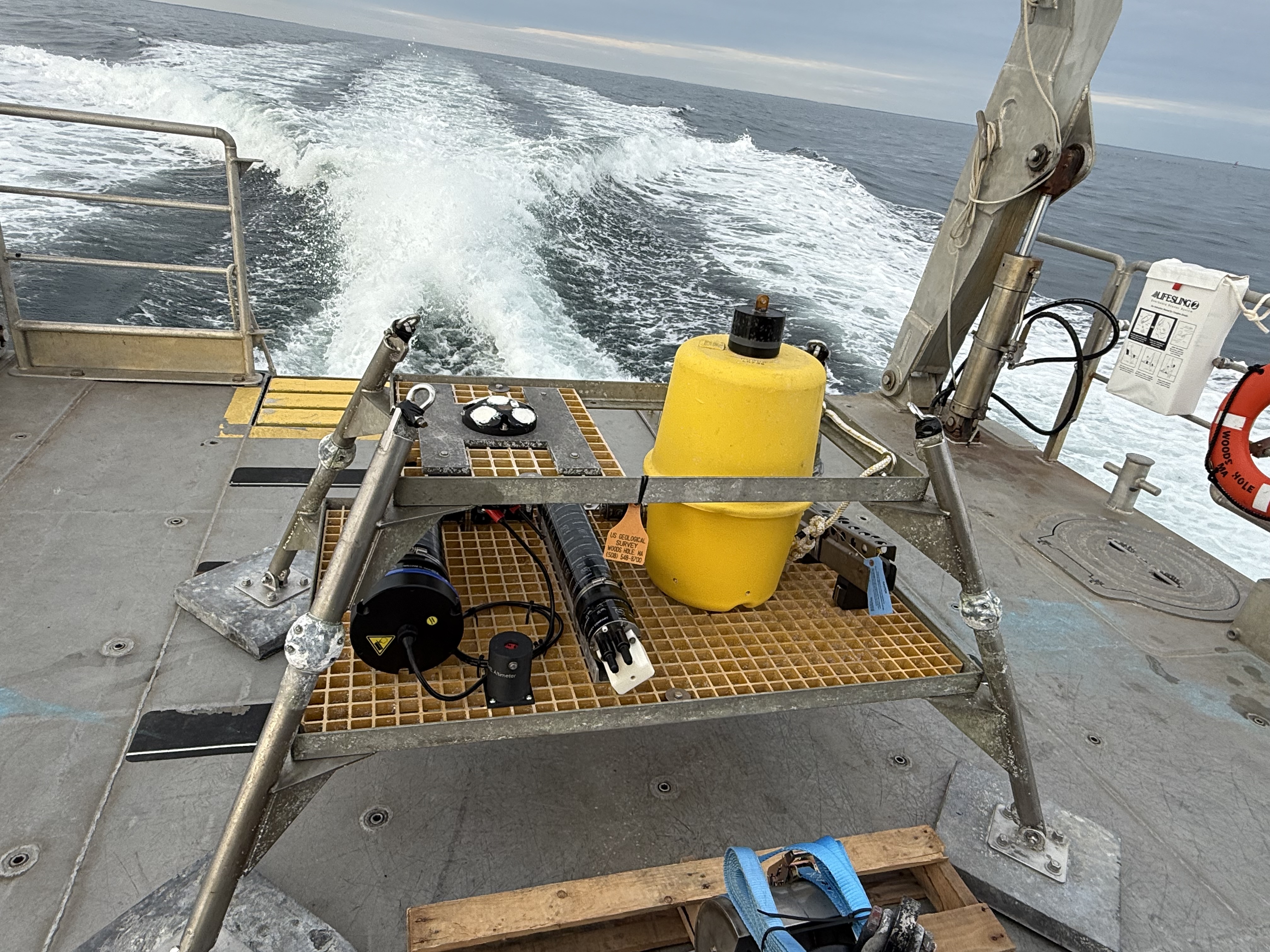
The U.S. Geological Survey (USGS) Woods Hole Coastal and Marine Science Center deployed a four-legged bottom landing frame (nanopod) containing oceanographic instruments to collect measurements of winter wave conditions directly offshore of Marconi Beach in Wellfleet, MA. Supplementary sediment samples were collected to characterize grain size. Marconi Beach is the site of ongoing measurements of wave runup, and this field work provides information on the incident waves and water levels that are ultimately responsible for wave runup on the beach. Maps of subaerial topography and nearshore bathymetry were made to augment the wave and runup measurements. These observations will allow us to test and validate models of wave shoaling and transformation and generation of wave runup. The larger objective of this work is to provide validation and indicate needed improvements for the Total Water Level and Coastal Change forecasts made publicly available in real time by the USGS. These forecasts provide information that emergency managers and the American public can use to help safeguard coastal property, businesses, energy production and distribution facilities, and national security installations.
Time Series Data
-
Time-series measurements of oceanographic data collected in the nearshore zone offshore of Marconi Beach, Wellfleet, MA, December 9, 2024 to March 10, 2025
A submerged nanopod was deployed to collect time series data of temperature, conductivity, salinity, seabed height, pressure, water velocity and acoustic surface tracking.
Data Files
11751sigb5-a.nc - 8.7 MB - MD5:c5e82399fe05471ef183facd9e929548
11751sigb5.nc - 13.4 GB - MD5:c15e1df55c75bfa7044bfd726213a266
11751sigb-a.nc - 34.5 MB - MD5:d0f572721a306e43548d89c0a69a0ed7
11751sigb.nc - 50.3 GB - MD5:fe4bdb52b045b215ec6b8649991fcb54
11751sigs-a.nc - 4.5 MB - MD5:e9b7e2037319878addf8f3f474e0fd86
11751sigs_diwasp-a.nc - 772.0 MB - MD5:9992e211287835f2aef56dcba5679738
11752sgt-a.nc - 999.3 KB - MD5:2ad2d80ec7efd32fd8afd58d427de5f6
11753mc-a.nc - 640.3 KB - MD5:7585384f3c71472f10a40e5106ad75d8
11754aab-a.nc - 820.2 KB - MD5:24b3f2688e29523b442252f7716ed100
11754aab.nc - 10.6 MB - MD5:82ddb6156ad88dcc6bf15ae667324462
caco-waves_timeseries.zip - 22.9 GB - MD5:f6995d89aec5c7aafe0ca98eb1545aed
Other Data Access
Metadata Files
caco-waves_timeseries_metadata.xml - 26.6 KB
caco-waves_timeseries_metadata.txt - 25.9 KB
Related Field Activities
- 2024-028-FA - View Details
- 2025-010-FA - View Details
Suggested Citation
De Meo, O.A., Suttles, S.E., Marsjanik, E.D., Bales, R.D., and Sherwood, C.R., 2026, Time-series measurements of oceanographic data collected in the nearshore zone offshore of Marconi Beach, Wellfleet, MA, December 9, 2024 to March 10, 2025: U.S. Geological Survey data release, https://doi.org/10.5066/P13KF7UW.
Overview Image