Nearshore wave time-series along the coast of Alaska computed with a numerical wave model
By Anita C. Engelstad, Li H. Erikson, Borja G. Reguero, Ann E. Gibbs, and Kees M. Nederhoff
https://doi.org/10.5066/P931CSO9
Dates
Published: March 12, 2024
Summary
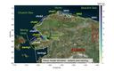
Alaska’s Arctic coast has some of the highest erosion rates in the world. Erosion in the Arctic is primarily driven by permafrost melting and wave activity. The warming climate decreases sea ice coverage, resulting in an increase in wave energy. To overcome the lack of available observational wave data in the nearshore, waves were downscaled with a numerical wave model (SWAN) for the hindcast period of 1979-2019 utilizing several model domains along the coast. For each domain, the model was forced at the open boundary with 2000 representative sea states, which are likely combinations of significant wave heights, mean wave periods and mean wave directions in addition to wind speed and directions. These were inferred from ERA5 reanalyzed winds and waves with a multivariant maximum-dissimilarity algorithm. The SWAN runs created a downscaled wave database (DWDB) at each grid point which was used to reconstruct time series in the nearshore along the 5 and 10 m isobaths at locations approximately 400 m apart and corresponding to transects from the U.S. Geological Survey (USGS) developed Digital Shoreline Analysis System (DSAS).
Simulation Data
-
Wave model input files
Provided here are the required input files to run a standalone wave model (Simulating Waves WAves Nearshore [SWAN]; Booij and others, 1999) on eleven model domains from the Canada-U.S. border to Norton Sound, Alaska to create a downscaled wave database (DWDB). The DWDB, in turn, can be used to reconstruct hindcast (1979-2019) and projected (2020-2050) time series at each point in the model domains see Engelstad and others, 2023 for further information on reconstruction of time-series. The model forcing files consist of reduced sets of binned wind and wave parameter combinations, hereafter termed ‘sea states’. The use of representative sea states allows for lower computational costs and follows modified methods outlined in for example Camus and others, 2011, Reguero and others, 2013, and Lucero and others, 2017. For these sea states, hourly time-series of wave heights, mean wave periods, and mean incident wave directions, wind speed and wind direction were first extracted from the ERA5 reanalysis (Hersbach and others, 2020; https://cds.climate.copernicus.eu/cdsapp#!/home) for the hindcast period (1979–2019) and from WAVEWATCHIII wave model runs (Erikson and others, 2022) driven by winds and sea ice fields from the 6th generation Coupled Model Inter-comparison Projects (CMIP6 Haarsma and others, 2016). Sea states were selected using a multivariant maximum-dissimilarity algorithm (MDA) which determined representative combinations of significant wave heights, mean wave periods, mean wave directions, wind speeds, and wind directions (for more details see Engelstad and others, 2024). The model output can be used to reconstruct time series at each grid point. The extent of each model domain can be inferred from the browse graphic. Model input files are described in the Entity and Attribute Overview section.
Data Files
WaveModel_InputFiles.zip - 66.5 MB
Metadata Files
WaveModel_Input_metadata.xml - 39.3 KB
WaveModel_Input_metadata.txt - 37.4 KB
-
Wave time-series: ERA5 hindcast period 1979-2019 - U.S. Canada border to Bering Strait
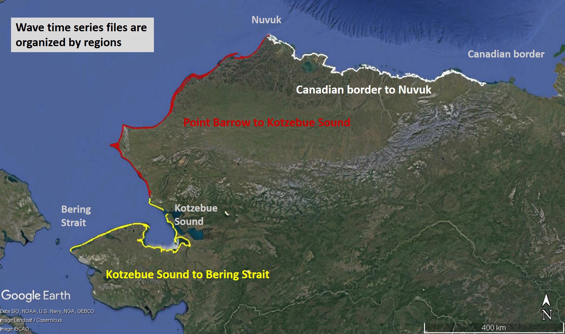
Modeled wave time series data are presented for the hindcast period of 1979 to 2019 from the U.S. Canada border to the Bering Strait close to the 5 and 10 m isobaths. Outputs include three-hourly nearshore significant wave heights (Hs), mean wave periods (Tm) and mean wave directions (Dm) for 6424 locations. Data are available as netCDF files and are packaged for the Beaufort Sea region from the U.S. Canada border to Nuvuk (Point Barrow), and for the Chukchi Sea region from Nuvuk to Kotzebue Sound and from Kotzebue Sound to the Bering Strait. The methods used to create this dataset are described in detail in Engelstad and others, 2024
Data Files
WaveTimeSeries_ERA5_CanadianBorder_to_Nuvuk_10mDepth.nc - 10.6 GB
WaveTimeSeries_ERA5_CanadianBorder_to_Nuvuk_5mDepth.nc - 10.6 GB
WaveTimeSeries_ERA5_KotzebueSound_to_BeringStrait_10mDepth.nc - 6.2 GB
WaveTimeSeries_ERA5_KotzebueSound_to_BeringStrait_5mDepth.nc - 6.0 GB
WaveTimeSeries_ERA5_Nuvuk_to_KotzebueSound_10mDepth.nc - 11.9 GB
WaveTimeSeries_ERA5_Nuvuk_to_KotzebueSound_5mDepth.nc - 11.9 GB
Metadata Files
WaveTimeSeries_ERA5_metadata.xml - 25.3 KB
WaveTimeSeries_ERA5_metadata.txt - 24.3 KB


Suggested Citation
Engelstad, A.C., Erikson, L.H., Reguero, B.G., Gibbs, A.E., Nederhoff, K.M., 2024, Nearshore wave time-series along the coast of Alaska computed with a numerical wave model: U.S. Geological Survey data release, https://doi.org/10.5066/P931CSO9.
Overview Image
