High-resolution multichannel sparker seismic-reflection and chirp sub-bottom data acquired along the Cascadia margin during USGS field activity 2019-024-FA
By Alicia F. Balster-Gee, Nathaniel C. Miller, Janet T. Watt, Emily C. Roland, Jared W. Kluesner, Samuel J. Heller, Patrick E. Hart, Ray W. Sliter, Emma K. Myers, Robert M. Wyland, Rachel K. Marcuson, Cordell Johnson, Alexander R. Nichols, Kevin Pszczola, and Chris Williams
https://doi.org/10.5066/P96ZBXK8
Dates
Published: Aug. 16, 2023
Summary
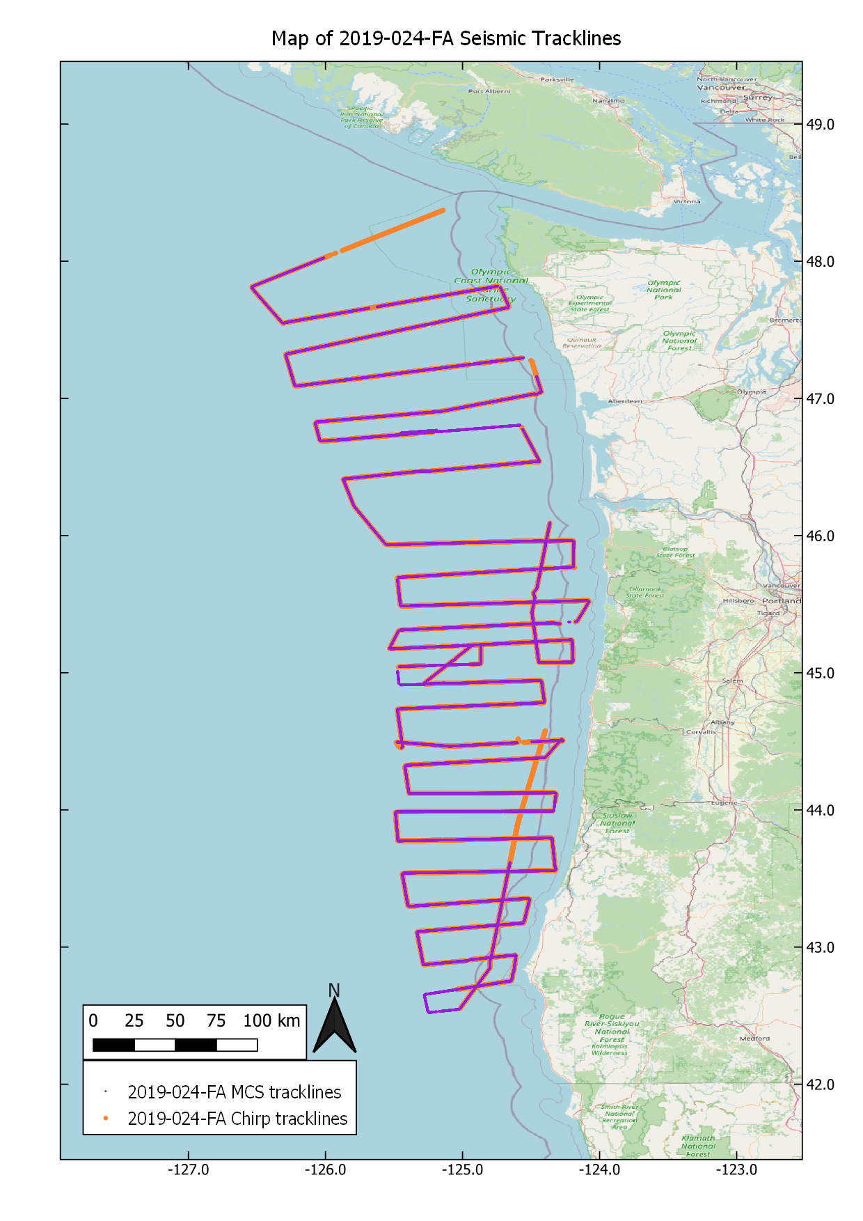
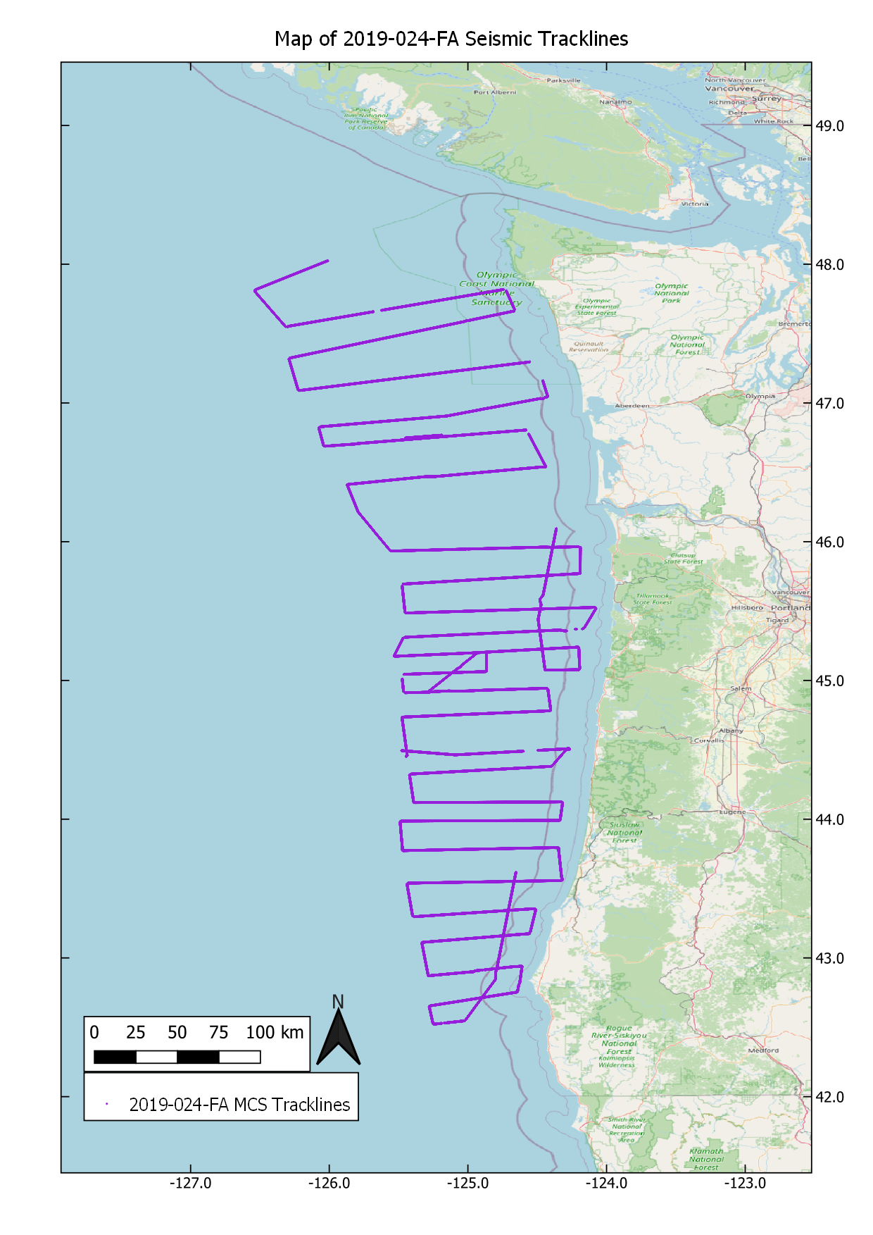
High-resolution multichannel sparker seismic (MCS) data and chirp sub-bottom data were collected by the U.S. Geological Survey in collaboration with the University of Washington (UW) in the summer of 2019 along the Cascadia submarine forearc offshore Oregon and Washington. Data were acquired to characterize quaternary deformation and sediment dynamics along the central and northern Cascadia margin. A total of 62 tracklines were collected and extend from the nearshore to the deformation front and were spaced between 25 and 50 kilometers apart. This work occurred on UW’s R/V Rachel Carson (UW cruise IDs RC0028 and RC0029). MCS data were collected coincidently with chirp sub-bottom data. These data and information are intended for science researchers, students, policy makers, and general public.
Seismic Data
-
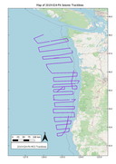
High-resolution multichannel sparker seismic-reflection data acquired along the Cascadia margin during USGS field activity 2019-024-FA
High-resolution multichannel sparker seismic (MCS) data were collected by the U.S. Geological Survey in collaboration with the University of Washington (UW) in the summer of 2019 along the Cascadia submarine forearc offshore Oregon and Washington.
Data Files
2019-024-FA.mcs.dcn.zip - 16.4 GB
2019-024-FA.mcs.mig.zip - 16.8 GB
Metadata Files
2019-024-FA.mcs.metadata.xml - 17.2 KB
2019-024-FA.mcs.metadata.txt - 16.5 KB
-
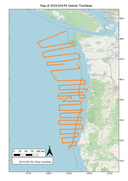
Chirp sub-bottom data acquired along the Cascadia margin during USGS field activity 2019-024-FA
Chirp sub-bottom data were collected by the U.S. Geological Survey in collaboration with the University of Washington (UW) in the summer of 2019 along the Cascadia submarine forearc offshore Oregon and Washington.
Data Files
2019-024-FA.chirp.zip - 57.0 GB
Metadata Files
2019-024-FA.chirp.metadata.xml - 15.3 KB
2019-024-FA.chirp.metadata.txt - 14.8 KB

Suggested Citation
Balster-Gee, A.F., Miller, N.C., Watt, J.T., Roland, E.C., Kluesner, J.W., Heller, S. J., Hart, P.E., Sliter, R.W., Myers, E.K., Wyland, R.M., Marcuson, R.K., Johnson, C.D., Nichols, A.R., Pszczola, K., Williams, C., 2023, High-resolution multichannel sparker seismic-reflection and chirp sub-bottom data acquired along the Cascadia margin during USGS field activity 2019-024-FA: U.S. Geological Survey data release, https://doi.org/10.5066/P96ZBXK8.
Overview Image