Multichannel minisparker seismic-reflection data collected offshore Glacier Bay National Park during USGS field activity 2015-629-FA
By Alicia F. Balster-Gee, Daniel S. Brothers, Peter J. Haeussler, Peter Dartnell, Patrick E. Hart, Robert M. Wyland, and Gerry A. Hatcher
https://doi.org/10.5066/P97Q990F
Dates
Published: March 14, 2023
Summary
Multichannel seismic reflection data were collected by the U.S. Geological Survey in May of 2015 outside of Palma Bay, Alaska. Seismic data were acquired coincidentally with high resolution bathymetry (Dartnell and others, 2022). Data were acquired to map the offshore extension of the Queen Charlotte-Fairweather Fault. The fault has produced several significant earthquakes during the last 150 years, yet little to no information exists along most of its length due to its location offshore. We aim to image the fault structure, mode of deformation and constrain its late Holocene slip rate for the northernmost segment.
Seismic Data
-
Multichannel minisparker seismic-reflection data collected offshore Glacier Bay National Park during USGS field activity 2015-629-FA
Multichannel seismic reflection data were collected by the U.S. Geological Survey in May of 2015 outside of Palma Bay, Alaska. Seismic data were acquired coincidentally with high resolution bathymetry (Dartnell and others, 2022).
Data Files
2015-629-FA.mcs.segy.zip - 169.5 MB
Metadata Files
2015-629-FA.mcs.metadata.xml - 14.8 KB
2015-629-FA.mcs.metadata.txt - 14.4 KB
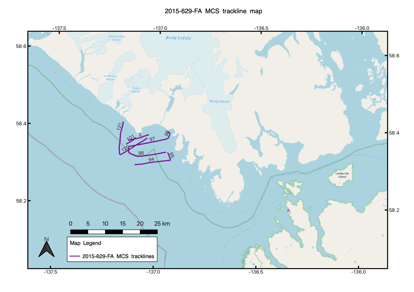
 Map of MCS tracklines collected during USGS field activity 2015-629-FA.
Suggested Citation
Balster-Gee, A.F., Brothers, D.S., Haeussler, P.J., Dartnell, P., Hart, P.E., Wyland, R., and Hatcher, G.A., 2022, Multichannel minisparker seismic-reflection data collected offshore Glacier Bay National Park during USGS field activity 2015-629-FA: U.S. Geological Survey data Release, https://doi.org/10.5066/P97Q990F.
Overview Image
