Donated AUV bathymetry and Chirp seismic-reflection data collected during Monterey Bay Aquarium Research Institute cruises in 2018-2019 offshore of south-central California
By Daniel J. Kennedy, Maureen A. Walton, Guy R. Cochrane, Charlie K. Paull, Dave Caress, Krystle Anderson, and Eve M. Lundsten
https://doi.org/10.5066/P97QM7NF
Dates
Published: Aug. 23, 2021
Data Collected: April 25, 2018 – May 11, 2019
Summary
This data release consists of donated AUV bathymetry and Chirp seismic-reflection data collected using an autonomous underwater vehicle (AUV) in 2018 and 2019. The collection of these data was funded entirely by the Monterey Bay Aquarium Research Institute (MBARI), and the data have been donated to the U.S. Geological Survey (USGS). The data were collected in collaboration with the USGS and the Bureau of Ocean Energy Management (BOEM) and they are located in the same study area as the collaborative California Deepwater Investigations and Groundtruthing I (Cal DIG I) project. The purpose of the overall Cal DIG I study is to assess shallow geohazards, benthic habitats, and thereby the potential for alternative energy infrastructure (namely floating wind turbines) offshore south-central California due to the study area's proximity to power grid infrastructure associated with the Morro Bay power plant.
Seismic Data
-
Donated AUV Chirp seismic-reflection data collected during Monterey Bay Aquarium Research Institute (MBARI) cruise in April 2018 offshore of south-central California
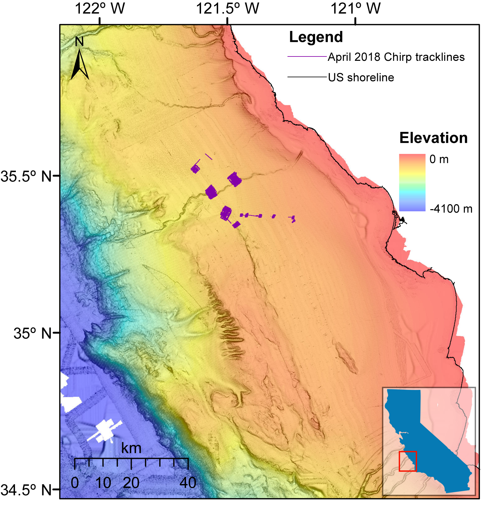
This dataset consists of autonomous underwater vehicle (AUV) Chirp seismic-reflection data collected in April 2018 aboard the R/V Rachel Carson, which is owned and operated by the Monterey Bay Aquarium Research Institute (MBARI). During the cruise, data were collected across eight AUV dives, six of which collected coincident bathymetry and Chirp seismic-reflection data (two dives collected Chirp seismic-reflection data only). The collection of these data was funded entirely by MBARI, and the data have been donated to the U.S. Geological Survey (USGS). The data were collected in collaboration with the USGS and the Bureau of Ocean Energy Management (BOEM) and they are located in the same study area as the collaborative California Deepwater Investigations and Groundtruthing I (Cal DIG I) project. The purpose of the overall Cal DIG I study is to assess shallow geohazards, benthic habitats, and thereby the potential for alternative energy infrastructure (namely floating wind turbines) offshore south-central California due to the study area's proximity to power grid infrastructure associated with the Morro Bay power plant. The AUV data in this portion of the data release provide ultra-high-resolution subsurface imaging of eight different patches of seafloor offshore of the south-central California coast. The AUV mapping navigation has not been accurately positioned and is considered as only partially processed.
Data Files
2021-603-DD_chirp_20180425m1.zip - 3.1 GB - MD5:3d5e428c4f2a3c058b11b5eea1728a58
2021-603-DD_chirp_20180425m2.zip - 2.8 GB - MD5:6bfdf15b29955f8202ce2a0591417571
2021-603-DD_chirp_20180426m1.zip - 2.3 GB - MD5:8ae9e7a1c351691ad7cbd7fe9cfedb3b
2021-603-DD_chirp_20180426m2.zip - 4.1 GB - MD5:e80cdca9ad62852e996002240405798a
2021-603-DD_chirp_20180427m1.zip - 2.6 GB - MD5:022db9830edb6186e3112229d4a16760
2021-603-DD_chirp_20180427m2.zip - 3.2 GB - MD5:90eeff9c1fa791bb068f3323b8631c97
2021-603-DD_chirp_20180427m3.zip - 2.5 GB - MD5:ea7110ca0d13a4f1619a4f6d91b0063e
2021-603-DD_chirp_20180428m1.zip - 4.7 GB - MD5:cba07e0bae5528a108e725c2ecb86b79
Metadata Files
2021-603-DD_chirp_201804_metadata.xml - 17.9 KB
2021-603-DD_chirp_201804_metadata.txt - 17.3 KB
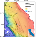
 Colored bathymetry map offshore of south-central California overlaid with MBARI-donated seismic data in purple.
 -
Donated AUV Chirp seismic-reflection data collected during Monterey Bay Aquarium Research Institute (MBARI) cruise in March 2019 offshore of south-central California
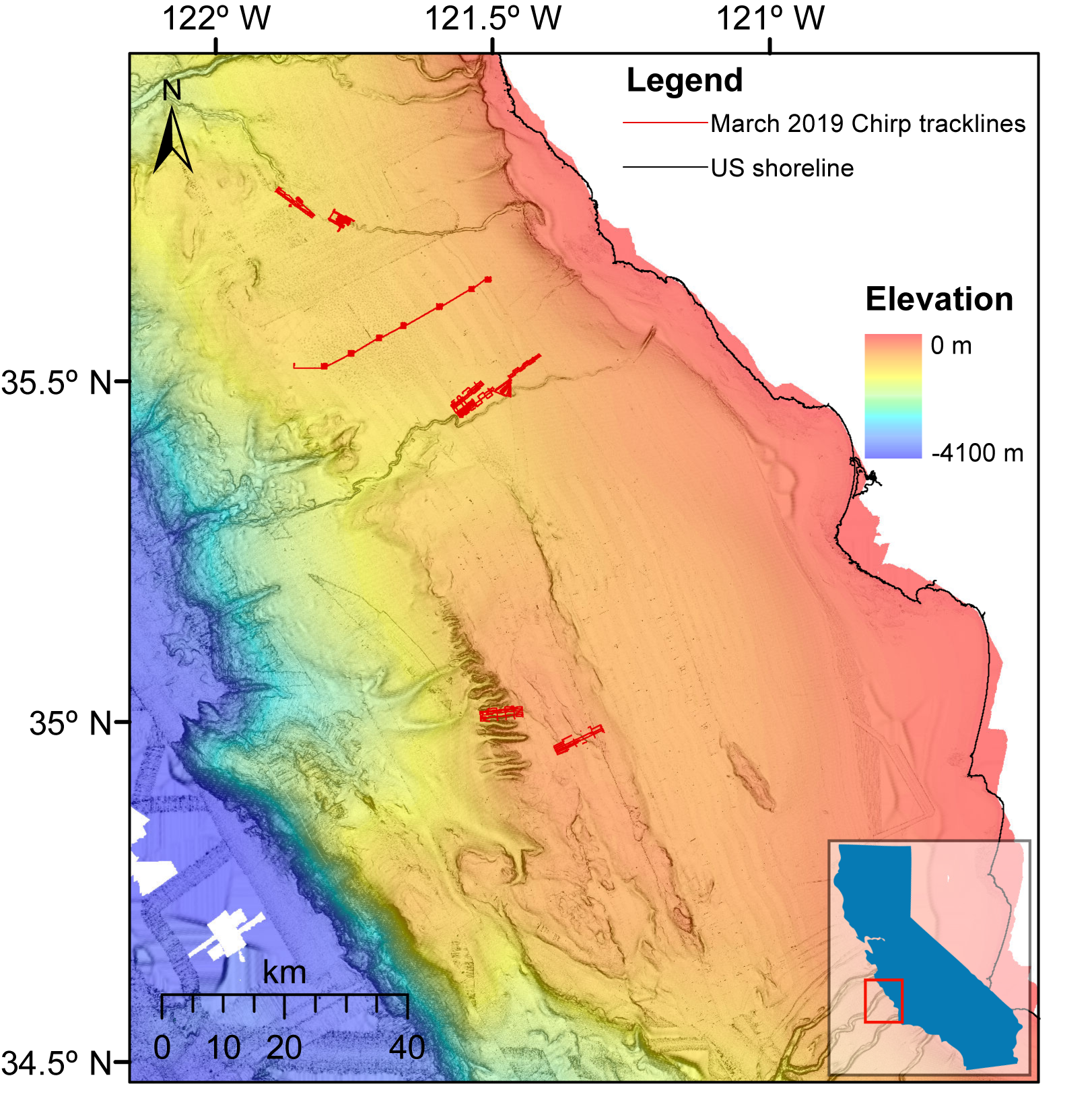
This dataset consists of autonomous underwater vehicle (AUV) Chirp seismic-reflection data collected in March 2019 aboard the R/V Rachel Carson, which is owned and operated by the Monterey Bay Aquarium Research Institute (MBARI). During the cruise, data were collected across eight AUV dives, all eight of which collected coincident bathymetry and Chirp seismic-reflection data. The collection of these data was funded entirely by MBARI, and the data have been donated to the U.S. Geological Survey (USGS). The data were collected in collaboration with the USGS and the Bureau of Ocean Energy Management (BOEM), and they are located in the same study area as the collaborative California Deepwater Investigations and Groundtruthing I (Cal DIG I) project. The purpose of the overall Cal DIG I study is to assess shallow geohazards, benthic habitats, and thereby the potential for alternative energy infrastructure (namely floating wind turbines) offshore south-central California due to the study area's proximity to power grid infrastructure associated with the Morro Bay power plant. The AUV data in this portion of the data release provide ultra-high-resolution subsurface imaging of eight different patches of seafloor offshore of the south-central California coast. The AUV mapping navigation has not been accurately positioned and is considered as only partially processed.
Data Files
2021-604-DD_chirp_20190314m4.zip - 3.6 GB - MD5:77fa7b60c460796b5ecb43cf7b815b4a
2021-604-DD_chirp_20190315m1.zip - 1.9 GB - MD5:2cbdb49a2bac595bceeb1f003d6c78f9
2021-604-DD_chirp_20190316m1.zip - 1.8 GB - MD5:7f1bc3279a7952585180017c0201fd38
2021-604-DD_chirp_20190317m1.zip - 2.8 GB - MD5:8aceedadfb8ec04d6e432e91476b1e72
2021-604-DD_chirp_20190317m2.zip - 3.0 GB - MD5:d1fdf97be3c6b0315dd5c92a3d284041
2021-604-DD_chirp_20190318m1.zip - 2.4 GB - MD5:6df60966a7a435f7debf3ce2c78e0e4e
2021-604-DD_chirp_20190318m2.zip - 3.9 GB - MD5:e46c0cdd40cba35201cfa72ef320c9bf
2021-604-DD_chirp_20190319m1.zip - 581.7 MB - MD5:0f8a69ea788458ed9a868cde0c9f4731
Metadata Files
2021-604-DD_chirp_201903_metadata.xml - 17.5 KB
2021-604-DD_chirp_201903_metadata.txt - 17.0 KB
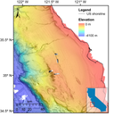
 Colored bathymetry map offshore of south-central California overlaid with MBARI-donated seismic data in red.
 -
Donated AUV Chirp seismic-reflection data collected during Monterey Bay Aquarium Research Institute (MBARI) cruise in May 2019 offshore of south-central California
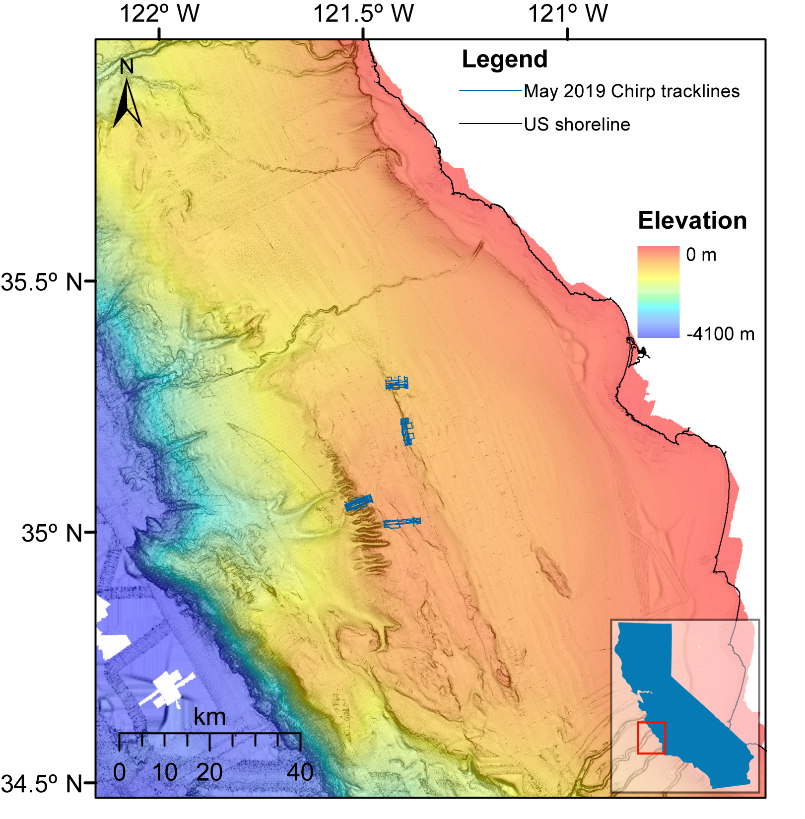
This dataset consists of autonomous underwater vehicle (AUV) Chirp seismic-reflection data collected in May 2019 aboard the R/V Rachel Carson, which is owned and operated by the Monterey Bay Aquarium Research Institute (MBARI). During the cruise, data were collected across four AUV dives, all four of which collected coincident bathymetry and Chirp seismic-reflection data. The collection of these data was funded entirely by MBARI, and the data have been donated to the U.S. Geological Survey (USGS). The data were collected in collaboration with the USGS and the Bureau of Ocean Energy Management (BOEM), and they are located in the same study area as the collaborative California Deepwater Investigations and Groundtruthing I (Cal DIG I) project. The purpose of the overall Cal DIG I study is to assess shallow geohazards, benthic habitats, and thereby the potential for alternative energy infrastructure (namely floating wind turbines) offshore south-central California due to the study area's proximity to power grid infrastructure associated with the Morro Bay power plant. The AUV data in this portion of the data release provide ultra-high-resolution subsurface imaging of four different patches of seafloor offshore of the south-central California coast. The AUV mapping navigation has not been accurately positioned and is considered as only partially processed.
Data Files
2021-605-DD_chirp_20190510m1.zip - 1.9 GB - MD5:f3b1736a4bb6972f23a1da2f48c13f5c
2021-605-DD_chirp_20190510m2.zip - 2.1 GB - MD5:bce72c4404105c4069182054e405e466
2021-605-DD_chirp_20190511m1.zip - 2.4 GB - MD5:d9fa044102a85c0becb06cc68f678da2
2021-605-DD_chirp_20190511m2.zip - 1.7 GB - MD5:1127b9ad50405bf9c75ea8e7dabb9949
Metadata Files
2021-605-DD_chirp_201905_metadata.xml - 17.6 KB
2021-605-DD_chirp_201905_metadata.txt - 17.1 KB
 Colored bathymetry map offshore of south-central California overlaid with MBARI-donated seismic data in blue.
Sonar Data
-
Donated AUV bathymetry data collected during Monterey Bay Aquarium Research Institute (MBARI) cruise in April 2018 offshore of south-central California
This dataset consists of autonomous underwater vehicle (AUV) bathymetry data collected in April 2018 aboard the R/V Rachel Carson, which is owned and operated by the Monterey Bay Aquarium Research Institute (MBARI). During the cruise, bathymetry data were collected across six AUV dives, all six of which collected coincident bathymetry and Chirp seismic-reflection data. A seventh bathymetric survey, 201804_LuciaChica2m, consists of MBARI data from several AUV dives that were conducted pre-2018 but were compiled in April 2018; these data are not being released with coincident Chirp data. The collection of these data was funded entirely by MBARI, and the data have been donated to the U.S. Geological Survey (USGS). The data were collected in collaboration with the USGS and the Bureau of Ocean Energy Management (BOEM), and they are located in the same study area as the collaborative California Deepwater Investigations and Groundtruthing I (Cal DIG I) project. The purpose of the overall Cal DIG I study is to assess shallow geohazards, benthic habitats, and thereby the potential for alternative energy infrastructure (namely floating wind turbines) offshore south-central California due to the study area's proximity to power grid infrastructure associated with the Morro Bay power plant. The AUV data in this part of the data release provide ultra-high-resolution seafloor imaging of seven different patches of seafloor offshore of the south-central California coast. The AUV mapping navigation has not been accurately positioned and is considered as only partially processed.
Data Files
2021-603-DD_bathy_201804-20180428m1.zip - 157.1 MB - MD5:77e2977c34ab93ea7e17745dbf5200b0
Metadata Files
2021-603-DD_bathy_201804_metadata.xml - 17.6 KB
2021-603-DD_bathy_201804_metadata.txt - 17.3 KB
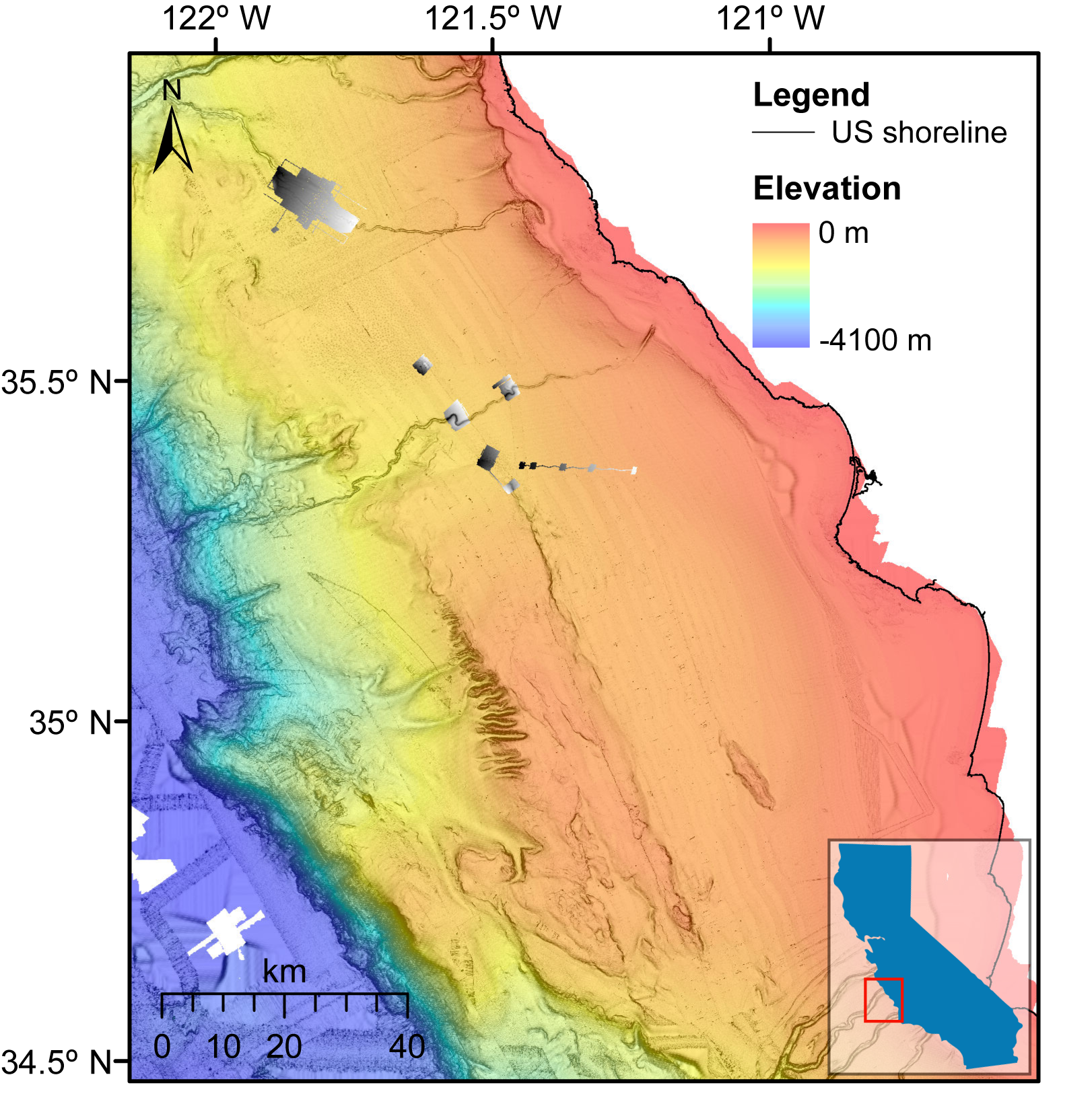
 Colored bathymetry map offshore of south-central California overlaid with MBARI-donated bathymetry data in greyscale.
 -
Donated AUV bathymetry data collected during Monterey Bay Aquarium Research Institute (MBARI) cruise in March 2019 offshore of south-central California
This dataset consists of autonomous underwater vehicle (AUV) bathymetry data collected in March 2019 aboard the R/V Rachel Carson, which is owned and operated by the Monterey Bay Aquarium Research Institute (MBARI). During the cruise, bathymetry data were collected across eight AUV dives, all eight of which collected coincident bathymetry and Chirp seismic-reflection data. The collection of these data was funded entirely by MBARI, and the data have been donated to the U.S. Geological Survey (USGS). The data were collected in collaboration with the USGS and the Bureau of Ocean Energy Management (BOEM), and they are located in the same study area as the collaborative California Deepwater Investigations and Groundtruthing I (Cal DIG I) project. The purpose of the overall Cal DIG I study is to assess shallow geohazards, benthic habitats, and thereby the potential for alternative energy infrastructure (namely floating wind turbines) offshore south-central California due to the study area's proximity to power grid infrastructure associated with the Morro Bay power plant. The AUV data in this part of the data release provide ultra-high-resolution seafloor imaging of eight different patches of seafloor offshore of the south-central California coast. The AUV mapping navigation has not been accurately positioned and is considered as only partially processed.
Data Files
2021-604-DD_bathy_20190314m4-20190319m1.zip - 162.5 MB - MD5:f8d27cc6fdc57af4a0f4dbe911eee63f
Metadata Files
2021-604-DD_bathy_201903_metadata.xml - 17.4 KB
2021-604-DD_bathy_201903_metadata.txt - 17.1 KB
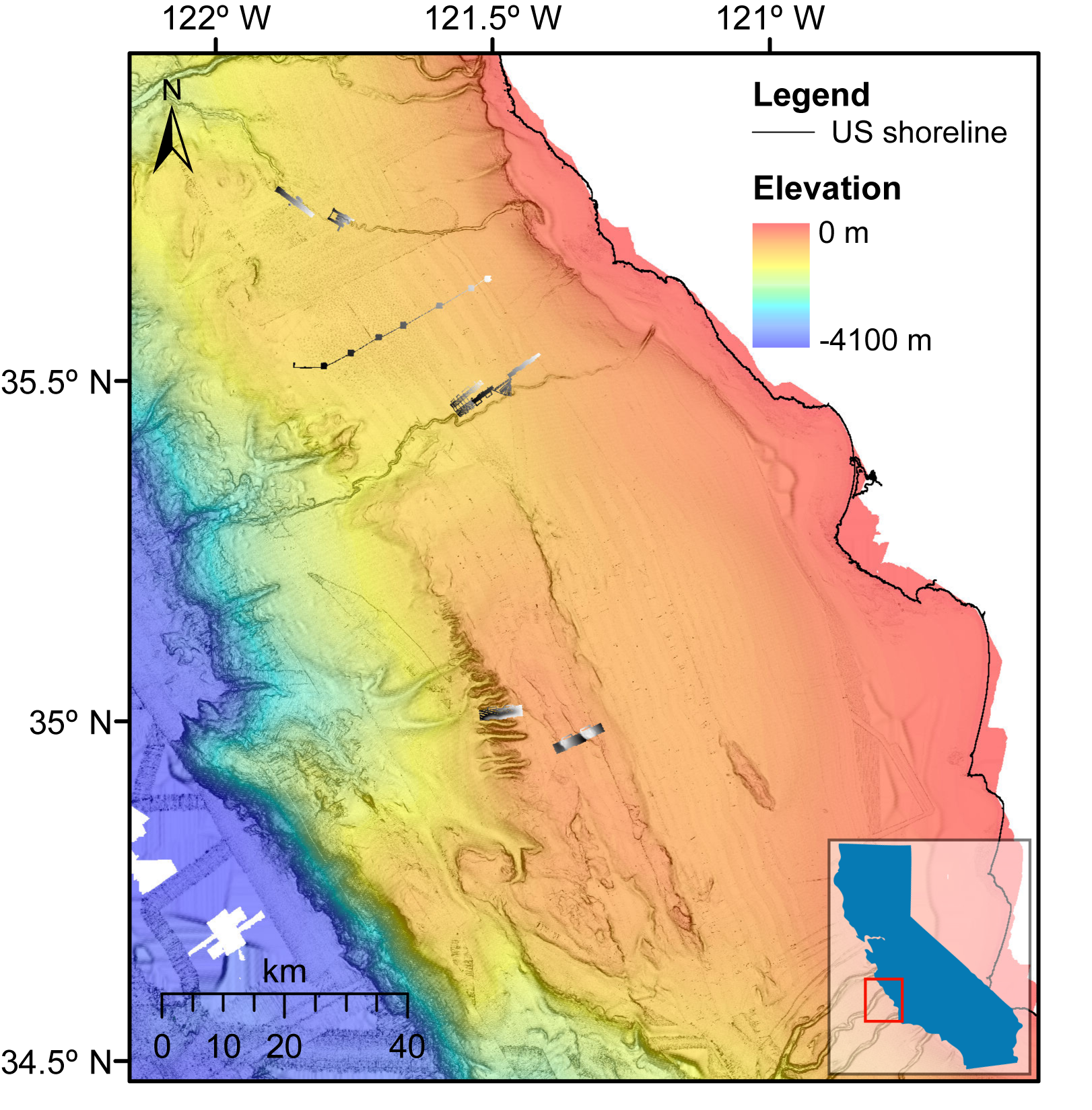
 Colored bathymetry map offshore of south-central California overlaid with MBARI-donated bathymetry data in greyscale.
 -
Donated AUV bathymetry data collected during Monterey Bay Aquarium Research Institute (MBARI) cruise in May 2019 offshore of south-central California
This dataset consists of autonomous underwater vehicle (AUV) bathymetry data collected in May 2019 aboard the R/V Rachel Carson, which is owned and operated by the Monterey Bay Aquarium Research Institute (MBARI). During the cruise, bathymetry data were collected across four AUV dives, all four of which collected coincident bathymetry and Chirp and seismic-reflection data. The collection of these data was funded entirely by MBARI, and the data have been donated to the U.S. Geological Survey (USGS). The data were collected in collaboration with the USGS and the Bureau of Ocean Energy Management (BOEM), and they are located in the same study area as the collaborative California Deepwater Investigations and Groundtruthing (Cal DIG I) project. The purpose of the overall Cal DIG I study is to assess shallow geohazards, benthic habitats, and thereby the potential for alternative energy infrastructure (namely floating wind turbines) offshore south-central California due to the study area's proximity to power grid infrastructure associated with the Morro Bay power plant. The AUV data in this part of the data release provide ultra-high-resolution seafloor imaging of four different patches of seafloor offshore of the south-central California coast. The AUV mapping navigation has not been accurately positioned and is considered as only partially processed.
Data Files
2021-605-DD_bathy_20190510m1-20190511m2.zip - 123.9 MB - MD5:17a064bb2698cb83ddad79fbb8874b48
Metadata Files
2021-605-DD_bathy_201905_metadata.xml - 17.5 KB
2021-605-DD_bathy_201905_metadata.txt - 17.1 KB
 Colored bathymetry map offshore of south-central California overlaid with MBARI-donated bathymetry data in greyscale.

Related Field Activities
- 2021-603-DD - View Details
- 2021-604-DD - View Details
- 2021-605-DD - View Details
Suggested Citation
Kennedy, D.J., Walton, M.A.L., Cochrane, G.R., Paull, C., Caress, D., Anderson, K., and Lundsten, E., 2021, Donated AUV bathymetry and Chirp seismic-reflection data collected during Monterey Bay Aquarium Research Institute cruises in 2018-2019 offshore of south-central California: U.S. Geological Survey data release, https://doi.org/10.5066/P97QM7NF
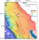
Overview Image
