Multichannel minisparker seismic-reflection and chirp subbottom data collected offshore Northern California during USGS field activity 2019-643-FA
By Alicia F. Balster-Gee, Jenna C. Hill, Janet T. Watt, Daniel S. Brothers, Nora M. Nieminski, Travis V. Alongi, Gerry A. Hatcher, and Brandon M. Nasr
https://doi.org/10.5066/P998EC72
Dates
Published: July 20, 2023
Summary
High-resoulution multichannel seismic-reflection (MCS) and Chirp sub-bottom data were collected by the U.S. Geological Survey in 2019 offshore Humboldt County of northern California to expand data coverage along the southern Cascadia Margin. Data were acquired to characterize offshore faults and to study sediment distribution. MCS and Chirp data were collected coincidentally and were used to determine sediment core targets for marine geohazard studies. These data and information are intended for science researchers, students, policy makers, and general public.
Sparker Data
-
Multichannel minisparker seismic-reflection data collected offshore Northern California during USGS field activity 2019-643-FA
High-resolution multichannel seismic (MCS) data were collected by the U.S. Geological Survey in 2019 offshore Humboldt County of northern California to expand data coverage along the southern Cascadia Margin.
Data Files
2019-643-FA.mcs.segy.zip - 6.9 GB
Metadata Files
2019-643-FA.mcs.metadata.xml - 15.0 KB
2019-643-FA.mcs.metadata.txt - 14.5 KB
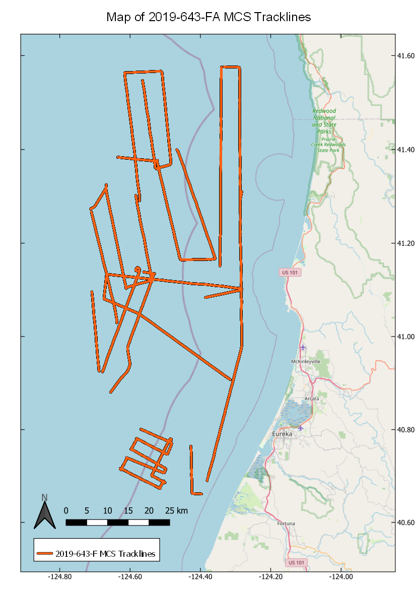
 Map of MCS tracklines collected during USGS field activity 2019-643-FA
Sub Bottom Profiler Data
-
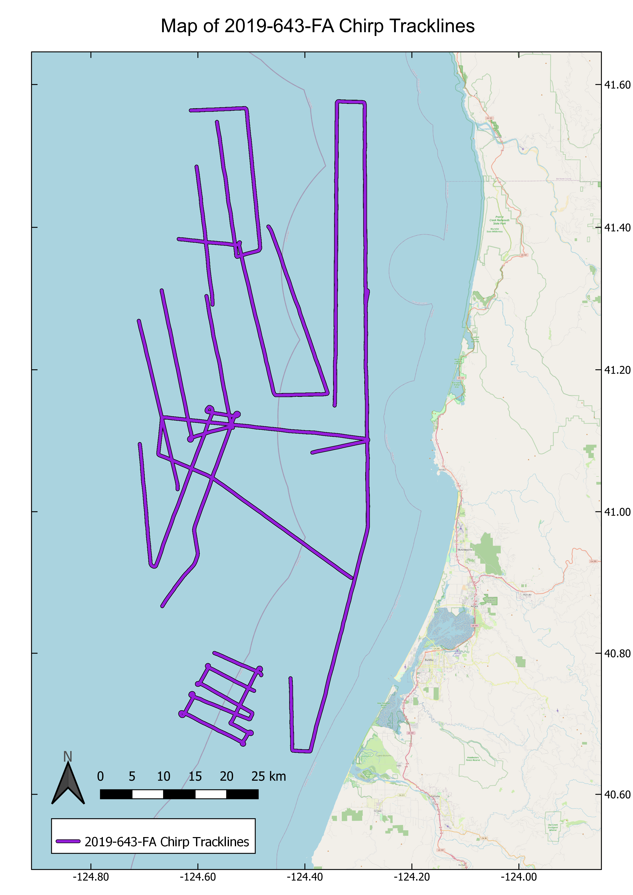
Chirp sub-bottom data collected offshore Northern California during USGS field activity 2019-643-FA
Chirp sub-bottom data were collected by the U.S. Geological Survey in 2019 offshore Humboldt County of northern California to expand data coverage along the southern Cascadia Margin.
Data Files
2019-643-FA.chirp.segy.zip - 15.8 GB
Metadata Files
2019-643-FA.chirp.metadata.xml - 14.4 KB
2019-643-FA.chirp.metadata.txt - 13.9 KB
 Map of chirp subbottom tracklines collected during USGS field acticity 2019-643-FA
Suggested Citation
Balster-Gee, A.F., Hill, J.C., Watt, J.T., Brothers, D.S., Nieminski, N.M., Alongi, T., Hatcher, G.A., Nasr, B.M., 2023, Multichannel minisparker seismic-reflection and chirp subbottom data collected offshore Northern California during USGS field activity 2019-643-FA: U.S. Geological Survey data release, https://doi.org/10.5066/P998EC72.
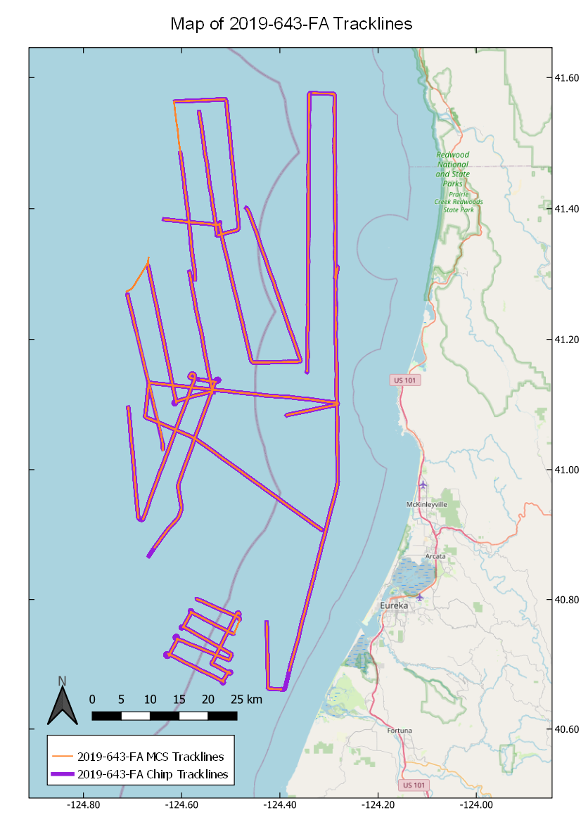
Overview Image