Future coastal hazards along the U.S. Atlantic coast
By Patrick L. Barnard, Kevin M. Befus, Jeffrey J Danielson, Anita C. Engelstad, Li H. Erikson, Amy C. Foxgrover, Maya K. Hayden, Daniel J. Hoover, Tim Leijnse, Chris Massey, Robert McCall, Norberto Nadal-Caraballo, Kees M. Nederhoff, Leonard Ohenhen, Andrea O'Neill, Kai A. Parker, Manoocher Shirzaei, Xin Su, Jennifer A. Thomas, Maarten van Ormondt, Sean F. Vitousek, and Madison Yawn
https://doi.org/10.5066/P9BQQTCI
Dates
Published: March 15, 2023
Last Revised: Nov. 22, 2024 (ver. 2.0)
Summary
This product consists of several datasets that map future coastal flooding and erosion hazards due to sea level rise (SLR) and storms for three States (Florida, Georgia, and Virginia) along the Atlantic coast of the United States. The SLR scenarios encompass a plausible range of projections by 2100 based on the best available science and with enough resolution to support a suite of different planning horizons. The storm scenarios are derived with the use of atmospheric drivers from the Coupled Model Intercomparison Project Phase 6 (CMIP6) High Resolution Model Intercomparison Project (HighResMIP), a widely endorsed study that seeks to improve GCM hurricane modeling and applies a systematic approach to investigate the impact of horizontal resolution on simulating climate variables and hurricanes. Downscaled data products provided as part of this data release include: Projected Flood hazards (28 scenarios of 7 SLRs in combination with 3 storms and daily conditions), storm surge and astronomic tide time-series within the nearshore region for projected future storms (2020-2050), shoreline change time-series (2020-2100); depth to water table (7 SLR scenarios); and vertical land motion (14 years of historical observations).
Satellite Data
-
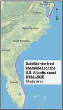
Satellite-derived shorelines for the U.S. Atlantic coast (1984-2021)
This dataset contains shoreline positions derived from available Landsat satellite imagery for five states (Delaware, Maryland, Viginia, Georgia, and Florida) along the U.S. Atlantic coast for the time period 1984 to 2021. An open-source toolbox, CoastSat (Vos and others, 2019a and 2019b), was used to classify coastal Landsat imagery and detect shorelines at the sub-pixel scale. Resulting shorelines are presented in KMZ format. Significant uncertainty is associated with the locations of shorelines in extremely dynamic regions, including at the locations of river mouths, tidal inlets, capes, and ends of spits. These data are readily viewable in Google Earth. For best display of results, it is recommended to turn off any 3D viewing. For technical users and researchers, data can be ingested into Global Mapper or QGIS for more detailed analysis. Similar shoreline positions for North Carolina and South Carolina are available from Barnard and others, 2023 at https://doi.org/10.5066/P9W91314.
Data Files
SatelliteDerivedShorelines_FL.kmz - 96.9 MB - MD5:e352cfc4bf37ee2a2eeea412faf71f0b
SatelliteDerivedShorelines_GA.kmz - 32.6 MB - MD5:a42cb6ca60d728ebafeebd4e11e77be3
SatelliteDerivedShorelines_VA_MD_DE.kmz - 32.7 MB - MD5:0665f0581f9e76c7dea6dffe2f9af991
Metadata Files
SatelliteDerivedShorelines_metadata.xml - 29.2 KB
SatelliteDerivedShorelines_metadata.txt - 27.8 KB
-
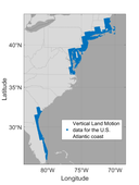
Vertical land motion rates for the years 2007 to 2020 for the U.S. Atlantic coast
This dataset contains rates of land subsidence and uplift derived from Sentinel-1A/B (2015-2020) and ALOS (2007-2011) synthetic aperture radar (SAR) satellites, at approximately 50-75 m resolution and mm-level precision for the U.S. Atlantic coast except for the states of North and South Carolina. The data consist of vertical land motion (VLM) rates and the 1-sigma error in land motion rates and are available as csv files. Similar vertical land motion rates for North Carolina and South Carolina are available from Barnard and others, 2023, at https://doi.org/10.5066/P9W91314.
Data Files
VerticalLandMotion_Rate_CT.zip - 21.8 MB - MD5:25ba3af8fb03bd95198216045ba37ee4
VerticalLandMotion_Rate_DE.zip - 8.8 MB - MD5:2ce967fc218c87966eadef08ee56afc7
VerticalLandMotion_Rate_FL.zip - 43.6 MB - MD5:add475f273d74c4b6af488019fe3067e
VerticalLandMotion_Rate_GA.zip - 27.7 MB - MD5:e61ce7daed4d5228c0e06e038df9ec2c
VerticalLandMotion_Rate_MA.zip - 33.3 MB - MD5:f8684f9aa44612f54eee347d10ed58e9
VerticalLandMotion_Rate_MD.zip - 25.1 MB - MD5:0f83374cb44ee49a689a9ea8a0c925dd
VerticalLandMotion_Rate_NH.zip - 2.5 MB - MD5:606642d117881604115593a4d22c673e
VerticalLandMotion_Rate_NJ.zip - 41.8 MB - MD5:3c8a922f86ddf2741c1c234dfa8d28ae
VerticalLandMotion_Rate_NY.zip - 21.5 MB - MD5:cdf036c7604311ed18ff061d0a1aa370
VerticalLandMotion_Rate_RI.zip - 3.3 MB - MD5:4e0d49983cbccdfff23c68f649038489
VerticalLandMotion_Rate_VA.zip - 11.7 MB - MD5:8322ae8e2f9698b75b3538a70ae1717b
Metadata Files
VerticalLandMotion_Rate_metadata.xml - 35.0 KB
VerticalLandMotion_Rate_metadata.txt - 33.3 KB


Simulation Data
-
Nearshore parametric wave setup future projections (2020-2050) for the U.S. Atlantic coast
This dataset presents alongshore wave setup timeseries for three states (Virginia, Georgia, and Florida) along the U.S. Atlantic coast. Wave setup was modelled using parameterization for open coast sandy beaches as presented in Stockdon and others (2006). The parameterization relates onshore wave setup to offshore wave conditions and beach characteristics. Wave conditions were extracted at approximately the 10 m depth contour and reverse shoaled to the deep-water condition. These data were then matched to cross-shore transects spaced at approximately 1 km along the coastline. Beach slope at these transects were extracted from lidar (Doran and others, 2017) and temporally averaged across all available datasets. Waves were modelled using a global WAVEWATCHIII model forced by atmospheric forcing from the Coupled Model Intercomparison Project (CMIP6) future period data. Data are provided for 6 CMIP6 models from the HighResMIP project (Haarsma and others, 2016). Output includes 1-hour wave setup provided at approximately 1,600 alongshore transects at approximately 1-5 km resolution. Data are available as csv files for each transect location and are bundled by state. The methodology used to produce this dataset is further detailed in Parker and others (2023) and similar modelled data for North Carolina and South Carolina are available from Barnard and others, 2023, at https://doi.org/10.5066/P9W91314.
Data Files
WaveSetup_CMIP6Fut_FL.zip - 1.9 GB - MD5:06b3fb5b03078f262784c492e7210181
WaveSetup_CMIP6Fut_GA.zip - 465.3 MB - MD5:78c30527ccf87b61b887c7f4e2799867
WaveSetup_CMIP6Fut_VA.zip - 150.5 MB - MD5:6a2daeb899886bdb1f7113b94f993391
WaveSetup_Ref_TransectIdsLocs_FL.csv - 24.2 KB - MD5:811628300f10772bc3befab49db2197c
WaveSetup_Ref_TransectIdsLocs_GA.csv - 6.4 KB - MD5:141c9e0831be318d67eef0af597d0a04
WaveSetup_Ref_TransectIdsLocs_VA.csv - 1.9 KB - MD5:9944f94def403d9088e7a4e6cbda2498
Metadata Files
WaveSetup_CMIP6Fut_metadata.xml - 35.3 KB
WaveSetup_CMIP6Fut_metadata.txt - 34.0 KB

-
Nearshore parametric wave setup hindcast data (1979-2019) for the U.S. Atlantic coast
This dataset presents alongshore wave setup timeseries for three states (Virginia, Georgia, and Florida) along the U.S. Atlantic coast. Wave setup was modelled using parameterization for open coast sandy beaches as presented in Stockdon and others (2006). The parameterization relates onshore wave setup to offshore wave conditions and beach characteristics. Wave conditions were extracted at approximately the 10 m depth contour and reverse shoaled to the deep-water condition. These data were then matched to cross-shore transects spaced at approximately 1 km along the coastline. Beach slope at these transects were extracted from lidar (Doran and others, 2017) and temporally averaged across all available datasets. The hindcast model is forced by waves taken directly from the ERA5 reanalysis, which incorporates observations and data assimilation (Hersbach and others, 2020). Modeled wave setup time series are presented for the hindcast period 1979 to 2019. Output includes 1-hour wave setup provided at approximately 1,600 alongshore transects at approximately 1-5 km resolution. Data are available as csv files for each transect location and are bundled by state. This dataset and the methodology used for its production is further detailed in Parker and others (2023) and similar modelled data for North Carolina and South Carolina are available from Barnard and others, 2023, at https://doi.org/10.5066/P9W91314).
Data Files
WaveSetup_ERA5_FL.zip - 897.8 MB - MD5:3f80bd21b41f60d09e80843f1d14efee
WaveSetup_ERA5_GA.zip - 216.9 MB - MD5:e7aace22e45daf10ba725bc4af11de9b
WaveSetup_ERA5_VA.zip - 67.6 MB - MD5:5e100562dee52bda264a6fd04a1ffcce
WaveSetup_Ref_TransectIdsLocs_FL.zip - 7.2 KB - MD5:26eac4db461971e0fd91dd0804d14a7a
WaveSetup_Ref_TransectIdsLocs_GA.zip - 2.1 KB - MD5:6316affa8db4526e0c5cc8c0771b51e2
WaveSetup_Ref_TransectIdsLocs_VA.zip - 808 bytes - MD5:e1c81d4da4770ec49cf90eea905c57b1
Metadata Files
WaveSetup_ERA5_metadata.xml - 34.4 KB
WaveSetup_ERA5_metadata.txt - 33.0 KB

-
Nearshore water level, tide, and non-tidal residual future projections (2016-2050) for the U.S. Atlantic coast
A dataset of modeled nearshore water levels (WLs) was developed for three states (Virginia, Georgia, and Florida) along the U.S. Atlantic coast. Water levels, defined for this dataset as the linear sum of tides and non-tidal residuals (NTR), were produced by Muis and others (2016) using a global tide and surge model (GTSM) forced by global atmospheric fields. Water level outputs were extracted from the global grid at approximately 20 km resolution along the Atlantic coastline. These data were then statistically downscaled using a signal-specific set of corrections to improve skill in comparison to tide gauge observations (Parker and others, 2023). Projected water levels were forced by CMIP6 future period data. Four CMIP6 climate models were selected from the High-Resolution Model Intercomparison project (highresMIP; Haarsma and others, 2016) to sample variability in climate predictions. Similar modeled data for North Carolina and South Carolina are available from Barnard and others, 2023, at https://doi.org/10.5066/P9W91314)
Data Files
WL_Tide_NTR_CMIP6Fut_FL.zip - 1.8 GB - MD5:a6ccc8785a4eee6ae7db09b18f739696
WL_Tide_NTR_CMIP6Fut_GA.zip - 361.3 MB - MD5:17241fbb8f39cce8c9b678010c63908f
WL_Tide_NTR_CMIP6Fut_VA.zip - 286.5 MB - MD5:b9568f2eaac045215c96363696c23361
WL_Tide_NTR_CMIP6_Ref_StationIdsLocs_FL.csv - 758 bytes - MD5:6652f80e4949faf33a1dd7d00128984f
WL_Tide_NTR_CMIP6_Ref_StationIdsLocs_GA.csv - 170 bytes - MD5:f175b35a9b4d806374233f9457eb2aca
WL_Tide_NTR_CMIP6_Ref_StationIdsLocs_VA.csv - 146 bytes - MD5:3eeca16022689842f042ae14cef0cccf
Metadata Files
WL_Tide_NTR_CMIP6Fut_metadata.xml - 38.3 KB
WL_Tide_NTR_CMIP6Fut_metadata.txt - 37.0 KB
-
Nearshore water level, tide, and non-tidal residual hindcasts (1979-2016) for the U.S. Atlantic coast
A dataset of modeled nearshore water levels (WLs) was developed for three states (Virginia, Georgia, and Florida) along the U.S. Atlantic coast. Water levels, defined for this dataset as the linear sum of tides and non-tidal residuals (NTR), were produced by Muis and others (2016) using a global tide and surge model (GTSM) forced by global atmospheric fields -. Water level outputs were extracted from the global grid at approximately 20 km resolution along the coastlines. These data were then statistically downscaled using a signal-specific set of corrections to improve skill in comparison to tide gauge observations (Parker and others, 2023). Hindcast water levels were forced by ERA5 atmospheric forcing provided by the dataset of Hersbach and others (2020). ERA5 is a reanalysis product, incorporating observations and data assimilation to best represent the experienced climate. Therefore, data from this version of the dataset are comparable to observed WLs along the study region. Similar modeled data for North Carolina and South Carolina are available from Barnard and others, 2023, at https://doi.org/10.5066/P9W91314)
Data Files
WL_Tide_NTR_ERA5hindc_FL.zip - 667.3 MB - MD5:7d942b67e8906d9a59b0820551d8f939
WL_Tide_NTR_ERA5hindc_GA.zip - 138.1 MB - MD5:73a5d4db4d893b686d8308e40769ffce
WL_Tide_NTR_ERA5hindc_VA.zip - 92.2 MB - MD5:f8f5ded3231a73ba28a6641582362e4f
WL_Tide_NTR_ERA5_Ref_StationIdsLocs_FL.csv - 789 bytes - MD5:b98bd6dc600a5b4acf9c2c648ddd6cf9
WL_Tide_NTR_ERA5_Ref_StationIdsLocs_GA.csv - 182 bytes - MD5:6d4ecf6ed79365f2e23401b57b63a1f9
WL_Tide_NTR_ERA5_Ref_StationIdsLocs_VA.csv - 134 bytes - MD5:f822d6b67925f290ae27cfc2c77ce3b7
Metadata Files
WL_Tide_NTR_ERA5hindc_metadata.xml - 35.2 KB
WL_Tide_NTR_ERA5hindc_metadata.txt - 33.7 KB
-
Projected groundwater emergence and shoaling along the Virginia, Georgia, and Florida coasts
Groundwater emergence and shoaling extents are derived from water table depth GeoTIFFs, which are calculated as steady-state groundwater model heads subtracted from high-resolution topographic digital elevation model (DEM) land surface elevations. Results are provided as shapefiles of water table depth in specific depth ranges. Similar modeled data for North Carolina and South Carolina are available from Barnard and others, 2023 at https://doi.org/10.5066/P9W91314.
Data Files
GWHazards_EmergShoaling_FL_Kx0p1_WTbins.zip - 393.1 MB - MD5:6275ef87e919a6731e3ff30bcfa8314a
GWHazards_EmergShoaling_FL_Kx10_WTbins.zip - 354.3 MB - MD5:44be082ab9c0aec95ce08b7cc90e65b4
GWHazards_EmergShoaling_FL_Kx1_WTbins.zip - 401.0 MB - MD5:16e8e4c98202b8295636bfe80ac2f06b
GWHazards_EmergShoaling_GA_Kx0p1_WTbins.zip - 110.8 MB - MD5:a712a7e81df5274c2a21999f9cd097c6
GWHazards_EmergShoaling_GA_Kx10_WTbins.zip - 85.4 MB - MD5:d3bf2f9e16e08131d635e587dd2142c8
GWHazards_EmergShoaling_GA_Kx1_WTbins.zip - 108.7 MB - MD5:79a7ef656dc8b8832ef3797db1aba844
GWHazards_EmergShoaling_VA_Kx0p1_WTbins.zip - 527.0 MB - MD5:c0d5139b6cb71d115f524eff0fae1461
GWHazards_EmergShoaling_VA_Kx10_WTbins.zip - 265.7 MB - MD5:94cd5e86b9fb7a85c3486be1ab9edd4d
GWHazards_EmergShoaling_VA_Kx1_WTbins.zip - 422.8 MB - MD5:c19e770eadaa67ac18e5b7957a314685
Metadata Files

-
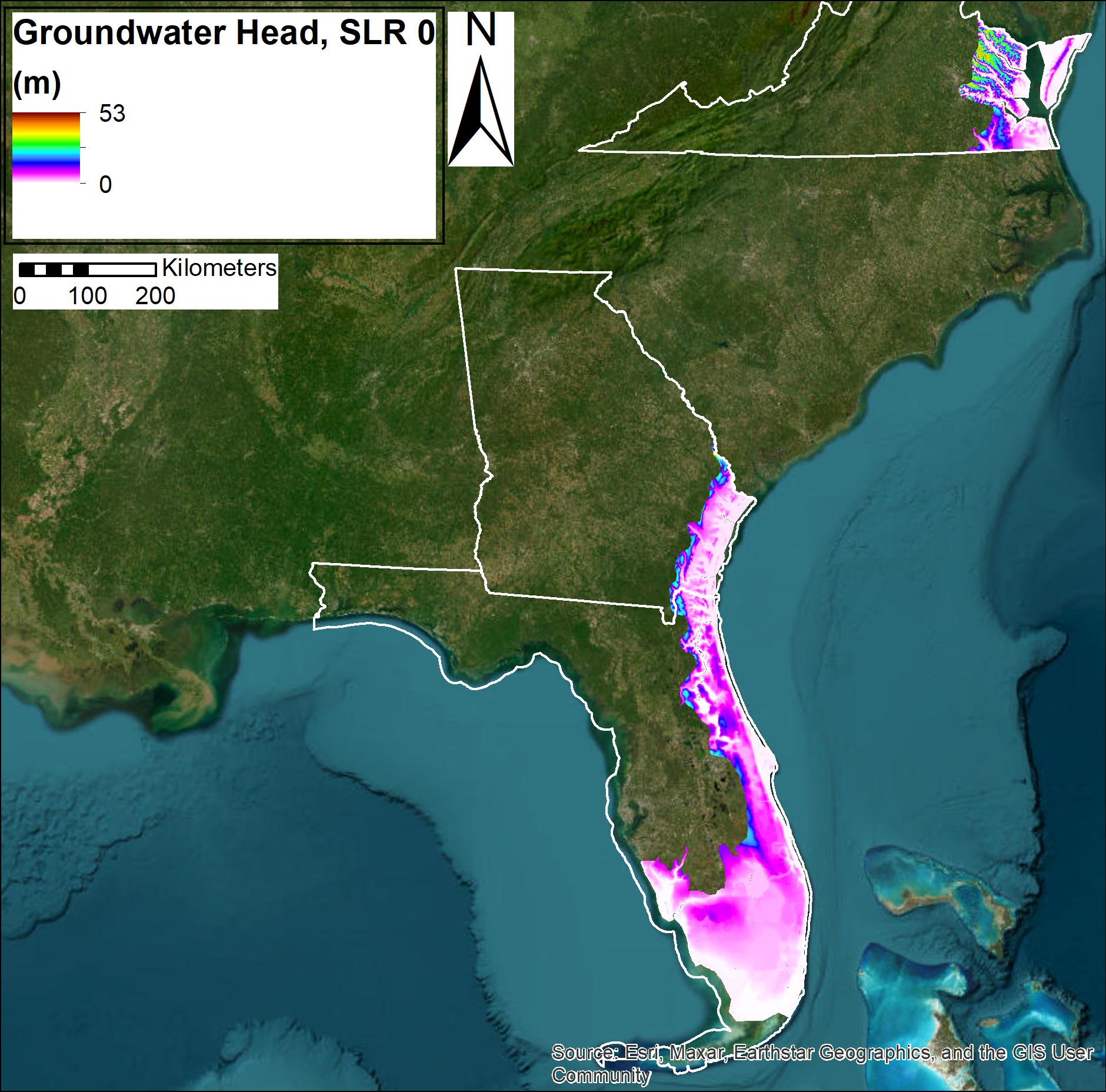
Projected groundwater head along the Virginia, Georgia, and Florida coasts
Seamless unconfined groundwater heads for U.S. coastal Virginia, Georgia, and Florida (Atlantic and Gulf coast south of Sarasota) groundwater systems were modeled with homogeneous, steady-state MODFLOW simulations. The geographic extent examined was limited primarily to low-elevation (land surface less than approximately 10 m above mean sea level) areas. Steady-state MODFLOW groundwater flow models were used to obtain detailed (50-meter-scale) predictions over large geographic scales (100s of kilometers) of groundwater heads for both current and future sea-level rise (SLR) scenarios (0, 0.25, 0.5, 1, 1.5, 2, 2.5, and 3 m) using 3 spatially varying hydraulic conductivities (K); one based on published K's, one with published K's reduced by a factor of 10 (K*0.1), and one with published K's increased by a factor of 10 (K*10) to assess the sensitivity of model results to K. All models had variable thicknesses corresponding to published transmissivities. The models were run with a local mean higher-high water (MHHW) marine boundary condition and with groundwater reaching the land surface removed from the model, simulating loss via natural drainage. Similar modeled data for North Carolina and South Carolina are available from Barnard and others, 2023 at https://doi.org/10.5066/P9W91314.
Data Files
GWHazards_GWHead_FL_Kx0p1.zip - 1.6 GB - MD5:87b688d171f986ec4a93d56a2b40acfb
GWHazards_GWHead_FL_Kx10.zip - 1.6 GB - MD5:2389355fff555db63f8e78a08ec09547
GWHazards_GWHead_FL_Kx1.zip - 1.6 GB - MD5:453ce8412a330de66defd438f27da2e9
GWHazards_GWHead_GA_Kx0p1.zip - 294.0 MB - MD5:db2d1de3a710e488529a274da64e4fdd
GWHazards_GWHead_GA_Kx10.zip - 291.3 MB - MD5:2698f059e2d9e23814655f5ef987d224
GWHazards_GWHead_GA_Kx1.zip - 293.1 MB - MD5:8450f9b760d762ab83c5b94a0c450801
GWHazards_GWHead_VA_Kx0p1.zip - 507.4 MB - MD5:89a9b332d424a2e14780d9530a335523
GWHazards_GWHead_VA_Kx10.zip - 503.8 MB - MD5:07bba8f3d2b5e7b724eb3092f64b8b3d
GWHazards_GWHead_VA_Kx1.zip - 506.8 MB - MD5:e3584f065184f23d1d158484c5d2ceb0
Metadata Files
GWHazards_GWHead_metadata_VA_GA_FL.xml - 28.8 KB
GWHazards_GWHead_metadata_VA_GA_FL.txt - 27.5 KB

-
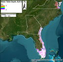
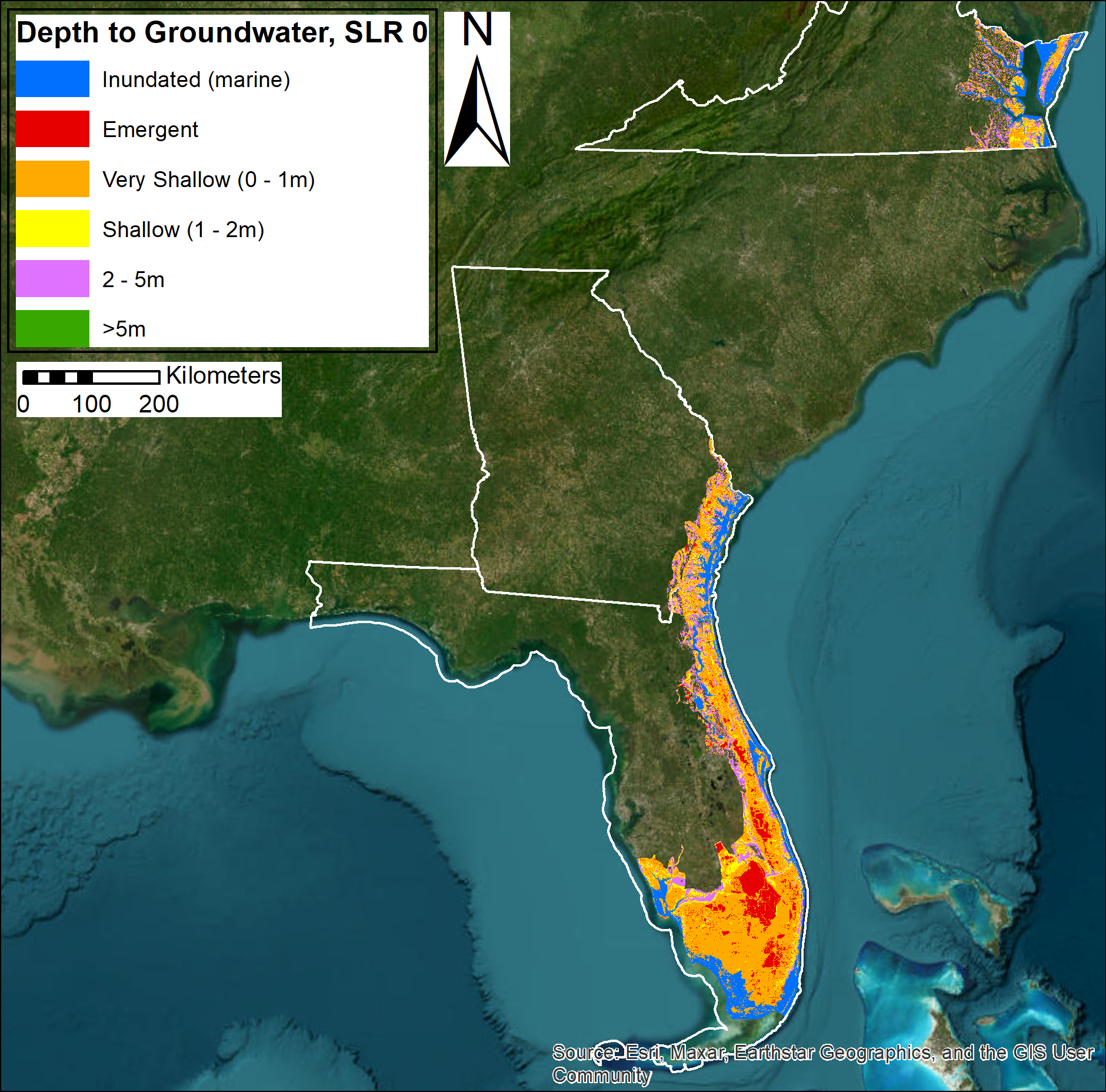
Projected water table depths along the Virginia, Georgia, and Florida coasts
To predict water table depths, seamless groundwater heads for unconfined coastal Virginia, Georgia, and Florida (Atlantic and Gulf coast south of Sarasota) groundwater systems were modeled with homogeneous, steady-state MODFLOW simulations. The geographic extent examined was limited primarily to low-elevation (land surface less than approximately 10 m above mean sea level) areas. Steady-state MODFLOW groundwater flow models were used to obtain detailed (50-meter-scale) predictions over large geographic scales (100s of kilometers) of groundwater heads for both current and future sea-level rise (SLR) scenarios (0, 0.25, 0.5, 1, 1.5, 2, 2.5, and 3 m) using 3 spatially varying hydraulic conductivities (K); one based on published K's, one with published K's reduced by a factor of 10 (K*0.1), and one with published K's increased by a factor of 10 (K*10) to assess the sensitivity of model results to K. All models had variable thicknesses corresponding to published transmissivities. The models were run with a local mean higher-high water (MHHW) marine boundary condition, and with groundwater reaching the land surface removed from the model, simulating loss via natural drainage. Modeled groundwater heads were then subtracted from high-resolution topographic digital elevation model (DEM) data to obtain the water table depths. Similar modeled data for North Carolina and South Carolina are available from Barnard and others, 2023, at https://doi.org/10.5066/P9W91314.
Data Files
FL_Kzell0p1_slr0p00m_10m_wt_depth.tif - 5.5 GB - MD5:2baf20a8658fc02e67ec5b57c50f97be
FL_Kzell0p1_slr0p25m_10m_wt_depth.tif - 5.5 GB - MD5:3c73ff06cc1ffc1749f160a02af08fc7
FL_Kzell0p1_slr0p50m_10m_wt_depth.tif - 5.4 GB - MD5:772664a99f8f42deb69e8f6358628a6a
FL_Kzell0p1_slr1p00m_10m_wt_depth.tif - 5.4 GB - MD5:88a2df21b709eb310904398be1d51efc
FL_Kzell0p1_slr1p50m_10m_wt_depth.tif - 5.4 GB - MD5:78ecf9f025eec8065a66ef7fd40f7af1
FL_Kzell0p1_slr2p00m_10m_wt_depth.tif - 5.4 GB - MD5:cf6c730327a0f536f44aed85daad9942
FL_Kzell0p1_slr2p50m_10m_wt_depth.tif - 5.3 GB - MD5:bbd6a77b9224a76ff1e2b5cb766abd95
FL_Kzell0p1_slr3p00m_10m_wt_depth.tif - 5.3 GB - MD5:d5c067efd97e4e190f476d48ea24a747
FL_Kzell10_slr0p00m_10m_wt_depth.tif - 5.5 GB - MD5:19a3f42e71ab547293009159c14d308e
FL_Kzell10_slr0p25m_10m_wt_depth.tif - 5.5 GB - MD5:8f6001edba9434c3fee1404640993fb2
FL_Kzell10_slr0p50m_10m_wt_depth.tif - 5.5 GB - MD5:06917f0c441f643761c5be29f3950332
FL_Kzell10_slr1p00m_10m_wt_depth.tif - 5.5 GB - MD5:21cee981ab92a95010e9ace10feea359
FL_Kzell10_slr1p50m_10m_wt_depth.tif - 5.5 GB - MD5:5ef954930738fcd20d2a9583a4201121
FL_Kzell10_slr2p00m_10m_wt_depth.tif - 5.5 GB - MD5:23c95424f6117c21550ae9a6bd714340
FL_Kzell10_slr2p50m_10m_wt_depth.tif - 5.4 GB - MD5:4d1fe0e9f7d66fbca62767726f51d72f
FL_Kzell10_slr3p00m_10m_wt_depth.tif - 5.4 GB - MD5:edf1a3e50b0fa5c825a47c12d752e99d
FL_Kzell1_slr0p00m_10m_wt_depth.tif - 5.5 GB - MD5:99dfc335e592cf780cc880258583fa46
FL_Kzell1_slr0p25m_10m_wt_depth.tif - 5.5 GB - MD5:fbf7affcf9c79cd147508f73944b991e
FL_Kzell1_slr0p50m_10m_wt_depth.tif - 5.5 GB - MD5:192ccdfa624f8ff352d1f00e05abcefc
FL_Kzell1_slr1p00m_10m_wt_depth.tif - 5.5 GB - MD5:0ed42106749a1489ff69e087fdf9d157
FL_Kzell1_slr1p50m_10m_wt_depth.tif - 5.4 GB - MD5:7877165a3dedcd2af667b3c6dba156d0
FL_Kzell1_slr2p00m_10m_wt_depth.tif - 5.5 GB - MD5:cfa7eaadd2621572d3a27bf86580c1cc
FL_Kzell1_slr2p50m_10m_wt_depth.tif - 5.4 GB - MD5:090d3b533024e73e30b28e0f4134634d
FL_Kzell1_slr3p00m_10m_wt_depth.tif - 5.4 GB - MD5:cc78e2780e036358c3e2d058fe959d75
GWHazards_WaterTableDepth_GA_SLR0p25.zip - 3.0 GB - MD5:7dd381dab78d9df11aeb15b73f08f933
GWHazards_WaterTableDepth_GA_SLR0p5.zip - 3.0 GB - MD5:94a645219a52e9dfcc16b9ccedd6e018
GWHazards_WaterTableDepth_GA_SLR0.zip - 3.0 GB - MD5:44cb054cbbc4c882b207511c2feb602e
GWHazards_WaterTableDepth_GA_SLR1p0.zip - 2.9 GB - MD5:d5e2de91ff1db1feffaad72b47473f97
GWHazards_WaterTableDepth_GA_SLR1p5.zip - 2.9 GB - MD5:a5b30456181a568a1b963103ecfdce50
GWHazards_WaterTableDepth_GA_SLR2p0.zip - 2.9 GB - MD5:500ac1a01f24dec1aaab0d6f0094ec98
GWHazards_WaterTableDepth_GA_SLR2p5.zip - 2.9 GB - MD5:a1ce0866d92c63d3850aba7015482d3b
GWHazards_WaterTableDepth_GA_SLR3p0.zip - 2.9 GB - MD5:d77dfec5410a157aee05a87b29db10ef
GWHazards_WaterTableDepth_VA_SLR0p25.zip - 4.8 GB - MD5:d6dcb2ea119c23612901e80ef707e5e3
GWHazards_WaterTableDepth_VA_SLR0p5.zip - 4.8 GB - MD5:6539aee2fd2b42ba75c9747692a23a0d
GWHazards_WaterTableDepth_VA_SLR0.zip - 4.8 GB - MD5:331787246e85848dc9c39d44e1857423
GWHazards_WaterTableDepth_VA_SLR1p0.zip - 4.8 GB - MD5:11330941b0f2ec7247de68ba279d3e0e
GWHazards_WaterTableDepth_VA_SLR1p5.zip - 4.8 GB - MD5:a9c7a6ef8281624629cc3359c45729ba
GWHazards_WaterTableDepth_VA_SLR2p0.zip - 4.8 GB - MD5:ba0b471ae7842b55e0dee36c6db81d49
GWHazards_WaterTableDepth_VA_SLR2p5.zip - 4.8 GB - MD5:bf7ae1038513e9711477723fecc7d193
GWHazards_WaterTableDepth_VA_SLR3p0.zip - 4.8 GB - MD5:87d27d08d42e715f997f0439c78aa382
Metadata Files
-
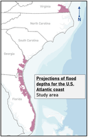
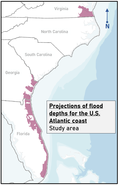
Projections of coastal flood depths for the U.S. Atlantic coast
Projected depths from compound coastal flood hazards for future sea-level rise (SLR) and storm scenarios are shown for the U.S. Atlantic coast for three states (Florida, Georgia, and Virginia). Projections were made using a system of numerical models driven by output from Global Climate Models (GCMs) from the Coupled Model Intercomparison Project Phase 6 (CMIP6) and a tropical cyclone database from U.S. Army Corp of Engineers. The resulting data are depths of projected flood hazards along the U.S. Atlantic coast due to sea-level rise and plausible future storm conditions that consider the changing climate, hurricanes, and natural variability. The resulting data products include flood depths that are consistent with coastal flood projections, also available in this dataset (Barnard, and others, 2023); see Nederhoff and others (2024) for a full explanation of data and methods. In addition to sea-level rise, flood simulations run by these numerical models included dynamic contributions from tide, storm surge, wind, waves, river discharge, precipitation, and seasonal sea-level fluctuations. Outputs include impacts from combinations of SLR scenarios (0, 0.25, 0.5, 1.0, 1.5, 2.0, and 3.0 m), storm conditions including 1-year, 20-year, and 100-year return interval storms, and a background condition (no storm - astronomic tide and average atmospheric conditions). Similar projections for North Carolina and South Carolina are available from Barnard and others, 2023, at https://doi.org/10.5066/P9W91314
Data Files
Projections_WaterDepth_FL.zip - 3.8 GB - MD5:9a49fa11ac121c2dfa8fb7d15283b3a7
Projections_WaterDepth_GA.zip - 1.6 GB - MD5:de7453058c619b8764b39748a00e1daa
Projections_WaterDepth_VA.zip - 967.3 MB - MD5:e5ebb7ecc4291ef70710eb0ff2afacce
Metadata Files
Projections_WaterDepths_AtlanticCoast_metadata.xml - 66.7 KB
Projections_WaterDepths_AtlanticCoast_metadata.txt - 63.7 KB
-
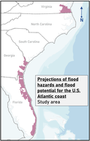
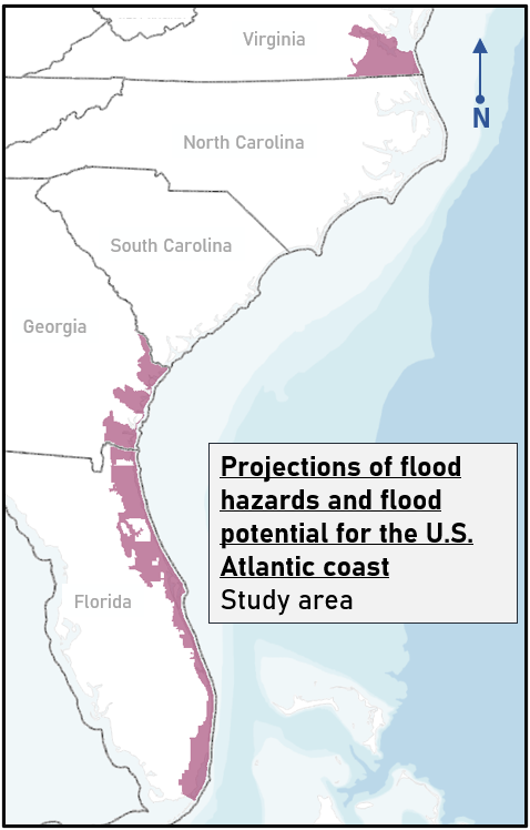
Projections of coastal flood hazards and flood potential for the U.S. Atlantic coast
Projected impacts by compound coastal flood hazards for future sea-level rise (SLR) and storm scenarios are shown for the U.S. Atlantic coast for three states (Florida, Georgia, and southern Virginia). Accompanying uncertainty for each SLR and storm scenario, indicating total uncertainty from model processes and contributing datasets, are illustrated in maximum and minimum flood potential. As described by Nederhoff and others (2024), projections were made using a system of numerical models driven by output from Global Climate Models (GCMs) from the Coupled Model Intercomparison Project Phase 6 (CMIP6) and a tropical cyclone database from US Army Corp of Engineers. The resulting data products include detailed flood-hazard maps along the U.S. Atlantic coast due to sea-level rise and plausible future storm conditions that consider the changing climate, hurricanes, and natural variability. In addition to sea-level rise, flood simulations run by these numerical models included dynamic contributions from tide, storm surge, wind, waves, river discharge, precipitation, and seasonal sea-level fluctuations. Outputs include impacts from combinations of SLR scenarios (0, 0.25, 0.5, 1.0, 1.5, 2.0, and 3.0 m) storm conditions including 1-year, 20-year and 100-year return interval storms and a background condition (no storm - astronomic tide and average atmospheric conditions). See Nederhoff and others (2024) for a full explanation of data and methods. Similar projections for North Carolina and South Carolina are available from Barnard and others, 2023, at https://doi.org/10.5066/P9W91314.
Data Files
FloodHaz_Areas_Not_Mapped_FL.zip - 146.1 KB - MD5:9f65e9e62a5e4a7b223925735c62e8c1
FloodHaz_Areas_Not_Mapped_GA.zip - 533.8 KB - MD5:1a16aaba87a9407fc229d25069b3e605
FloodHaz_ModelOutput_Boundary_FL.zip - 234.9 KB - MD5:f9b0c1a3eb4a6abb18a62dabd8a0157a
FloodHaz_ModelOutput_Boundary_GA.zip - 639.5 KB - MD5:c8ce5e3d06044d743e5a86145f15f3a9
FloodHaz_ModelOutput_Boundary_VA.zip - 46.2 KB - MD5:f475368dc23f86900aba6bdc81fe8572
Projections_FloodHazard_FL.zip - 585.3 MB - MD5:78b1f1a46acc8136a035d3ebaa884c95
Projections_FloodHazard_GA.zip - 205.9 MB - MD5:9303dccd856157ffbea590049b27b0d6
Projections_FloodHazard_VA.zip - 164.9 MB - MD5:34eb39d50a681e030d02b55062c23d9b
Metadata Files
Projections_FloodHazards_AtlanticCoast_metadata.xml - 69.8 KB
Projections_FloodHazards_AtlanticCoast_metadata.txt - 66.6 KB
-
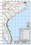
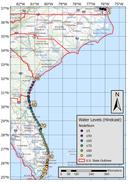
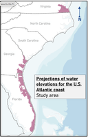
Projections of coastal flood water elevations for the U.S. Atlantic coast
Projected water elevations from compound coastal flood hazards for future sea-level rise (SLR) and storm scenarios are shown for the U.S. Atlantic coast for three states (Florida, Georgia, and Virginia). Projections were made using a system of numerical models driven by output from Global Climate Models (GCMs) from the Coupled Model Intercomparison Project Phase 6 (CMIP6) and a tropical cyclone database from U.S. Army Corps of Engineers. The resulting data are water elevations of projected flood hazards along the U.S. Atlantic coast due to sea-level rise and plausible future storm conditions that consider the changing climate, hurricanes, and natural variability. The resulting data products include water elevations that are consistent with coastal flood projections, also available in this dataset (Barnard, and others, 2023); see Nederhoff and others (2024) for a full explanation of data and methods. In addition to sea-level rise, flood simulations run by these numerical models included dynamic contributions from tide, storm surge, wind, waves, river discharge, precipitation, and seasonal sea-level fluctuations. Outputs include impacts from combinations of SLR scenarios (0, 0.25, 0.5, 1.0, 1.5, 2.0, and 3.0 m), storm conditions including 1-year, 20-year, and 100-year return interval storms, and a background condition (no storm - astronomic tide and average atmospheric conditions). Similar projections for North Carolina and South Carolina are available from Barnard and others, 2023, at https://doi.org/10.5066/P9W91314
Data Files
Projections_WaterElevation_FL.zip - 1.0 GB - MD5:b29def89a5a1682b68fd07ff6254924d
Projections_WaterElevation_GA.zip - 403.5 MB - MD5:a36a9a3753bd2884d1f742d6747edaf6
Projections_WaterElevation_VA.zip - 267.7 MB - MD5:08c41e7ae55ab7e409854340dc086b44
Metadata Files
Projections_WaterElevation_AtlanticCoast_metadata.xml - 66.2 KB
Projections_WaterElevation_AtlanticCoast_metadata.txt - 63.2 KB
-
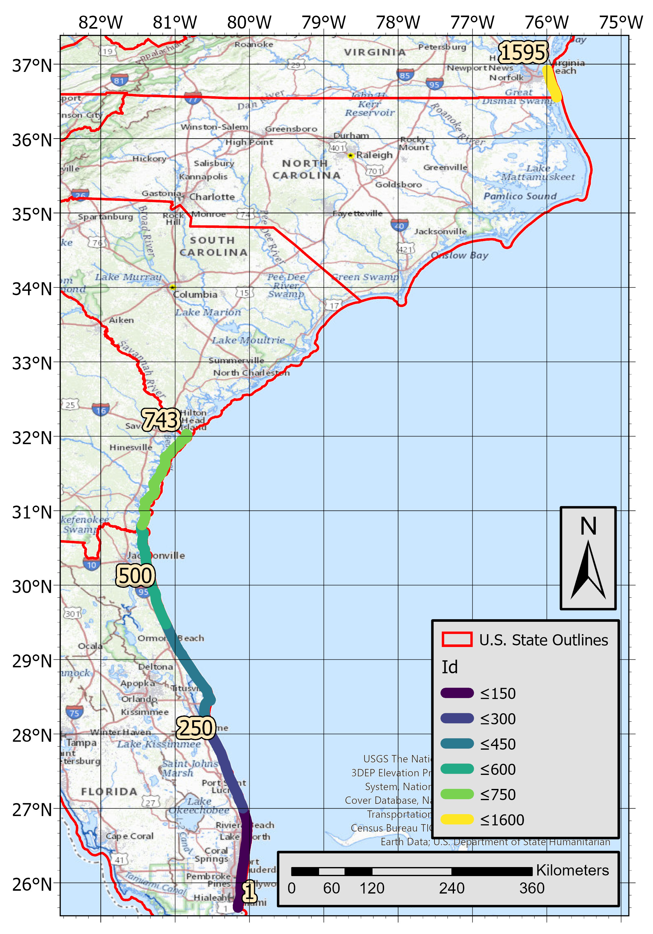
Projections of shoreline change of current and future (2005-2100) sea-level rise scenarios for the U.S. Atlantic Coast
This dataset contains projections of shoreline change and uncertainty bands for future scenarios of sea-level rise (SLR). Scenarios include 25, 50, 75, 100, 150, 200, and 300 centimeters (cm) of SLR by the year 2100. Output for SLR of 0 cm is also included, reflective of conditions in 2005, in accordance with recent SLR projections and guidance from the National Oceanic and Atmospheric Administration (NOAA; see process steps).Projections were made using the Coastal Storm Modeling System - Coastal One-line Assimilated Simulation Tool (CoSMoS-COAST), a numerical model (described in Vitousek and others, 2017; 2021; 2023) run in an ensemble forced with global-to-local nested wave models and assimilated with satellite-derived shoreline (SDS) observations. Shoreline positions from models are generated at pre-determined cross-shore transects and output includes different cases covering important model behaviors (cases are described in process steps of metadata; see citations listed in the Cross References section for more details on the methodology and supporting information). This model shows change in shoreline positions along transects, considering sea level, wave conditions, along-shore/cross-shore sediment transport, long-term trends due to sediment supply, and estimated variability due to unresolved processes (as described in Vitousek and others, 2021). Variability associated with complex coastal processes (for example, beach cusps/undulations and shore-attached sandbars) are included via a noise parameter in a model, which is tuned using observations of shoreline change at each transect and run in an ensemble of 200 simulations; this approach allows for a representation of statistical variability in a model that is assimilated with sequences of noisy observations. The model synthesizes and improves upon numerous, well-established shoreline models in the scientific literature; processes and methods are described in this metadata (see lineage and process steps), but also described in more detail in Vitousek and others 2017, 2021, and 2023. KMZ data are readily viewable in Google Earth. For best display of results, it is recommended to turn off any 3D features or terrain. For technical users and researchers, shapefile and KMZ data can be ingested into geographic information system (GIS) software such as Global Mapper or QGIS.
Data Files
ShorelineChange_projctn_DE.zip - 17.9 MB - MD5:010beaefdf44cb554d4589f9be637ce4
ShorelineChange_projctn_FL.zip - 258.5 MB - MD5:40f330ec5a478df6f5192be3afb1efb4
ShorelineChange_projctn_GA.zip - 58.4 MB - MD5:a0815d5e7c5d6ea10fc94257b9dcc5b1
ShorelineChange_projctn_MD.zip - 22.8 MB - MD5:a34b147fb0b1f4cdabb77e92a2dba677
ShorelineChange_projctn_VA.zip - 68.1 MB - MD5:edc92193164aa9b343469ab72fedfea4
Metadata Files
ShorelineChange_projctn_AtlanticCoast_metadata.xml - 62.5 KB
ShorelineChange_projctn_AtlanticCoast_metadata.txt - 60.9 KB


Suggested Citation
Barnard, P.L., Befus, K., Danielson, J.J., Engelstad, A.C., Erikson, L.H., Foxgrover, A.C., Hayden, M.K., Hoover, D.J., Leijnse, T., Massey, C., McCall, R., Nadal-Caraballo, N., Nederhoff, K., Ohenhen, L., O'Neill, A., Parker, K.A., Shirzaei, M., Su, X., Thomas, J.A., van Ormondt, M., Vitousek, S.F., Vos, K., Yawn, M.C., 2023, Future coastal hazards along the U.S. Atlantic coast (ver. 2.0, November 2024): U.S. Geological Survey data release, https://doi.org/10.5066/P9BQQTCI.
Revision History
First release: 2023
Revised: November 2024 (ver. 2.0)
Changes in Version 2.0
New dataset added for rasters of water surface elevation derived from existing flood depth data