Multichannel minisparker and chirp seismic reflection data collected during USGS field activity 2021-614-FA along the Palos Verdes Fault Zone
By Travis V. Alongi, Alicia F. Balster-Gee, Jared W. Kluesner, George R. Snyder, Daniel S. Brothers, James E. Conrad, and Rachel K. Marcuson
https://doi.org/10.5066/P9HCOSDF
Dates
Published: April 3, 2024
Summary
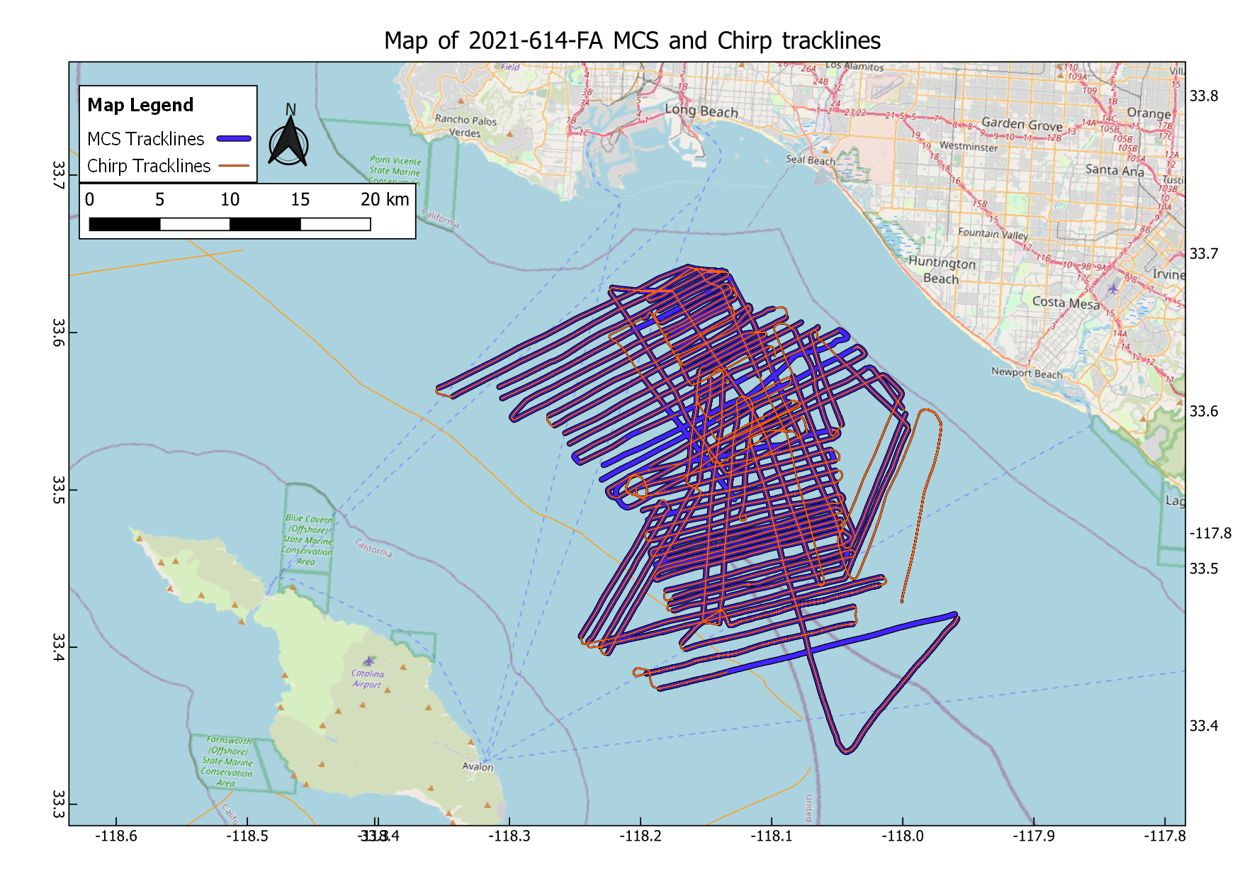
High-resolution multichannel seismic (MCS) and coincident Chirp sub-bottom data were acquired during USGS field activity 2021-614-FA aboard the R/V Sproul in May of 2021. The survey was conducted in the offshore region of southern California, specifically in the inner continental borderlands tectonic region. The focus of the survey was to collect seismic lines perpendicular to the Palos Verdes Fault with close adjacent line spacing of approximately 500 meters to explore the spatial properties and distribution of faulting in the shallow subsurface. These data and information are intended for science researchers, students, policy makers, and the general public.
Seismic Data
-
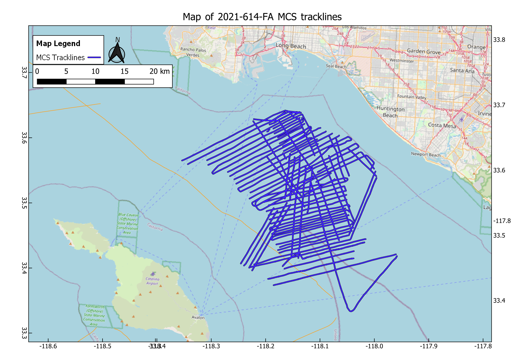
Multichannel minisparker seismic reflection data collected during USGS field activity 2021-614-FA along the Palos Verdes Fault Zone
High-resolution multichannel minisparker seismic reflection (MCS) data were collected by the U.S. Geological Survey in May of 2021 along the Palos Verdes Fault Zone in San Pedro Bay and San Pedro Channel. MCS data were acquired coincident with chirp sub-bottom data.
Data Files
2021-614-FA.mcs.zip - 5.9 GB - MD5:2d17a818ad2866de9c2eb064c2108488
Metadata Files
2021-614-FA.mcs.metadata.xml - 16.4 KB
2021-614-FA.mcs.metadata.txt - 15.9 KB
 Map of MCS tracklines acquired during USGS field activity 2021-614-FA
 -
Chirp sub-bottom data collected during USGS field activity 2021-614-FA along the Palos Verdes Fault Zone
Chirp sub-bottom data were collected by the U.S. Geological Survey in May of 2021 along the Palos Verdes Fault Zone in San Pedro Bay and San Pedro Channel. MCS data were acquired coincident with chirp sub-bottom data.
Data Files
2021-614-FA.chirp.zip - 8.0 GB - MD5:56a0d36319ee9528a6ef7ef9c7f09d3b
Metadata Files
2021-614-FA.chirp.metadata.xml - 15.2 KB
2021-614-FA.chirp.metadata.txt - 14.8 KB
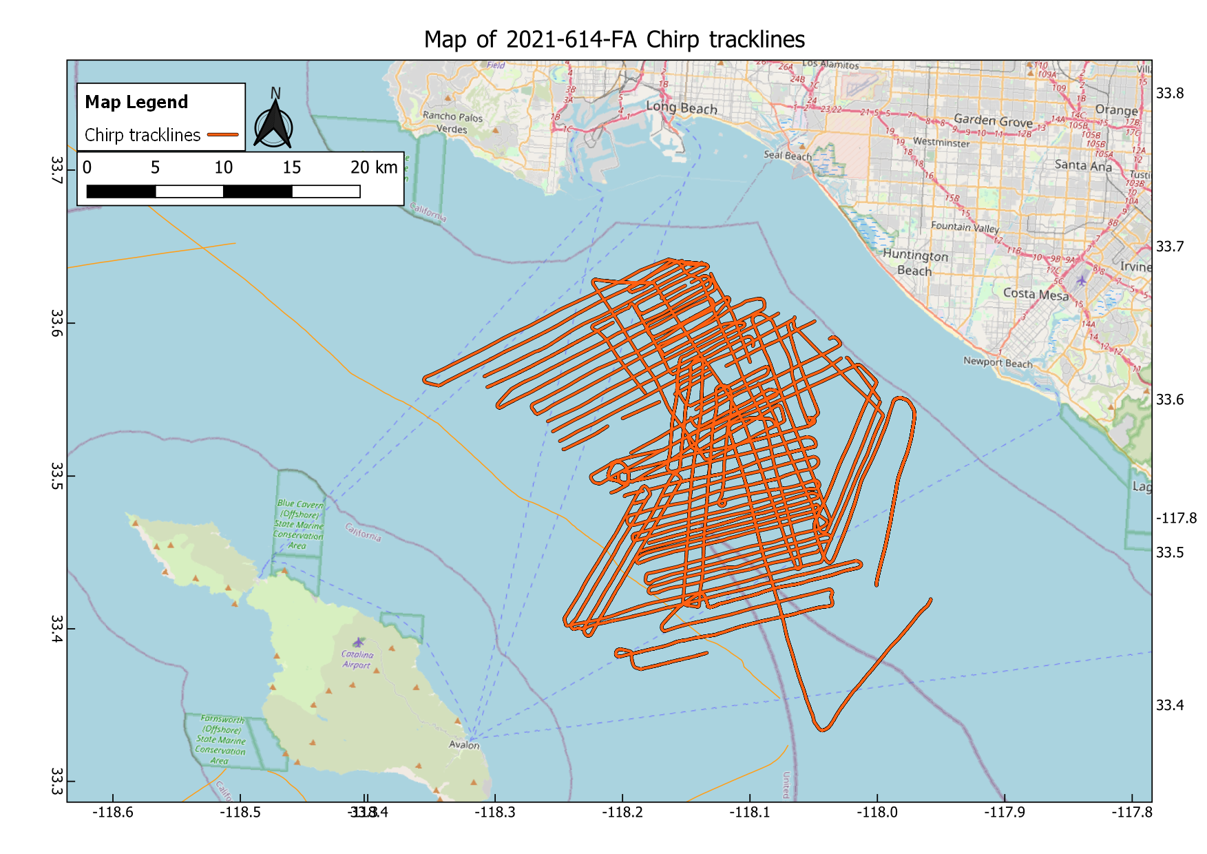
 Map of Chirp tracklines acquired during USGS field activity 2021-614-FA
Suggested Citation
Alongi, T., Balster-Gee, A.F. Kluesner, J.W., Snyder, G.R., Brothers, D.S., Conrad, J.E., Marcuson, R.K., 2024, Multichannel minisparker and chirp seismic reflection data collected during USGS field activity 2021-614-FA along the Palos Verdes Fault Zone: U.S. Geological Survey data release, https://doi.org/10.5066/P9HCOSDF
Overview Image