Coastal hazards assessment associated with sea level rise and storms along the Whatcom County, Northwest Washington State coast
By Eric E. Grossman, Nathan R. vanArendonk, Sean C. Crosby, Babak Tehranirad, Kees M. Nederhoff, Patrick L. Barnard, Li H. Erikson, and Jeffrey J. Danielson
https://doi.org/10.5066/P9I08NS5
Dates
Published: Feb. 13, 2024
Data Collected: Dec. 15, 2019 – Dec. 15, 2022
Summary
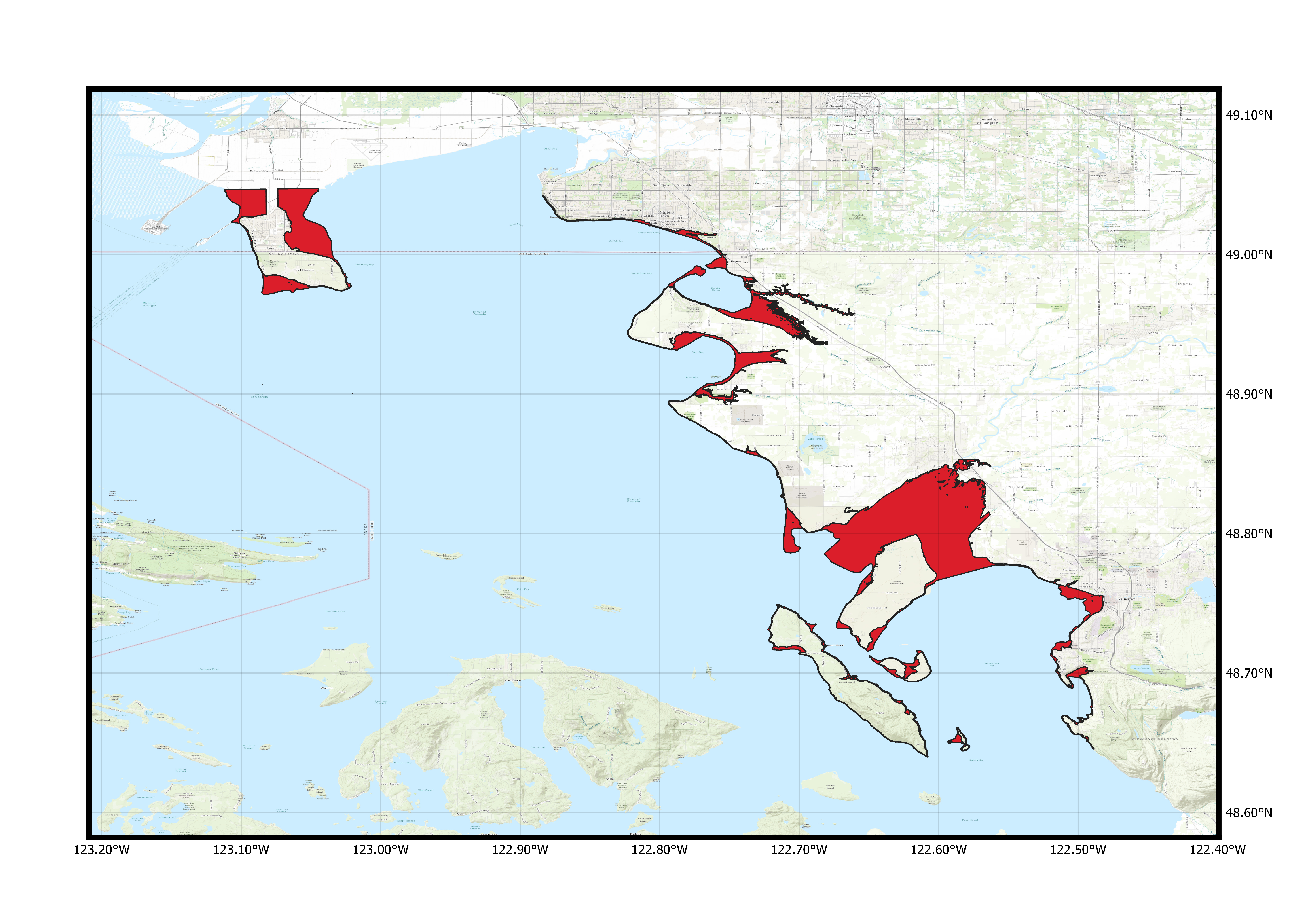
This product contains several datasets that map exposure to future forecasted hazards related to coastal flooding and extreme wave heights accounting for sea level rise (SLR) and climate change along the Whatcom County coast of northwestern Washington State in the Salish Sea. The SLR scenarios encompass a plausible range of projections by 2100 based on the best available science and storms account for dynamically downscaled projections of the Geophysical Fluid Dynamics Laboratory (GFDL) CM3 model forecast of the Coupled Model Intercomparison Project Phase 5 (CMIP5-GFDL-CM3) shown to capture important variability in climate of the Pacific Northwest. Data products provided as part of this data release include flood extents, water levels, water depths, flood duration and flow velocities of floods associated with 72 flood hazard scenarios. These scenarios reflect 9 sea level positions ranging between 0 and 5 m and 8 storm recurrence events ranging from daily to the 100-year storm event and account for the combined effects of astronomic tides, storm surge, waves, and stream flows to coastal flooding for the period 2015-2100. The spatial distribution of significant wave heights is also provided for the 8 extreme recurrence events under existing sea level. The validation data used to quantify model performance in the form of measured and simulated storm inundation for a recent flood of record in the study domain at Birch Bay on December 20, 2018 is served. Lastly the model input code, elevation data and necessary boundary conditions are included.
Simulation Data
-
Projections of coastal flood extents for Whatcom County, Northwest Washington State coast (2015-2100)
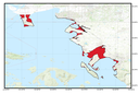
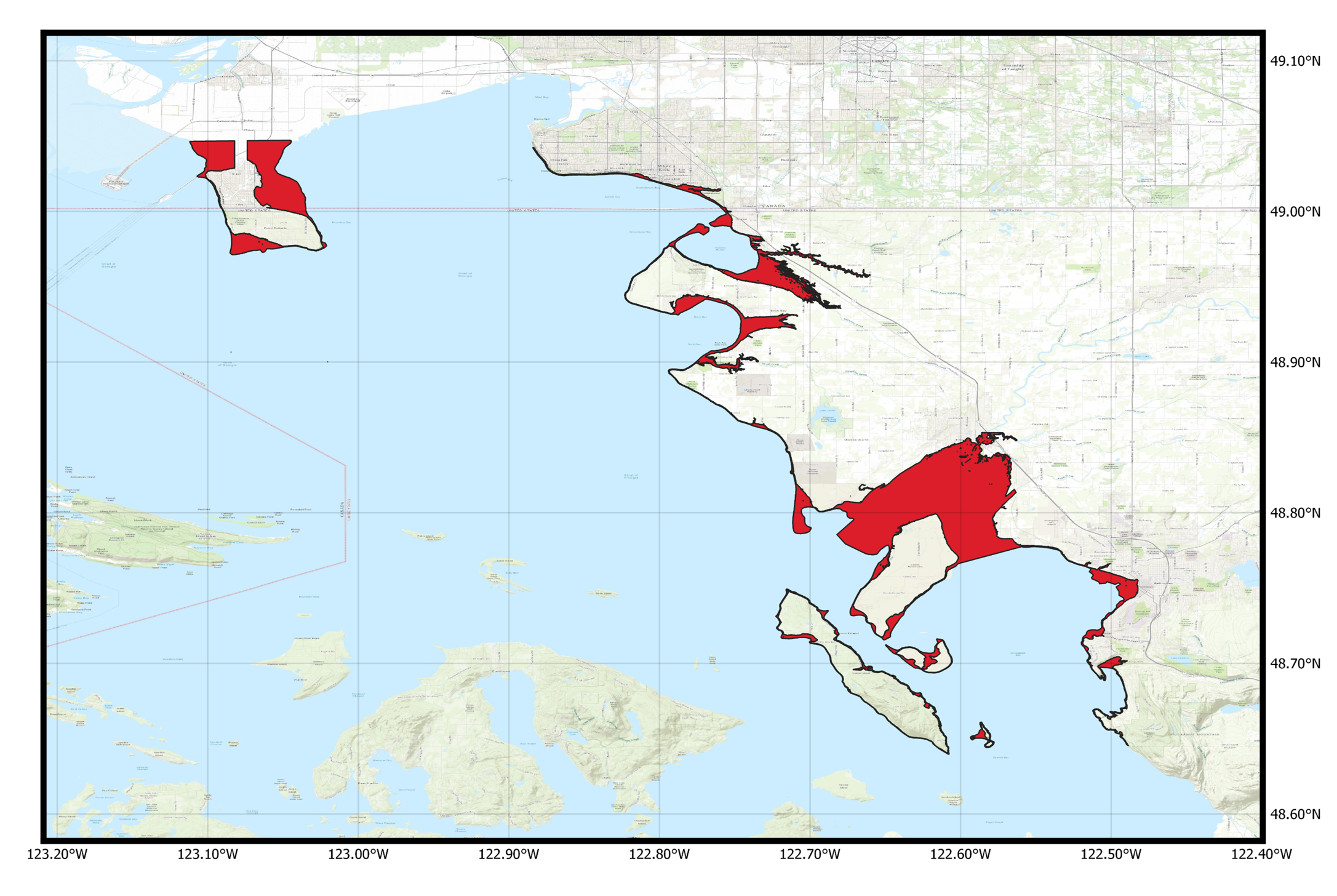
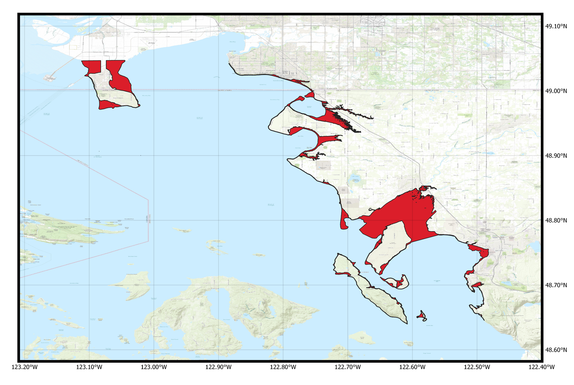
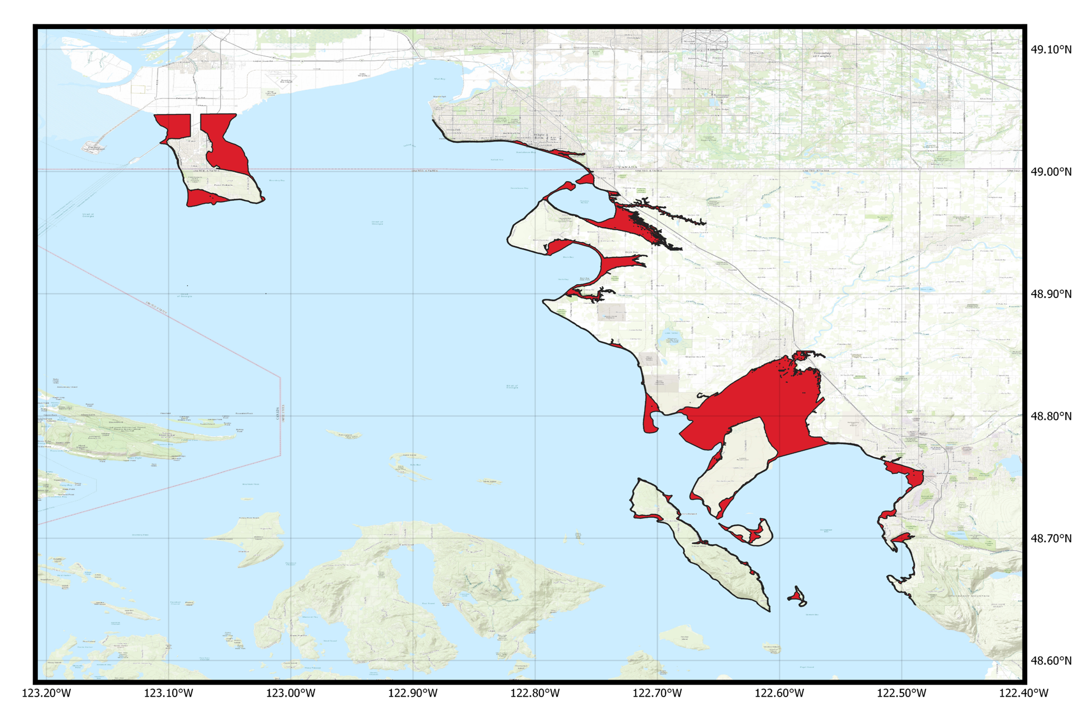
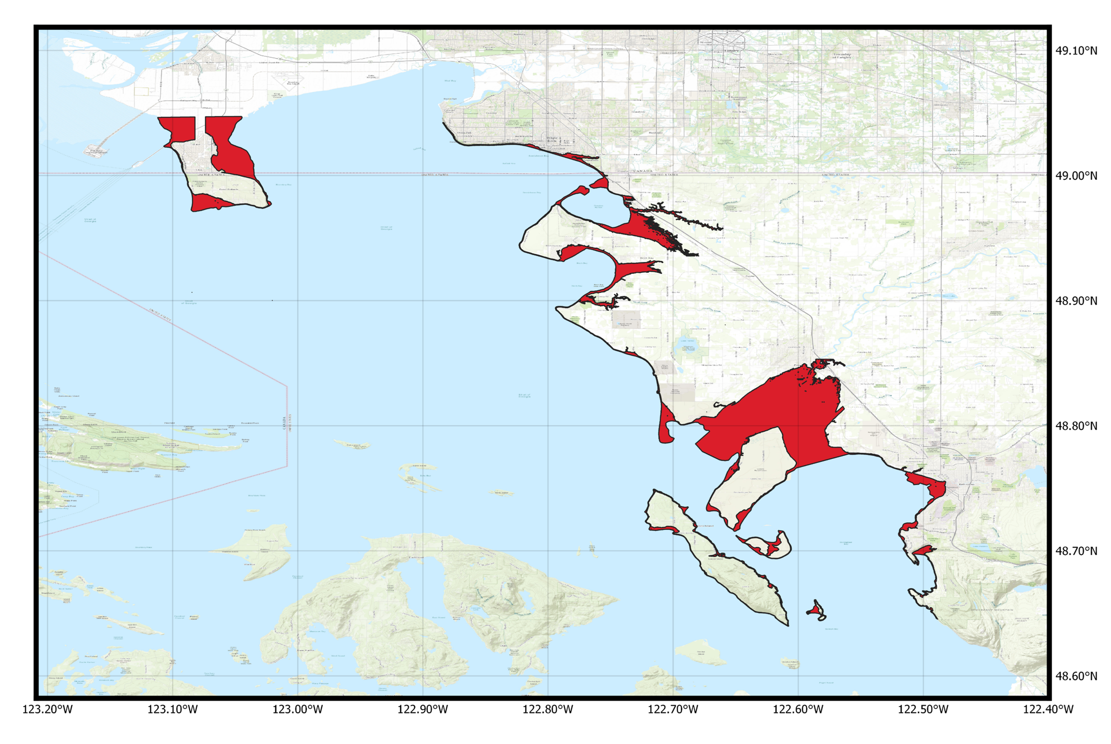
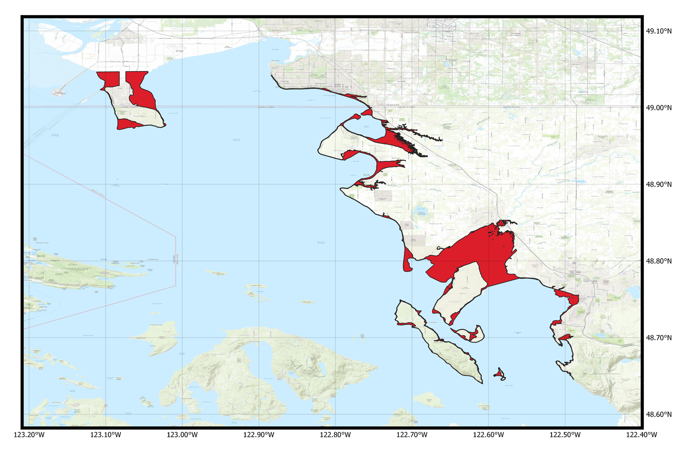
Projected flood extents associated with compound coastal flood hazards for future sea-level rise (SLR) and storm scenarios are provided for Whatcom County, Washington, in a series of shapefile files. Projections were made using a system of numerical models with atmospheric forcing, tides, sea level position and stream discharge driven by output from Global Climate Models (GCMs) from the Coupled Model Intercomparison Project Phase 5 (CMIP5). The resulting computed coastal flood extents along the Whatcom County coast due to predicted sea level rise and future storm conditions consider the changing climate. In addition to sea-level rise, flood simulations run by these numerical models included dynamic contributions from tide, storm surge, wind, waves, and seasonal sea-level fluctuations. In the absence of concordant downscaled GCM stream discharge, daily average stream discharge was fed to the model. Outputs include flood extents from the combinations of SLR scenarios (0, 0.25, 0.5, 1.0, 1.5, 2.0, 2.5, 3.0 and 5.0 m) storm conditions including 1-year, 5-year, 10-year, 20-year, 50-year and 100-year return interval storms and a background condition (no storm - astronomic tide and average atmospheric conditions). Predicted flood extents during the largest annual astronomic tides (King Tide) in combination with an average storm surge scenario are also provided.
Data Files
Projections_FloodHazard_D1_SLR000.zip - 36.5 MB - MD5:5a28c3f5fd006a8bf6cb1487d2358efa
Projections_FloodHazard_D1_SLR025.zip - 37.0 MB - MD5:0cbc71dad7af7f89ad848bf92083cfcb
Projections_FloodHazard_D1_SLR050.zip - 36.0 MB - MD5:0a85b60b5986496bb58ef5c9be890e3e
Projections_FloodHazard_D1_SLR100.zip - 32.5 MB - MD5:461d10e2508ccf0f136cfd8f0adbc727
Projections_FloodHazard_D1_SLR150.zip - 27.9 MB - MD5:910c0bb0954502ede22b5a085348fdf3
Projections_FloodHazard_D1_SLR200.zip - 25.8 MB - MD5:00b18c61945926227be89a5accfe00a2
Projections_FloodHazard_D1_SLR250.zip - 24.1 MB - MD5:e408e61fc65f3edef8d5a841762876e1
Projections_FloodHazard_D1_SLR300.zip - 23.3 MB - MD5:d5a32d76251851f2992ae53d5b5199de
Projections_FloodHazard_D1_SLR500.zip - 24.7 MB - MD5:cb7f92f49d2739198d8af8e5043419f0
Metadata Files
-
Projections of coastal flood water levels for Whatcom County, Northwest Washington State coast (2015-2100)
Projected flood levels associated with compound coastal flood hazards for future sea-level rise (SLR) and storm scenarios are provided for Whatcom County, Washington, in a series of raster geotiff files. Projections were made using a system of numerical models with atmospheric forcing, tides, sea level position and stream discharge driven by output from Global Climate Models (GCMs) from the Coupled Model Intercomparison Project Phase 5 (CMIP5). The resulting computed coastal flood levels along the Whatcom County coast due to predicted sea level rise and future storm conditions consider the changing climate. In addition to sea-level rise, flood simulations run by these numerical models included dynamic contributions from tide, storm surge, wind, waves, and seasonal sea-level fluctuations. In the absence of concordant downscaled GCM stream discharge, daily average stream discharge was fed to the model. Outputs include flood levels from the combinations of SLR scenarios (0, 0.25, 0.5, 1.0, 1.5, 2.0, 2.5, 3.0 and 5.0 m) storm conditions including 1-year, 5-year, 10-year, 20-year, 50-year and 100-year return interval storms and a background condition (no storm - astronomic tide and average atmospheric conditions). Predicted flood levels during the largest annual astronomic tides (King Tide) in combination with an average storm surge scenario are also provided.
Data Files
waterlevel_D1_SLR000_uncertainty.zip - 953.4 MB - MD5:352f6475be5926ebe16940e9818509b7
waterlevel_D1_SLR000.zip - 496.9 MB - MD5:39d2e843cbdc8d8c3e34c6fbc62523fe
waterlevel_D1_SLR025_uncertainty.zip - 1.0 GB - MD5:40c8ee3c5e953403f12a72672d2e67a4
waterlevel_D1_SLR025.zip - 549.8 MB - MD5:a7d5a4831521d1f8ed7138b0cc177c0d
waterlevel_D1_SLR050_uncertainty.zip - 1.1 GB - MD5:36d6878e52e79554a9b2cfbc7a98ffd4
waterlevel_D1_SLR050.zip - 605.0 MB - MD5:9a882824aa58c41e24dca6c235eb7d41
waterlevel_D1_SLR100_uncertainty.zip - 1.3 GB - MD5:fecc91ce6da5a4d17aeb974d777ae7e6
waterlevel_D1_SLR100.zip - 662.1 MB - MD5:648c192af52f4fe0ebc22d0c5e819937
waterlevel_D1_SLR150_uncertainty.zip - 1.4 GB - MD5:aa745428ab094e2b2efb340f8d994d1d
waterlevel_D1_SLR150.zip - 711.4 MB - MD5:859c1cf6188d9615718286e1bd7817d2
waterlevel_D1_SLR200_uncertainty.zip - 1.4 GB - MD5:6ed7fad0b402156a92aaa6f1e6cb5bdb
waterlevel_D1_SLR200.zip - 729.9 MB - MD5:e170aec9fa1a92e94bb52d7f1abb65e1
waterlevel_D1_SLR250_uncertainty.zip - 1.4 GB - MD5:2c701a292113672e8c7f862cc572e564
waterlevel_D1_SLR250.zip - 732.6 MB - MD5:f2ffe2c5e3ad9238153fecdc3c966502
waterlevel_D1_SLR300_uncertainty.zip - 1.4 GB - MD5:49dfe9a591afb623b3db5190988eb98a
waterlevel_D1_SLR300.zip - 747.1 MB - MD5:a0aa25a89ccd1de04fc062033d9612d8
waterlevel_D1_SLR500_uncertainty.zip - 1.3 GB - MD5:468a84dbc7de5247ed9692599492ab3d
waterlevel_D1_SLR500.zip - 693.0 MB - MD5:98a9c58cebf2158ba29b38188a5a9238
Metadata Files
waterlevel_D1_CoSMoS_WA_metadata.xml - 30.7 KB
waterlevel_D1_CoSMoS_WA_metadata.txt - 29.5 KB
-
Projections of coastal flood depths for Whatcom County, Northwest Washington State coast (2015-2100)
Projected flood depths associated with compound coastal flood hazards for future sea-level rise (SLR) and storm scenarios are provided for Whatcom County, Washington, in a series of raster geotiff files. Projections were made using a system of numerical models with atmospheric forcing, tides, sea level position and stream discharge driven by output from Global Climate Models (GCMs) from the Coupled Model Intercomparison Project Phase 5 (CMIP5). The resulting computed coastal flood depths along the Whatcom County coast due to predicted sea level rise and future storm conditions consider the changing climate. In addition to sea-level rise, flood simulations run by these numerical models included dynamic contributions from tide, storm surge, wind, waves, and seasonal sea-level fluctuations. In the absence of concordant downscaled GCM stream discharge, daily average stream discharge was fed to the model. Outputs include flood depths from the combinations of SLR scenarios (0, 0.25, 0.5, 1.0, 1.5, 2.0, 2.5, 3.0 and 5.0 m) storm conditions including 1-year, 5-year, 10-year, 20-year, 50-year and 100-year return interval storms and a background condition (no storm - astronomic tide and average atmospheric conditions). Predicted flood depths during the largest annual astronomic tides (King Tide) in combination with an average storm surge scenario are also provided.
Data Files
waterdepth_D1_SLR000_uncertainty.zip - 1.8 GB - MD5:f8b2487deb3ab52b93f274f4731806b8
waterdepth_D1_SLR000.zip - 917.9 MB - MD5:f5b1a6dfa60b302d6139b226570325d9
waterdepth_D1_SLR025_uncertainty.zip - 2.1 GB - MD5:85248c3393ec47daaf531f69dd164294
waterdepth_D1_SLR025.zip - 1.0 GB - MD5:89ff4bc4ac3ee7ffa79d23d985109e5a
waterdepth_D1_SLR050_uncertainty.zip - 2.4 GB - MD5:cc6dc2e0fa322cd700cebace8e38bd21
waterdepth_D1_SLR050.zip - 1.2 GB - MD5:694bf2788ee9888bc8a5f3321f5e0df0
waterdepth_D1_SLR100_uncertainty.zip - 2.8 GB - MD5:6863da7829d0bee30f54c89dbcaae193
waterdepth_D1_SLR100.zip - 1.5 GB - MD5:8a29bcf838e3c55af97753ea06e52be4
waterdepth_D1_SLR150_uncertainty.zip - 3.2 GB - MD5:3b0cd2e225cfcdc6adc16ad264bca057
waterdepth_D1_SLR150.zip - 1.6 GB - MD5:c6418039d96c0c66047b159470dfb0ab
waterdepth_D1_SLR200_uncertainty.zip - 3.5 GB - MD5:44126b742ab3d27bfb2eb1c1bc121c53
waterdepth_D1_SLR200.zip - 1.8 GB - MD5:3d4ff1f611e0890d1b6a983c80511189
waterdepth_D1_SLR250_uncertainty.zip - 3.7 GB - MD5:4df88dacc43e3c1438c79f95cfb1ee71
waterdepth_D1_SLR250.zip - 1.8 GB - MD5:476da2a85b0b497197169e6e65b99083
waterdepth_D1_SLR300_uncertainty.zip - 3.8 GB - MD5:67ed4d124bb47c857579215be5081d51
waterdepth_D1_SLR300.zip - 1.9 GB - MD5:6f70352d0d3859bb1d12e2a45c428407
waterdepth_D1_SLR500_uncertainty.zip - 4.3 GB - MD5:045c16fe960b681dbf061ab03dcbb9ba
waterdepth_D1_SLR500.zip - 2.1 GB - MD5:e8a63a6798c3a99c5ef9a8a39c48607b
Metadata Files
waterdepth_D1_CoSMoS_WA_metadata.xml - 30.7 KB
waterdepth_D1_CoSMoS_WA_metadata.txt - 29.6 KB
-
Projections of coastal flood durations for Whatcom County, Northwest Washington State coast (2015-2100)
Projected flood duration associated with compound coastal flood hazards for future sea-level rise (SLR) and storm scenarios are provided for Whatcom County, Washington, in a series of raster geotiff files. Projections were made using a system of numerical models with atmospheric forcing, tides, sea level position and stream discharge driven by output from Global Climate Models (GCMs) from the Coupled Model Intercomparison Project Phase 5 (CMIP5). The resulting computed coastal flood duration along the Whatcom County coast due to predicted sea level rise and future storm conditions consider the changing climate. In addition to sea-level rise, flood simulations run by these numerical models included dynamic contributions from tide, storm surge, wind, waves, and seasonal sea-level fluctuations. In the absence of concordant downscaled GCM stream discharge, daily average stream discharge was fed to the model. Outputs include flood durations from the combinations of SLR scenarios (0, 0.25, 0.5, 1.0, 1.5, 2.0, 2.5, 3.0 and 5.0 m) storm conditions including 1-year, 5-year, 10-year, 20-year, 50-year and 100-year return interval storms and a background condition (no storm - astronomic tide and average atmospheric conditions). Predicted flood duration during the largest annual astronomic tides (King Tide) in combination with an average storm surge scenario are also provided.
Data Files
duration_D1_SLR000_uncertainty.zip - 1.5 GB - MD5:955876db0340963badc277620932ffc0
duration_D1_SLR000.zip - 782.1 MB - MD5:415e3ca4abaf968e4c72ab3f0ee47ef0
duration_D1_SLR025_uncertainty.zip - 1.7 GB - MD5:c4a973b8d942412d40706fbebcae51f8
duration_D1_SLR025.zip - 877.1 MB - MD5:80b3a482ce3371db5b37ba6dc0a8a306
duration_D1_SLR050_uncertainty.zip - 1.9 GB - MD5:0f6e891166fe9f96af0011cdca47b903
duration_D1_SLR050.zip - 997.0 MB - MD5:1a936c6ebe2d35024f572be299241ac4
duration_D1_SLR100_uncertainty.zip - 2.2 GB - MD5:a3fed4af92c0132b9c5491d5128fddce
duration_D1_SLR100.zip - 1.1 GB - MD5:27afe3f10e4a6a4895e1cb2036cb0f07
duration_D1_SLR150_uncertainty.zip - 2.5 GB - MD5:160fda378d845406a06a19d758ab4eeb
duration_D1_SLR150.zip - 1.3 GB - MD5:15a80dbb6bb1948c9ccf02a488ea44ef
duration_D1_SLR200_uncertainty.zip - 2.7 GB - MD5:9b72183b5c32a5735fb752e83305f0b7
duration_D1_SLR200.zip - 1.3 GB - MD5:d85ce761fafb6b15d9b4e5dbcd89df80
duration_D1_SLR250_uncertainty.zip - 2.8 GB - MD5:578525667be1d276d6788f9094013218
duration_D1_SLR250.zip - 1.4 GB - MD5:bb7cec2f9efbc3a182d516e8995b780b
duration_D1_SLR300_uncertainty.zip - 2.9 GB - MD5:8805c67a0eabc5fda276d476bde72687
duration_D1_SLR300.zip - 1.4 GB - MD5:62050b4039772393de450d95aff30266
duration_D1_SLR500_uncertainty.zip - 3.2 GB - MD5:3e5b0b33ac8f25ec35ce976b32e51787
duration_D1_SLR500.zip - 1.6 GB - MD5:7c84c1a7ed9aaa5dcb85958049103c27
Metadata Files
duration_D1_CoSMoS_WA_metadata.xml - 30.5 KB
duration_D1_CoSMoS_WA_metadata.txt - 29.4 KB
-
Projections of coastal flood velocities for Whatcom County, Northwest Washington State coast (2015-2100)
Projected flood velocities associated with compound coastal flood hazards for future sea-level rise (SLR) and storm scenarios are provided for Whatcom County, Washington, in a series of raster geotiff files. Projections were made using a system of numerical models with atmospheric forcing, tides, sea level position and stream discharge driven by output from Global Climate Models (GCMs) from the Coupled Model Intercomparison Project Phase 5 (CMIP5). The resulting computed coastal flood velocities along the Whatcom County coast due to predicted sea level rise and future storm conditions consider the changing climate. In addition to sea-level rise, flood simulations run by these numerical models included dynamic contributions from tide, storm surge, wind, waves, and seasonal sea-level fluctuations. In the absence of concordant downscaled GCM stream discharge, daily average stream discharge was fed to the model. Outputs include flood velocities from the combinations of SLR scenarios (0, 0.25, 0.5, 1.0, 1.5, 2.0, 2.5, 3.0 and 5.0 m) storm conditions including 1-year, 5-year, 10-year, 20-year, 50-year and 100-year return interval storms and a background condition (no storm - astronomic tide and average atmospheric conditions). Predicted flood velocities during the largest annual astronomic tides (King Tide) in combination with an average storm surge scenario are also provided.
Data Files
velocity_D1_SLR000_uncertainty.zip - 1.7 GB - MD5:ff4952381db00964c137f72cba284cf2
velocity_D1_SLR000.zip - 870.4 MB - MD5:c288940a5a5b129d0becc92144ab3230
velocity_D1_SLR025_uncertainty.zip - 2.0 GB - MD5:148c4e4d228f83a5d3a5e2b088be810c
velocity_D1_SLR025.zip - 992.3 MB - MD5:cd897977583064bfe5fd375c08cc3a7a
velocity_D1_SLR050_uncertainty.zip - 2.2 GB - MD5:36ab9085227a1727b132f60ea1f70d92
velocity_D1_SLR050.zip - 1.1 GB - MD5:81925be3862a884e33d769a45aa23e6d
velocity_D1_SLR100_uncertainty.zip - 2.6 GB - MD5:cb3f68278247498f54e5d86060b55efe
velocity_D1_SLR100.zip - 1.3 GB - MD5:63b6afe2b718fbb8b01ce5975669d064
velocity_D1_SLR150_uncertainty.zip - 2.9 GB - MD5:6bc9cc6c5fb0baf2e15c3a556543c406
velocity_D1_SLR150.zip - 1.5 GB - MD5:62dbfc0b344f9d171f9d05494ea23760
velocity_D1_SLR200_uncertainty.zip - 3.1 GB - MD5:69acf2a97df13e13bd2e18266b13b7c3
velocity_D1_SLR200.zip - 1.6 GB - MD5:fe1ecfe629e81d7a3048dae77876ebdd
velocity_D1_SLR250_uncertainty.zip - 3.3 GB - MD5:5f37b6f516ac7afb6b5b531bd5ca5a7b
velocity_D1_SLR250.zip - 1.7 GB - MD5:9e344579fa773916565e61812677875e
velocity_D1_SLR300_uncertainty.zip - 3.4 GB - MD5:3f12c7bf3ba119ee0de984c6632b61cc
velocity_D1_SLR300.zip - 1.7 GB - MD5:4533da531eac23319b2e4beb12f50456
velocity_D1_SLR500_uncertainty.zip - 3.8 GB - MD5:35124d8139db89047fe534e7a515f93c
velocity_D1_SLR500.zip - 1.9 GB - MD5:269272f5f7ffaf236b6522f1ad97ce26
Metadata Files
velocity_D1_ CoSMoS_WA_metadata.xml - 30.8 KB
velocity_D1_ CoSMoS_WA_metadata.txt - 29.7 KB
-
Projections of wave heights for Whatcom County, Northwest Washington State coast (2015-2100)
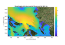
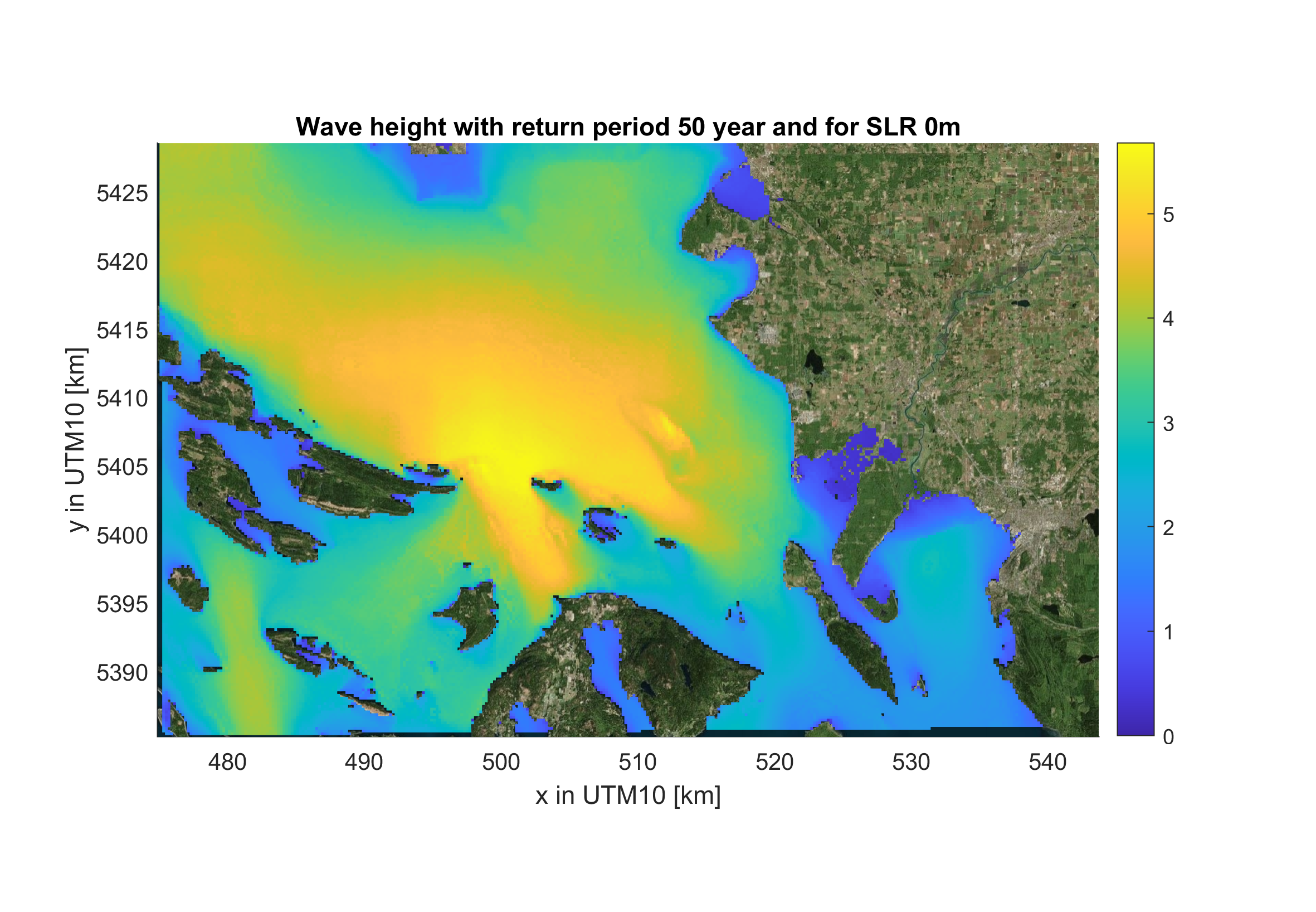
Projected wave heights associated with compound coastal flood hazards for existing and future sea-level rise (SLR) and storm scenarios are shown for Whatcom County, Washington, in a series of raster geotiff files. Projections were made using a system of numerical models driven by output from Global Climate Models (GCMs) from the Coupled Model Intercomparison Project Phase 5 (CMIP5). The resulting data are water levels of projected flood hazards along the Whatcom County coast due to sea level rise and plausible future storm conditions that consider the changing climate and natural variability. In addition to sea-level rise, flood simulations run by these numerical models included dynamic contributions from tide, storm surge, wind, waves, river discharge, and seasonal sea-level fluctuations. Outputs include waves from combinations of SLR scenarios (0, 0.25, 0.5, 1.0, 1.5, 2.0, 2.5, 3.0 and 5.0 m) storm conditions including 1-year, 5-year, 10-year, 20-year, 50-year and 100-year return interval storms and a background condition (no storm - astronomic tide and average atmospheric conditions). The annual average King Tide is also provided and includes mean storm surge occurring during King Tides.
Data Files
D1_waveGEV_Raster.zip - 12.9 MB - MD5:09c67e1fb2e89f414bf6085678c925b3
Metadata Files
D1_waveGEV_CoSMoS_WA_metadata.xml - 24.3 KB
D1_waveGEV_CoSMoS_WA_metadata.txt - 23.5 KB
-
CoSMoS Whatcom County model input files
This data set consists of physics-based XBeach and SFINCS hydrodynamic model input files used for Coastal Storm Modeling System (CoSMoS) Tier 3 simulations. This data release is for Whatcom County in Washington State and presents the final tier 3 models used to produce output data that is then post-processed into final CoSMoS products. Example model input and configuration files are included for a single domain and SLR scenario, with the full modelling framework iterating on this process to simulate hundreds of individual storm events and sea-level rise (SLR) scenarios.
Data Files
model_setup_tier3_CoSMoS_WA_Whatcom.zip - 2.1 GB - MD5:f0460fed0e9fbe0f2d94184c8d7d21d6
Metadata Files
model_setup_tier3_CoSMoS_WA_metadata.xml - 21.5 KB
model_setup_tier3_CoSMoS_WA_metadata.txt - 20.7 KB
Suggested Citation
Grossman, E.E., vanArendonk, N.R., Crosby, S.C., Tehranirad, B., Nederhoff, K., Barnard, P.L., Erikson, L., and Danielson, J.J., 2024, Coastal hazards assessment associated with sea level rise and storms along the Whatcom County, Northwest Washington State coast. U.S. Geological Survey data release, https://doi.org/10.5066/P9I08NS5.
Overview Image