Time-series measurements of pressure, conductivity, temperature, and water level collected in Puget Sound and Bellingham Bay, Washington, USA, 2018 to 2021
By Daniel J. Nowacki, Andrew W. Stevens, Nathan R. vanArendonk, and Eric E. Grossman
https://doi.org/10.5066/P9JTFJ6M
Dates
Published: Dec. 11, 2021
Data Collected: Nov. 2, 2018 – June 4, 2021
Summary
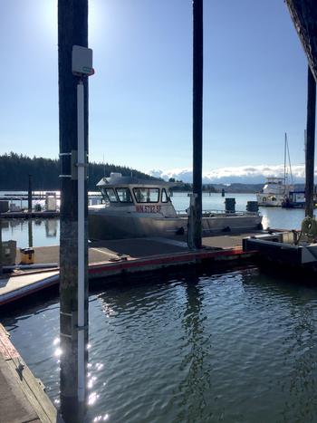
Pressure, conductivity, temperature, and water level relative the North American Vertical Datum of 1988 (NAVD88) were measured at seven locations in Puget Sound and Bellingham Bay, Washington, USA, from November 2, 2018 to June 4, 2021. These data were collected using submersible pressure-conductivity-temperature sensors mounted on piers to support studies of extreme water levels and flooding hazards in the region.
Time Series Data
-
Time-series measurements of pressure, conductivity, temperature, and water level collected in Puget Sound and Bellingham Bay, Washington, USA, 2018 to 2021
Pressure, conductivity, temperature, and water level relative the North American Vertical Datum of 1988 (NAVD88) were measured at seven locations in Puget Sound and Bellingham Bay, Washington, USA, from November 2, 2018 to June 4, 2021. These data were collected using submersible pressure-conductivity-temperature sensors mounted on piers to support studies of extreme water levels and flooding hazards in the region.
Data Files
belAtroll-a.nc - 461.3 KB
belBtroll-a.nc - 1008.0 KB
belCtroll-a.nc - 519.0 KB
edmAtroll-a.nc - 540.0 KB
edmBtroll-a.nc - 841.3 KB
edmCtroll-a.nc - 584.0 KB
edmDtroll-a.nc - 714.8 KB
hooAtroll-a.nc - 192.3 KB
hooBtroll-a.nc - 2.8 MB
lofAtroll-a.nc - 540.9 KB
lofBtroll-a.nc - 842.7 KB
lofCtroll-a.nc - 582.1 KB
oakAtroll-a.nc - 548.6 KB
oakBtroll-a.nc - 847.8 KB
oakCtroll-a.nc - 571.2 KB
olyAtroll-a.nc - 104.4 KB
olyBtroll-a.nc - 332.9 KB
steAtroll-a.nc - 391.2 KB
steBtroll-a.nc - 727.4 KB
steCtroll-a.nc - 584.0 KB
steDtroll-a.nc - 869.6 KB
Other Data Access
Metadata Files
pswl_metadata.xml - 15.5 KB
pswl_metadata.txt - 15.2 KB
Related Field Activities
- 2018-678-FA - View Details
- 2019-602-FA - View Details
- 2019-637-FA - View Details
- 2019-652-FA - View Details
- 2020-635-FA - View Details
- 2021-649-FA - View Details
Suggested Citation
Nowacki, D.J., Stevens, A.W., Vanarendonk, N.R., and Grossman, E.E., 2021, Time-series measurements of pressure, conductivity, temperature, and water level collected in Puget Sound and Bellingham Bay, Washington, USA, 2018 to 2021: U.S. Geological Survey data release, https://doi.org/10.5066/P9JTFJ6M.

