Composite multibeam bathymetry surface and data sources of the central Cascadia Margin offshore Oregon
By Peter Dartnell, Janet T. Watt, Jenna C. Hill, and James E. Conrad
https://doi.org/10.5066/P9PERGFK
Dates
Published: Nov. 30, 2023
Summary
In 2018 and 2019 the NOAA ships Rainier and Fairweather collected multibeam bathymetry data in 4 areas along the central Cascadia Margin offshore Oregon as part of a cooperative project between the U.S. Geological Survey, Pacific Coastal and Marine Science Center and NOAA. These regions were combined with other publicly available multibeam bathymetry data. The surface was generated to assist research projects studying offshore geohazards including mapping faults, submarine landslides, sediment transport pathways, and seafloor seeps.
Location-Elevation Data
-
Composite multibeam bathymetry surface of the central Cascadia Margin offshore Oregon
Data from various sources, including 2018 and 2019 multibeam bathymetry data collected by the National Oceanic and Atmospheric Administration (NOAA) and the U.S. Geological Survey (USGS) were combined to create a composite 30-m resolution multibeam bathymetry surface of central Cascadia Margin offshore Oregon. The data are available as a geoTIFF file.
Data Files
CentralCascadia_composite_bathymetry_UTM10_NAD83.zip - 86.1 MB - MD5:98e2ccb7e7442ca905d4eb813624f33e
Metadata Files
CentralCascadia_composite_bathymetry_UTM10_NAD83_metadata.xml - 19.8 KB
CentralCascadia_composite_bathymetry_UTM10_NAD83_metadata.txt - 19.5 KB
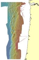 Quick view image of the central Cascadia Margin composite multibeam bathymetry surface

Other Data
-
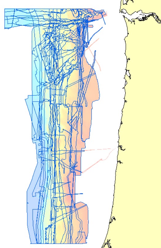
Polygon shapefile of data sources used to create a composite multibeam bathymetry surface of the central Cascadia Margin offshore Oregon
Data from various sources, including 2018 and 2019 multibeam bathymetry data collected by the National Oceanic and Atmospheric Administration (NOAA) and the U.S. Geological Survey (USGS) were combined to create a composite 30-m resolution multibeam bathymetry surface of central Cascadia Margin offshore Oregon. These metadata describe the polygon shapefile that outlines and identifies each publicly available bathymetric dataset. The data are available as a polygon shapefile.
Data Files
CentralCascadia_composite_bathymetry_UTM10_NAD83_data_sources.zip - 396.9 KB - MD5:85831953e3111d5a9166b7e8030e288a
Metadata Files
CentralCascadia_composite_bathymetry_UTM10_NAD83_data_sources_metadata.xml - 20.5 KB
CentralCascadia_composite_bathymetry_UTM10_NAD83_data_sources_metadata.txt - 20.0 KB
 Quick view image of the central Cascadia Margin composite multibeam bathymetry data source polygons
Suggested Citation
Dartnell, P., Watt, J.T., Hill, J.C., and Conrad, J.E., 2023, Composite multibeam bathymetry surface and data sources of the central Cascadia Margin offshore Oregon: U.S. Geological Survey data release, https://doi.org/10.5066/P9PERGFK.