High-resolution multichannel seismic reflection data collected along the New England outer continental shelf, slope, and rise south of Martha's Vineyard and Nantucket, Massachusetts, U.S. Geological Survey Field Activity 2016-018-FA
By Wayne E. Baldwin and Nathaniel C. Miller
https://doi.org/10.5066/P9R3VW5H
Dates
Published: July 21, 2023
Data Collected: June 11, 2016 – June 12, 2016
Summary
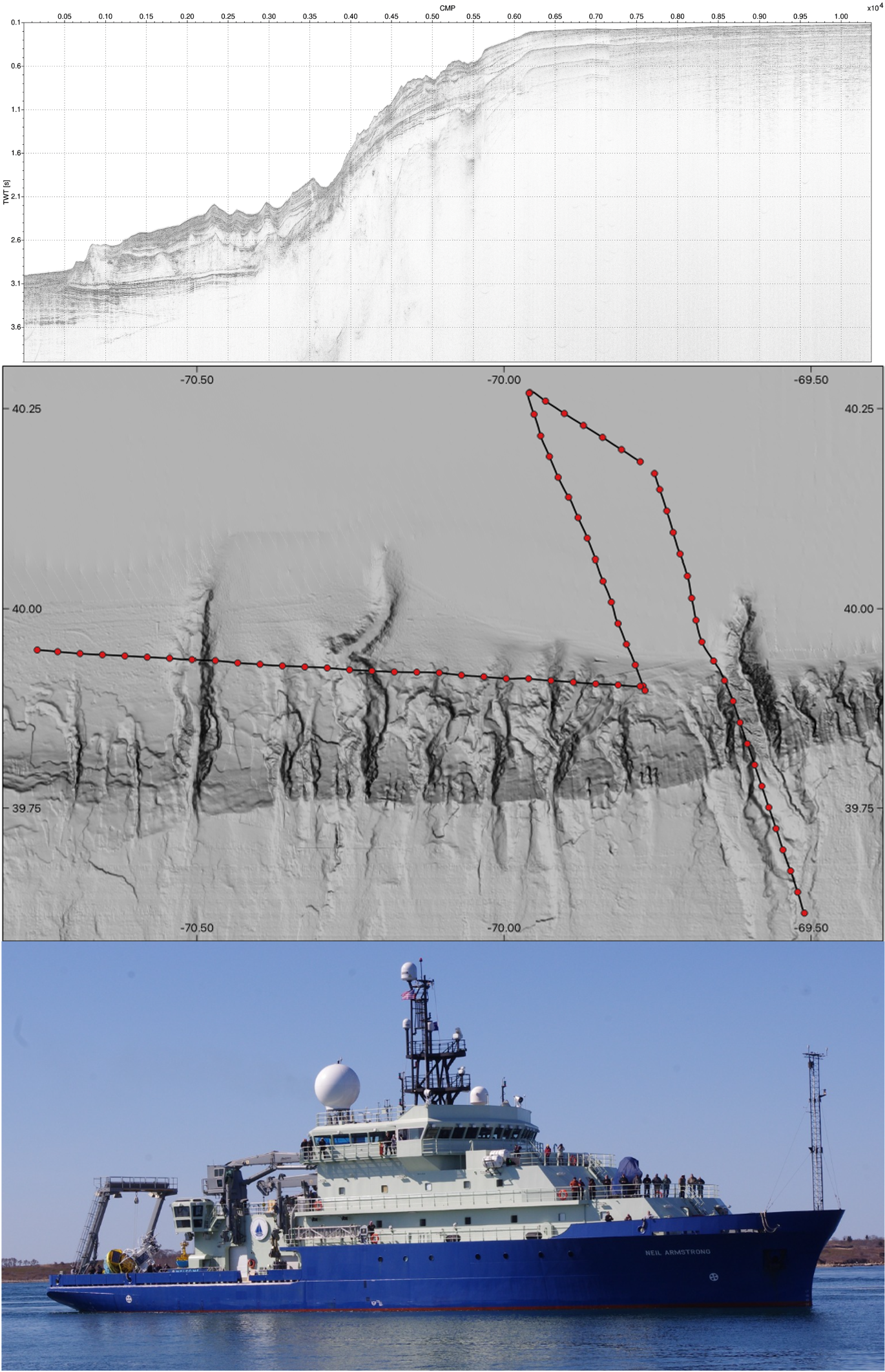
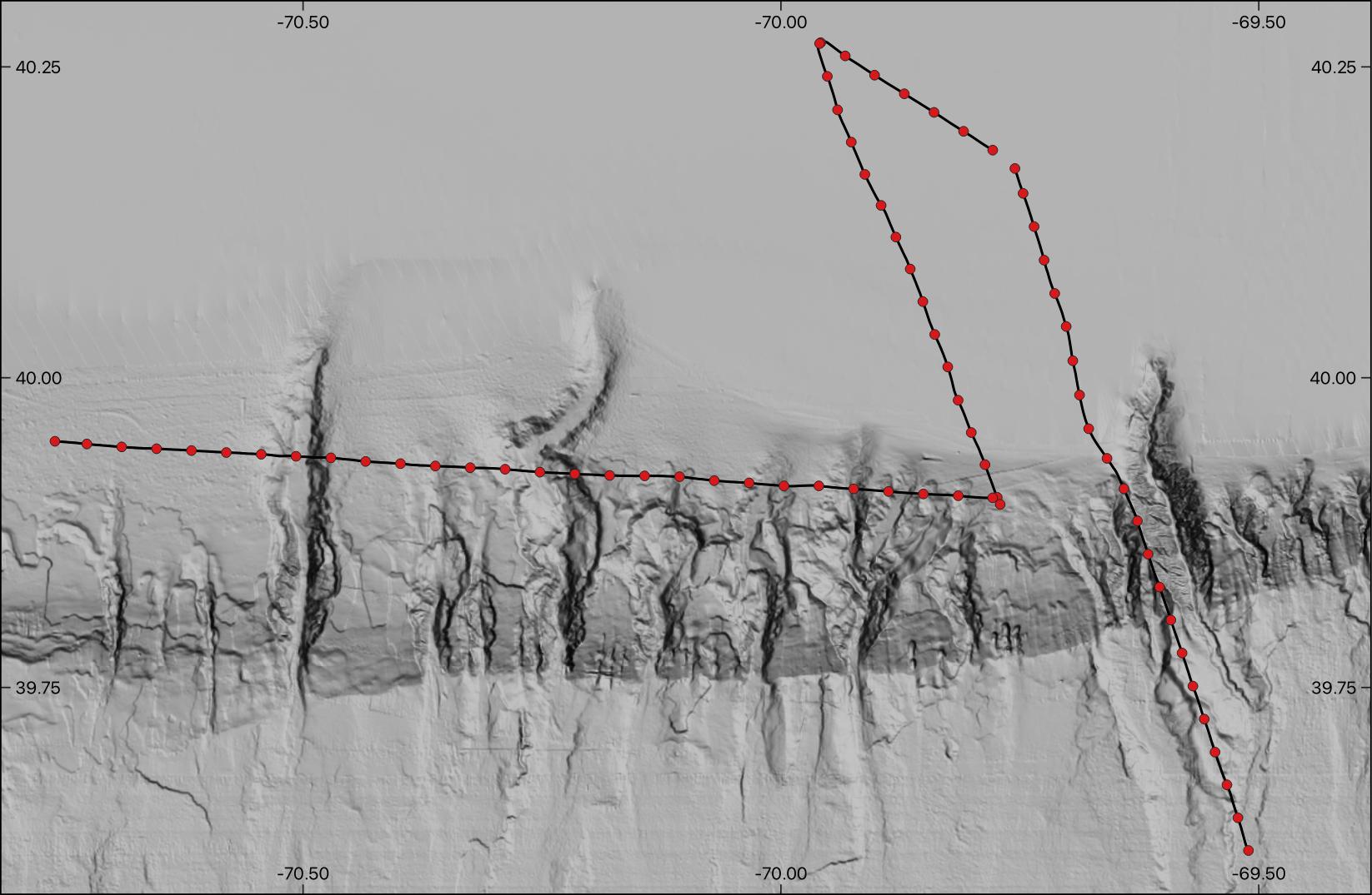
High resolution multichannel seismic-reflection data were collected along the New England outer continental shelf, slope, and rise south of Martha's Vineyard and Nantucket, Massachusetts, aboard the Woods Hole Oceanographic Institution (WHOI) research vessel Neil Armstrong on June 11 - 12, 2016 in order to characterize the stratigraphy of a portion of the New England continental margin incised by submarine canyons and showing evidence of mass transport processes. The activity was conducted as a part of the Science Verification Leg 5 (AR5) for the new vessel.
Seismic Data
-
High-resolution multichannel seismic reflection data collected along the New England outer continental shelf, slope, and rise south of Martha's Vineyard and Nantucket, Massachusetts, U.S. Geological Survey Field Activity 2016-018-FA
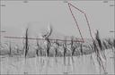
This dataset contains shot coordinate navigation, common mid-point (CMP) coordinate and trackline navigation, profile images, and processed stack and raw SEG-Y trace data for approximately 212 km of multichannel seismic-reflection data collected by the U.S. Geological Survey during USGS field activity 2016-018-FA along the New England outer continental shelf, slope, and rise south of Martha's Vineyard and Nantucket, Massachusetts. Images of each seismic profile were generated in order to provide portable and easily viewable alternatives to the SEG-Y versions of the data. Each profile image can be hyperlinked to its corresponding trackline navigation contained within the Esri polyline shapefile '2016-008-FA_MCS_cmpTracklines.shp'. CMP tick marks along the top of the PNG images correlate to the positions of 500 CMP intervals within the Esri point shapefile '2016-018-FA_MCS_cmp500.shp'. This information allows for spatial correlation of MCS seismic-reflection profiles images with other geophysical data for investigating sea-floor morphology and stratigraphy in the area.
Data Files
2016-018-FA_Line-01.sht-raw_geom.sgy.zip - 13.9 GB - MD5:cac66b200552f1118cd8620c570f85e0
2016-018-FA_Line-02.sht-raw_geom.sgy.zip - 4.1 GB - MD5:b9cc59314d21e8d654c126f528360514
2016-018-FA_Line-03.sht-raw_geom.sgy.zip - 10.2 GB - MD5:87828497265888a2bffc872f6d7994f4
2016-018-FA_Line-04.sht-raw_geom.sgy.zip - 18.6 GB - MD5:95d394539437c0429c9d01797f40777b
2016-018-FA_MCS_cmpnav.csv.zip - 618.8 KB - MD5:d71e4d04c5133c3c4456e223902b8d9c
2016-018-FA_MCS_cmpTracklines_browse.jpg - 174.5 KB - MD5:48bd2ccddf8bea33078e3a990fe721f6
2016-018-FA_MCS_Images.zip - 63.1 MB - MD5:826d3b9cad592ba4572318c355288fcf
2016-018-FA_MCS_Shapefiles.zip - 810.5 KB - MD5:4df7e17a26465ec034ea1d23e303c8ce
2016-018-FA_MCS_shtnav.csv.zip - 372.7 KB - MD5:0d72061c7855ccebc0e6c3012434f79c
2016-018-FA_MCS_StackSegyData.zip - 1.3 GB - MD5:e3745419f2a9aaa37f9c3f1ee7ede2c2
Metadata Files
2016-018-FA_MCS_meta.xml - 55.0 KB
2016-018-FA_MCS_meta.txt - 54.9 KB

Suggested Citation
Baldwin, W.E. and Miller, N.C., 2023, High-resolution multichannel seismic reflection data collected along the New England outer continental shelf, slope, and rise south of Martha's Vineyard and Nantucket, Massachusetts, U.S. Geological Survey Field Activity 2016-018-FA: U.S. Geological Survey data release, https://doi.org/10.5066/P9R3VW5H.
Overview Image