Geophysical and sampling data collected offshore Oceanside, southern California during field activity 2017-686-FA from 2017-10-23 to 2017-10-31
By Ray W. Sliter, James E. Conrad, Thomas D. Lorenson, Antoinette G. Papesh, Janet T. Watt, and Jonathan A. Warrick
https://doi.org/10.5066/P9UELSBU
Dates
Published: March 17, 2021
Data Collected: Oct. 23, 2017 – Oct. 31, 2017
Summary
This data release contains geophysical and sediment sample data that were collected aboard the R/V Snavely in 2017 on U.S. Geological Survey cruise 2017-686-FA offshore Oceanside, southern California. The goal of the survey was to provide high-resolution imaging, magnetic anomaly profiles and sediment analysis to characterize the surface and subsurface properties of the study area such as unconsolidated sediment thickness, hazards to dredging and and sediment composition. This cruise was funded through partnerships with the Bureau of Ocean Energy Management (BOEM) and the State of California Ocean Protection Council (OPC).
Magnetic Data
-
Marine magnetic data collected offshore Oceanside, southern California during field activity 2017-686-FA from 2017-10-23 to 2017-10-31
This part of the data release contains marine magnetic data that were collected aboard the R/V Snavely in 2017 on U.S. Geological Survey cruise 2017-686-FA offshore Oceanside, southern California. The magnetic field data were collected to characterize the surface and subsurface properties of the study area, including unconsolidated sediment thickness and subsurface sediment horizons.
Data Files
2017-686-FA_magnetics.zip - 12.5 MB - MD5:61c0bc19b870c1b0cbbb11e2bbb6a308
Metadata Files
2017-686-FA_magnetics_metadata.xml - 18.5 KB
2017-686-FA_magnetics_metadata.txt - 18.2 KB
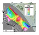 Map showing magnetic anomaly data

Sampling Data
-
Sediment grain size data from samples collected offshore Oceanside, southern California during field activity 2017-686-FA from 2017-10-23 to 2017-10-31
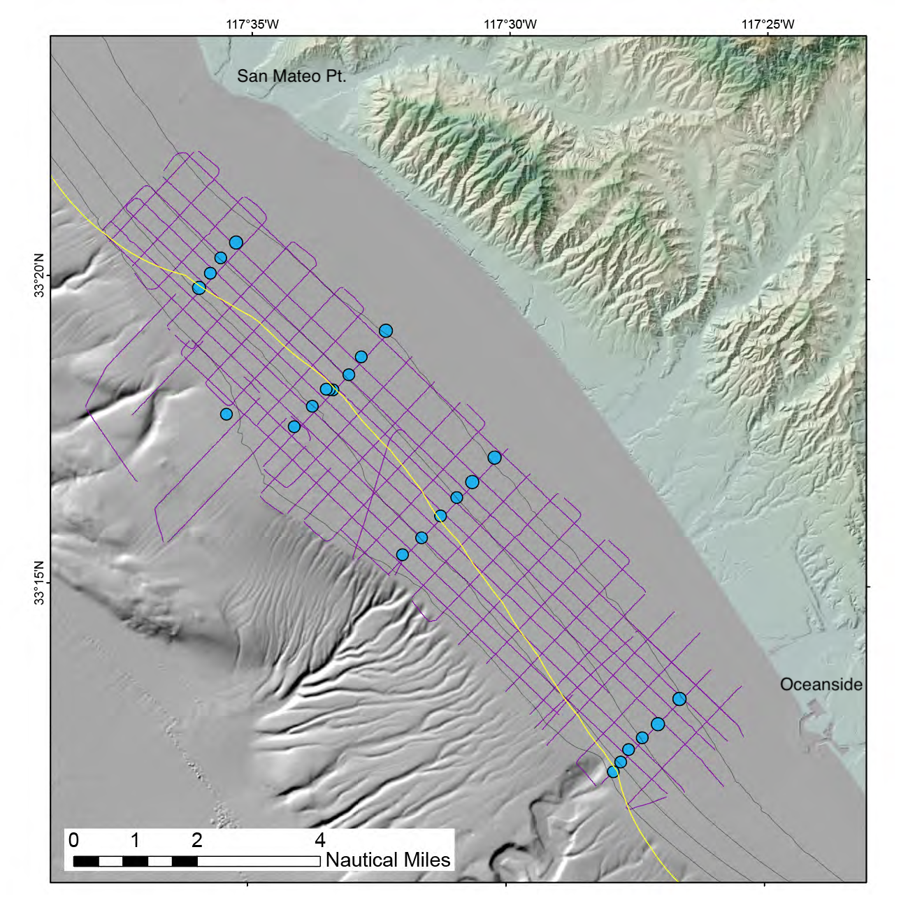
This section of the data release contains grain-size analysis of twenty-six seafloor surface grab samples that were collected aboard the R/V Snavely in 2017 on U.S. Geological Survey cruise 2017-686-FA offshore Oceanside, southern California. The samples were collected at strategic locations along the same transects as seismic-reflection lines oriented to assess sand and gravel resources in Federal and State waters for potential use in future beach nourishment projects along stretches of the coast where critical erosion hotspots have been identified. Samples were collected at 23 locations using a Van Veen sediment sampler along 4 shore-perpendicular transects spaced 5 to 9 km apart, aligned with previously collected seismic profile lines, at depths ranging from about 20 to 80 m. One sample on the outer shelf (BSS-06) was collected to evaluate an area of suspected sand occurrence. Two duplicate samples were collected at one location (BSS-08) in order to evaluate local sample variability.
Data Files
2017-686-FA_samples.csv - 26.4 KB - MD5:9bec2aebb5671fcb67aa8dfd53491769
Metadata Files
2017-686-FA_sample_metadataxml.xml - 67.4 KB
2017-686-FA_sample_metadataxml.txt - 66.1 KB
Seismic Data
-
High-resolution chirp seismic-reflection data collected offshore Oceanside, southern California during field activity 2017-686-FA from 2017-10-23 to 2017-10-31
This section of the data release contains approximately 369 line-kilometers of processed, high-resolution chirp seismic-reflection profiles that were collected aboard the R/V Snavely in 2017 on U.S. Geological Survey cruise 2017-686-FA offshore Oceanside, southern California. The along-shore and across-shore chirp profiles are oriented to assess sand and gravel resources in Federal and State waters for potential use in future beach nourishment projects along stretches of the coast where critical erosion hotspots have been identified. The chirp profiles were acquired using an Edgetech 512 Chirp sub-bottom profiling system.
Data Files
2017-686_chirp.zip - 6.9 GB - MD5:c3d3909c07492b53d677820239819082
Metadata Files
2017-686-FA_chirp_metadata.xml - 15.2 KB
2017-686-FA_chirp_metadata.txt - 14.8 KB
Related Field Activities
- 2017-686-FA - View Details
Suggested Citation
Sliter, R.W., Conrad, J.E., Lorenson, T.D., Papesh, A.G., Watt, J.T., and Warrick, J.A., 2021, Geophysical and sampling data collected offshore Oceanside, southern California during field activity 2017-686-FA from 2017-10-23 to 2017-10-31: U.S. Geological Survey data release, https://doi.org/10.5066/P9UELSBU.
Oceanside Study Area