Geophysical and sampling data collected offshore Oceanside, southern California during field activity 2017-686-FA from 2017-10-23 to 2017-10-31
https://doi.org/10.5066/P9UELSBU
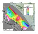
Marine magnetic data collected offshore Oceanside, southern California during field activity 2017-686-FA from 2017-10-23 to 2017-10-31
Summary
This part of the data release contains marine magnetic data that were collected aboard the R/V Snavely in 2017 on U.S. Geological Survey cruise 2017-686-FA offshore Oceanside, southern California. The magnetic field data were collected to characterize the surface and subsurface properties of the study area, including unconsolidated sediment thickness and subsurface sediment horizons.
Purpose
The U.S. Geological Survey (USGS) collected marine magnetic in 2017 offshore Oceanside, southern California. The goal of the magnetic survey was to provide magnetic field data to characterize the surface and subsurface properties of the study area, including unconsolidated sediment thickness and subsurface sediment horizons. This cruise was funded through partnerships with the Bureau of Ocean Energy Management (BOEM) and the State of California Ocean Protection Council (OPC).
Data Files
- 2017-686-FA_magnetics.zip - 12.5 MB
Metadata Files
Suggested Citation
Sliter, R.W., Conrad, J.E., Lorenson, T.D., Papesh, A.G., Watt, J.T., and Warrick, J.A., 2021, Geophysical and sampling data collected offshore Oceanside, southern California during field activity 2017-686-FA from 2017-10-23 to 2017-10-31: U.S. Geological Survey data release, https://doi.org/10.5066/P9UELSBU.

