Bathymetry and acoustic backscatter data collected in 2008 offshore Tijuana River Estuary, California during USGS Field Activity S-5-08-SC
https://doi.org/10.5066/P9Y8CDFI
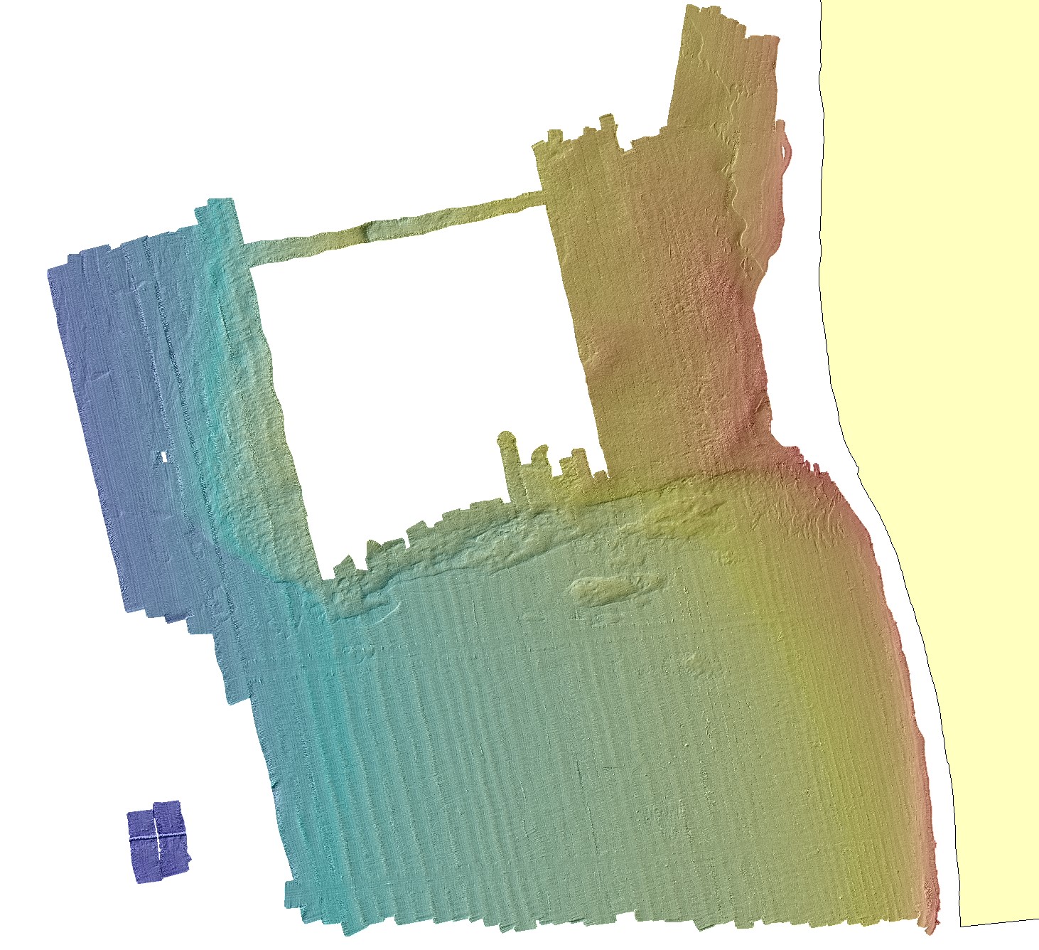
Bathymetry data collected in 2008 offshore Tijuana River Estuary, California during USGS Field Activity S-5-08-SC
Summary
These metadata describe bathymetry data collected during a 2008 SWATHPlus-M survey offshore Tijuana River Estuary, California. Data were collected and processed by the U.S. Geological Survey (USGS), Pacific Coastal and Marine Science Center (PCMSC) with fieldwork activity number S-5-08-SC. The bathymetry data are provided as GeoTIFF images in UTM, zone 11, NAD83 coordinates, vertically referenced to both NAVD88 and WGS84. A standard deviation grid is also provided.
Purpose
Coastal mapping was conducted as part of the Tijuana Estuary Fine Sediment Fate and Transport Demonstration Project, which was developed by a number of State of California, Federal, and private industry partners to provide information about the directions, rates, and processes of fine sediment transport at nearshore settings of California. The primary goal of the Demonstration Project was the monitoring of the transport, fate, and impacts of fine sediment from beach sediment nourishments in 2008 and 2009 near the Tijuana River Estuary, Imperial Beach, California. To achieve this goal, the USGS monitored the water, beach, and seafloor properties near the project site. The coastal mapping described in this report provided important baseline bathymetric and seafloor substrate information for the Demonstration Project and was used to develop sampling programs for the Demonstration Project. These data are intended for science researchers, students, policy makers, and the general public. These data can be used with geographic information systems or other software to identify bathymetric features. These data are not intended to be used for navigation.
Data Files
- S-5-08-SC_bathymetry_navd88_utm11_1m.zip - 40.4 MB
- S-5-08-SC_bathymetry_wgs84_utm11_1m.zip - 37.6 MB
- S-5-08-SC_bathy_stddev_nad83_utm11_1m.zip - 20.9 MB
Metadata Files
Suggested Citation
Dartnell, P., Finlayson, D.P., and Warrick, J.A., 2020, Bathymetry and acoustic backscatter data collected in 2008 offshore Tijuana River Estuary, California during USGS Field Activity ID: S-5-08-SC: U.S. Geological Survey data release, https://doi.org/10.5066/P9Y8CDFI.