Georeferenced TIFF image displaying 1 meter resolution backscatter data collected by the U.S. Geological Survey in the Steamboat Lumps Marine Protected Area, Gulf of Mexico in 2000 (UTM Zone 16N, WGS 84, GeoTIFF image)

Metadata also available as - [Parseable text] - [XML]

Metadata:

Identification_Information:
Citation:
Citation_Information:
Originator: U.S. Geological Survey
Publication_Date: 2016
Title:
Georeferenced TIFF image displaying 1 meter resolution backscatter data collected by the U.S. Geological Survey in the Steamboat Lumps Marine Protected Area, Gulf of Mexico in 2000 (UTM Zone 16N, WGS 84, GeoTIFF image)
Edition: 1.0
Geospatial_Data_Presentation_Form: remote-sensing image
Series_Information:
Series_Name: data release
Issue_Identification: DOI:10.5066/F7JD4TVC
Publication_Information:
Publication_Place:
Woods Hole Coastal and Marine Science Center, Woods Hole, Massachusetts
Publisher: U.S. Geological Survey, Coastal and Marine Geology Program
Online_Linkage: https://doi.org/10.5066/F7JD4TVC
Online_Linkage: Online_Linkage: Larger_Work_Citation:
Citation_Information:
Originator: Kathryn M. Scanlon
Originator: Brian J. Buczkowski
Publication_Date: 2016
Title:
High-resolution geophysical data collected in the Madison Swanson and Steamboat Lumps Marine Protected Areas, Gulf of Mexico in 2000, U.S. Geological Survey Field Activity 2000-005-FA
Edition: 1.0
Series_Information:
Series_Name: data release
Issue_Identification: DOI:10.5066/F7JD4TVC
Publication_Information:
Publication_Place: Reston, VA
Publisher: U.S. Geological Survey
Online_Linkage: https://doi.org/10.5066/F7JD4TVC
Description:
Abstract:
The U.S. Geological Survey (USGS) mapped approximately 22 square miles of the Madison Swanson Marine Protected Area (MPA) and Steamboat Lumps MPA, which are located on the Florida shelf edge in the northeastern Gulf of Mexico in 2000 using sidescan sonar and high-resolution chirp seismic-reflection systems. This survey was conducted as part of a larger study of the effectiveness of no-fishing reserves in protecting grouper spawning aggregations. Field activity information for this cruise is available on-line through the U.S. Geological Survey Coastal and Marine Geoscience Data System at https://cmgds.marine.usgs.gov/fan_info.php?fa=2000-005-FA.
Purpose:
The sidescan-sonar data were collected and processed during USGS field activity 2000-005-FA to map the surficial geology of the Steamboat Lumps Marine Protected Area.
Time_Period_of_Content:
Time_Period_Information:
Range_of_Dates/Times:
Beginning_Date: 20000222
Ending_Date: 20000301
Currentness_Reference: ground condition
Status:
Progress: Complete
Maintenance_and_Update_Frequency: None planned
Spatial_Domain:
Bounding_Coordinates:
West_Bounding_Coordinate: -84.803800
East_Bounding_Coordinate: -84.597571
North_Bounding_Coordinate: 28.252913
South_Bounding_Coordinate: 28.047552
Keywords:
Theme:
Theme_Keyword_Thesaurus: USGS Metadata Identifier
Theme_Keyword: USGS:e11f5cb7-ca7b-4cac-a57b-b9e56260f8e4
Theme:
Theme_Keyword_Thesaurus: None
Theme_Keyword: USGS
Theme_Keyword: U.S. Geological Survey
Theme_Keyword: CMGP
Theme_Keyword: Coastal and Marine Geology Program
Theme_Keyword: WHCMSC
Theme_Keyword: Woods Hole Coastal and Marine Science Center
Theme_Keyword: Marine Geology
Theme_Keyword: field activity number 2000-005-FA
Theme_Keyword: backscatter
Theme_Keyword: sidescan sonar
Theme_Keyword: SIS 1000
Theme_Keyword: R/V Oregon II
Theme:
Theme_Keyword_Thesaurus: ISO 19115 Topic Category
Theme_Keyword: oceans
Theme_Keyword: geoscientificInformation
Theme_Keyword: imageryBaseMapsEarthCover
Theme:
Theme_Keyword_Thesaurus: USGS Thesaurus
Theme_Keyword: sea-floor acoustic reflectivity
Theme_Keyword: image mosaics
Theme_Keyword: sidescan sonar
Theme_Keyword: marine geophysics
Theme_Keyword: geospatial datasets
Place:
Place_Keyword_Thesaurus: None
Place_Keyword: North America
Place_Keyword: United States
Place_Keyword: Florida
Place_Keyword: West Florida Shelf
Place_Keyword: Gulf of Mexico
Place_Keyword: Steamboat Lumps Marine Protected Area
Access_Constraints: none
Use_Constraints:
Public domain data from the U.S. Government are freely redistributable with proper metadata and source attribution. Please recognize the U.S. Geological Survey as the originator of the dataset. These data are not to be used for navigation.
Point_of_Contact:
Contact_Information:
Contact_Organization_Primary:
Contact_Organization: U.S. Geological Survey
Contact_Person: Kathryn M. Scanlon
Contact_Position: Research Geologist
Contact_Address:
Address_Type: mailing and physical address
Address: 384 Woods Hole Road
City: Woods Hole
State_or_Province: Massachusetts
Postal_Code: 02543-1598
Country: USA
Contact_Voice_Telephone: 508-548-8700 x 2323
Contact_Facsimile_Telephone: 508-457-2310
Contact_Electronic_Mail_Address: kscanlon@usgs.gov
Browse_Graphic:
Browse_Graphic_File_Name: Browse_Graphic_File_Description:
Browse graphic of the sidescan-sonar mosaic of the Steamboat Lumps area of field activity 2000-005-FA.
Browse_Graphic_File_Type: PNG
Native_Data_Set_Environment:
Microsoft Windows Vista Version 6.1 (Build 7601) Service Pack 1; ESRI ArcCatalog 9.3.1.4095
Cross_Reference:
Citation_Information:
Originator: Mark Capone
Originator: Kathryn M. Scanlon
Originator: B. Ann Swift
Publication_Date: 2002
Title:
Archive of Chirp Subbottom Data Collected During USGS Cruise ORGN00005, Northeastern Gulf of Mexico, 15 February - 2 March, 2000
Edition: 1.0
Geospatial_Data_Presentation_Form: digital data
Series_Information:
Series_Name: Open-File Report
Issue_Identification: 2002-045
Publication_Information:
Publication_Place: Reston, VA
Publisher: U.S. Geological Survey
Online_Linkage: https://pubs.er.usgs.gov/publication/ofr0245
Data_Quality_Information:
Logical_Consistency_Report:
This is a GeoTIFF image and associated world file of the data originally collected on field activity 2000-005-FA, recorded by ISIS acquisition system and processed while at sea. All files in this mosaic were acquired with a 400 meter swath width (200 meter range). These files were acquired with 12 dB of gain.
Completeness_Report:
This mosaic represents all of the processed backscatter data collected in the Steamboat Lumps Marine Protected Area during USGS field activity 2000-005-FA. The line numbers falling in this particular area are L54F1 to L1121F (which was intended to be L121F1). Also misnamed is L1120F1, which should have been L120F1. Line L122F1 is a tie line that runs southwest to northeast across the study area and is not included in the mosaic. L65F1 was missing a large section of navigation (45 minutes) so just straight extrapolation was used when mapping that file. L69F2 is actually outside the study area. Line 69 was continued in order to avoid a collision with another vessel. L82F1 was not processed - the gear was pulled. The line was rerun as L82F2. During L102F1 navigation was lost after the Julian Day change. Navigation was manually created at 00:09, 00:19, and 00:29 based on the distance between points earlier in the line assuming a constant ship speed and direction. The turns are not included in the mosaic.
Positional_Accuracy:
Horizontal_Positional_Accuracy:
Horizontal_Positional_Accuracy_Report:
Differential GPS, with an Ashtech BR2G beacon receiver, was used to navigate the ship. The towfish navigation system was a Benthos DS 7000 acoustic deck set that used range to towfish to account for layback of the towfish. The position of the towfish was corrected using HYPACK and ISIS software. The range to fish did not always work well. The assumed approximate horizontal offset is 20-30 meters.
Lineage:
Process_Step:
Process_Description:
The SIS 1000 towfish by Datasonics was used to collect all of the sidescan-sonar data at a 400 meter total swath width. The data were recorded using ISIS by Triton Elics International in QMIPS format.
Process_Date: 2000
Process_Contact:
Contact_Information:
Contact_Organization_Primary:
Contact_Organization: U.S. Geological Survey
Contact_Person: Kathryn M. Scanlon
Contact_Position: Research Geologist
Contact_Address:
Address_Type: mailing and physical address
Address: 384 Woods Hole Rd.
City: Woods Hole
State_or_Province: MA
Postal_Code: 02543-1598
Contact_Voice_Telephone: 508-548-8700 x2323
Contact_Facsimile_Telephone: 508-457-2310
Contact_Electronic_Mail_Address: kscanlon@usgs.gov
Process_Step:
Process_Description:
XSonar processing software (Danforth and others, 1991) was used to process the sidescan sonar QMIPS files. The files were demultiplexed using a 4x3 sample interval and a normalization value of 8192. The scan size was 768 pixels, and the output resolution was 0.781250 meters. A command-line script was used to help remove surface noise. An example of the command line is: removeSurface -S20 -p10 -s10 -N10 -O0.6 -i l35f1. -o l35f1new. Manual bottom tracking was used in order to remove the water column from the swaths with the slant range correction. Destriping and beam angle corrections were applied using 300 lines with a 100 ping overlap; maximum beam angle of 90; response angle = 55; data normalization = 0; port/starboard tone adjust = ON. This processing effectively aids in suppressing speckle noise and reding file size, and corrects for slant-range distortion, signal attenuation, and dropped sonar pings. This process step and all subsequent process steps were performed by VeeAnn A. Cross.

Danforth, W. W., T. F. O'Brien, and W. C. Schwab. 1991. US Geological Survey Image Processing System: Near Real-Time Mosaicking of High-Resolution Sidescan-Sonar Data. Sea Technology, Jan. 1991: 54-59.

Danforth, W., 1997, Xsonar/ShowImage; a complete system for rapid sidescan sonar processing and display: U.S. Geological Survey Open-File Report 97-686, 77 p.
Process_Date: 2000
Process_Contact:
Contact_Information:
Contact_Organization_Primary:
Contact_Organization: U.S. Geological Survey
Contact_Person: VeeAnn A. Cross
Contact_Position: Marine Geologist
Contact_Address:
Address_Type: mailing and physical address
Address: 384 Woods Hole Rd.
City: Woods Hole
State_or_Province: MA
Postal_Code: 02543-1598
Contact_Voice_Telephone: 508-548-8700 x2251
Contact_Facsimile_Telephone: 508-457-2310
Contact_Electronic_Mail_Address: vatnipp@usgs.gov
Process_Step:
Process_Description:
The individual lines were then processed with the WHIPS software package to additionally filter the lines using a 7 line filter and mapping the odd and even lines into separate georeferenced images for mosaicking in PCI software (Paskevich 1992; Paskevich 1996). These images had a pixel resolution of 1 meter/pixel.

Paskevich, V. F. 1992. Digital Mapping of Sidescan Sonar Data with the Woods Hole Image Processing System Software. Open-File Report 92-536, 87 pp.

Paskevich, V. F. 1996. MAPIT: An Improved Method for Mapping Digital Sidescan Sonar Data using the Woods Hole Image Processing System (WHIPS) Software. Open-File Report 96-281, 73 pp.
Process_Date: 2000
Process_Step:
Process_Description:
Non-overlapping swaths were then brought into the remote sensing software package PCI Geomatics. Two channels were used so that one channel (line by line) could be brought in and mapped - mosaicked - to the other channel by picking control points to further constrain the positioning of the line. The lines set as "true" were the even lines, and the odd lines were mapped to those using control points. The final mosaic was then exported from PCI as a TIFF image with an associated world file for georeferencing purposes. GeoTiffExamine was then used to add the world file information to the TIFF image transforming it into a GeoTIFF.
Process_Date: 2000
Process_Step:
Process_Description:
The online links to the data were updated to reflect the new server hosting the data. Additionally, other small edits could be made to the metadata, such as modifying http to https where appropriate. The metadata date (but not the metadata creator) was edited to reflect the date of these changes.
Process_Date: 20170406
Process_Contact:
Contact_Information:
Contact_Organization_Primary:
Contact_Organization: U.S. Geological Survey
Contact_Person: VeeAnn A. Cross
Contact_Position: Marine Geologist
Contact_Address:
Address_Type: Mailing and Physical
Address: 384 Woods Hole Road
City: Woods Hole
State_or_Province: MA
Postal_Code: 02543-1598
Contact_Voice_Telephone: 508-548-8700 x2251
Contact_Facsimile_Telephone: 508-457-2310
Contact_Electronic_Mail_Address: vatnipp@usgs.gov
Process_Step:
Process_Description: USGS Thesaurus keywords added to the keyword section.
Process_Date: 20180720
Process_Contact:
Contact_Information:
Contact_Organization_Primary:
Contact_Organization: U.S. Geological Survey
Contact_Person: VeeAnn A. Cross
Contact_Position: Marine Geologist
Contact_Address:
Address_Type: Mailing and Physical
Address: 384 Woods Hole Road
City: Woods Hole
State_or_Province: MA
Postal_Code: 02543-1598
Contact_Voice_Telephone: 508-548-8700 x2251
Contact_Facsimile_Telephone: 508-457-2310
Contact_Electronic_Mail_Address: vatnipp@usgs.gov
Process_Step:
Process_Description:
Added keywords section with USGS persistent identifier as theme keyword.
Process_Date: 20200908
Process_Contact:
Contact_Information:
Contact_Organization_Primary:
Contact_Organization: U.S. Geological Survey
Contact_Person: VeeAnn A. Cross
Contact_Position: Marine Geologist
Contact_Address:
Address_Type: Mailing and Physical
Address: 384 Woods Hole Road
City: Woods Hole
State_or_Province: MA
Postal_Code: 02543-1598
Contact_Voice_Telephone: 508-548-8700 x2251
Contact_Facsimile_Telephone: 508-457-2310
Contact_Electronic_Mail_Address: vatnipp@usgs.gov
Spatial_Data_Organization_Information:
Direct_Spatial_Reference_Method: Raster
Raster_Object_Information:
Raster_Object_Type: Pixel
Row_Count: 22392
Column_Count: 19841
Vertical_Count: 1
Spatial_Reference_Information:
Horizontal_Coordinate_System_Definition:
Planar:
Grid_Coordinate_System:
Grid_Coordinate_System_Name: Universal Transverse Mercator
Universal_Transverse_Mercator:
UTM_Zone_Number: 16
Transverse_Mercator:
Scale_Factor_at_Central_Meridian: 0.999600
Longitude_of_Central_Meridian: -87.000000
Latitude_of_Projection_Origin: 0.000000
False_Easting: 500000.000000
False_Northing: 0.000000
Planar_Coordinate_Information:
Planar_Coordinate_Encoding_Method: row and column
Coordinate_Representation:
Abscissa_Resolution: 1.000000
Ordinate_Resolution: 1.000000
Planar_Distance_Units: meters
Geodetic_Model:
Horizontal_Datum_Name: D_WGS_1984
Ellipsoid_Name: WGS_1984
Semi-major_Axis: 6378137.000000
Denominator_of_Flattening_Ratio: 298.257224
Entity_and_Attribute_Information:
Overview_Description:
Entity_and_Attribute_Overview:
The pixel value (1-255) indicates the reflectance of the sea-floor surface. Light areas (high value) contain highly reflective substrate types, while fine-grained sediment produces a low reflectance and is found in dark areas (low value). A value of zero represents no data.
Entity_and_Attribute_Detail_Citation: U.S. Geological Survey data processor.
Distribution_Information:
Distributor:
Contact_Information:
Contact_Person_Primary:
Contact_Person: Brian J. Buczkowski
Contact_Organization: U.S. Geological Survey
Contact_Position: Physical Scientist
Contact_Address:
Address_Type: mailing and physical address
Address: 384 Woods Hole Road
City: Woods Hole
State_or_Province: Massachusetts
Postal_Code: 02543
Country: USA
Contact_Voice_Telephone: 508-548-8700 x2361
Contact_Facsimile_Telephone: 508-457-2310
Contact_Electronic_Mail_Address: bbuczkowski@usgs.gov
Resource_Description:
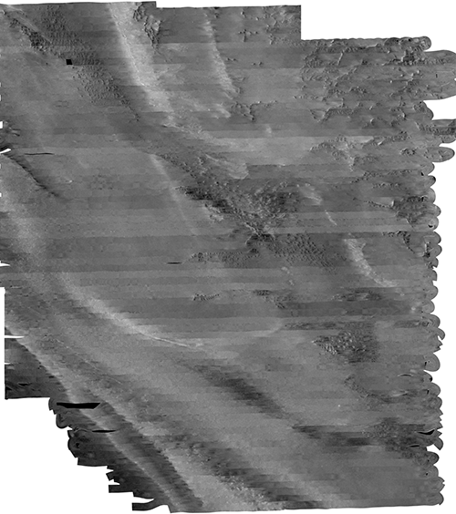
The 2000-005-FA_SL_sss.zip file contains the GeoTIFF image 2000-005-FA_SL_sss.tif and the associated world file 2000-005-FA_SL_sss.tfw. In addition to the image and world file, the zip file also contains the FGDC CSDGM metadata in the following formats: XML, HTML, and text.
Distribution_Liability:
Neither the U.S. Government, the Department of the Interior, nor the USGS, nor any of their employees, contractors, or subcontractors, make any warranty, express or implied, nor assume any legal liability or responsibility for the accuracy, completeness, or usefulness of any information, apparatus, product, or process disclosed, nor represent that its use would not infringe on privately owned rights. The act of distribution shall not constitute any such warranty, and no responsibility is assumed by the USGS in the use of these data or related materials. Any use of trade, product, or firm names is for descriptive purposes only and does not imply endorsement by the U.S. Government.
Standard_Order_Process:
Digital_Form:
Digital_Transfer_Information:
Format_Name: GeoTIFF
Format_Version_Number: unknown
Format_Specification: GeoTIFF image file
Format_Information_Content:
GeoTIFF image file and TFW world file derived from sonar data collected during USGS field activity 2000-005-FA. This also includes associated metadata.
File_Decompression_Technique: Use WinZip, 7zip, Peazip or pkUnzip
Transfer_Size: 240
Digital_Transfer_Option:
Online_Option:
Computer_Contact_Information: Access_Instructions: Data can be downloaded via the Internet
Fees: none
Technical_Prerequisites:
This WinZip file contains a GeoTIFF image file, a world file, and associated metadata files. To utilize these data, the user must have software capable of viewing GeoTIFF image files.
Metadata_Reference_Information:
Metadata_Date: 20240318
Metadata_Contact:
Contact_Information:
Contact_Person_Primary:
Contact_Person: Brian J. Buczkowski
Contact_Organization: U.S. Geological Survey
Contact_Position: Physical Scientist
Contact_Address:
Address_Type: mailing and physical address
Address: 384 Woods Hole Road
City: Woods Hole
State_or_Province: Massachusetts
Postal_Code: 02543
Country: USA
Contact_Voice_Telephone: 508-548-8700 x2361
Contact_Facsimile_Telephone: 508-457-2310
Contact_Electronic_Mail_Address: whsc_data_contact@usgs.gov
Contact_Instructions:
The metadata contact email address is a generic address in the event the person is no longer with USGS. (updated on 20240318)
Metadata_Standard_Name: FGDC Content Standards for Digital Geospatial Metadata
Metadata_Standard_Version: FGDC-STD-001-1998
Metadata_Time_Convention: local time

Generated by mp version 2.9.50 on Thu Mar 28 14:58:17 2024