Seismic reflection and sample data collected offshore of Fire Island, New York in 2014, U.S. Geological Field Activity 2014-009-FA
| Field activity number | 2014-009-FA |
|---|---|
| Version | 1 |
| Area of operation | offshore of Fire Island, New York |
| Dates | 2014 |
| Chief scientist | William C. Schwab |
Suggested citation: Denny, J.F., Schwab, W.C., Ackerman, S.D., Baldwin, W.E., Danforth, W.W., Moore, E., Nichols, A.R., and Worley, C.R., 2017, High-resolution geophysical and sample data collected offshore of Fire Island, New York in 2014, U.S. Geological data release, https://doi.org/10.5066/F7FF3QTQ
Abstract: The U.S. Geological Survey (USGS) conducted a geophysical and sampling survey in October 2014 that focused on a series of shoreface-attached ridges offshore of western Fire Island, NY. Seismic-reflection data, surficial grab samples and bottom photographs and video were collected along the lower shoreface and inner continental shelf. The purpose of this survey was to assess the impact of Hurricane Sandy on this coastal region. These data were compared to seismic-reflection and surficial sediment data collected by the USGS in the same area in 2011 to evaluate any post-storm changes in seabed morphology and modern sediment thickness on the inner continental shelf. For more information about the WHCMSC Field Activity, see: https://cmgds.marine.usgs.gov/fan_info.php?fan=2014-009-FA.
| Filename and description | Preview | Metadata | Download |
|---|---|---|---|
Bathymetry | |||
| The Teledyne Reson T20-P multibeam echosounder was tested in 2014 during U.S. Geological Survey Field Activity 2014-009-FA offshore of Fire Island, NY. No usable data were collected due to hardware and software malfunctions. | |||
Seismics |
|||
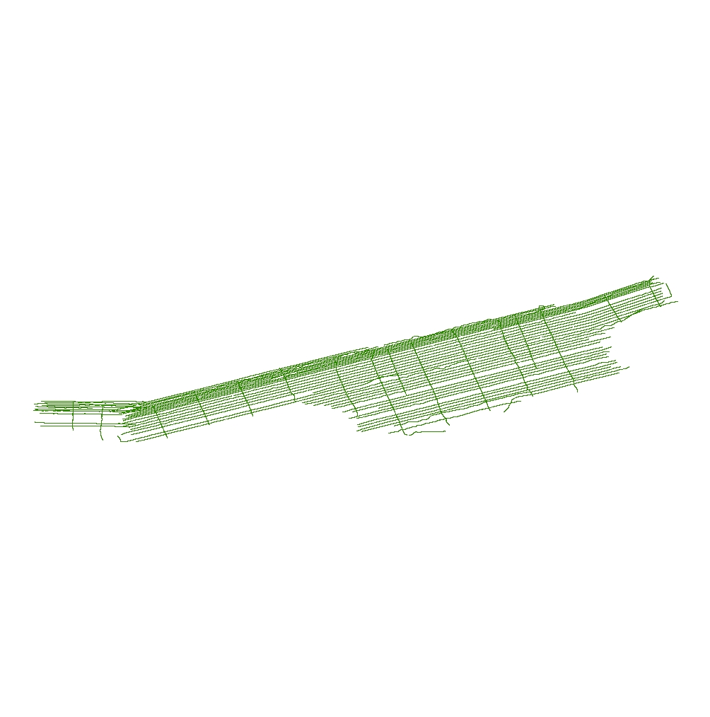
| 2014-009-FA_512i_Tracklines: Trackline navigation for the EdgeTech SB-512i chirp seismic-reflection data collected in 2014 by the U.S. Geological Survey offshore of Fire Island, NY (Esri polyline shapefile, GCS WGS 84). |
 |
HTML FAQ TEXT XML |
2014-009-FA_512i_Tracklines.zip |
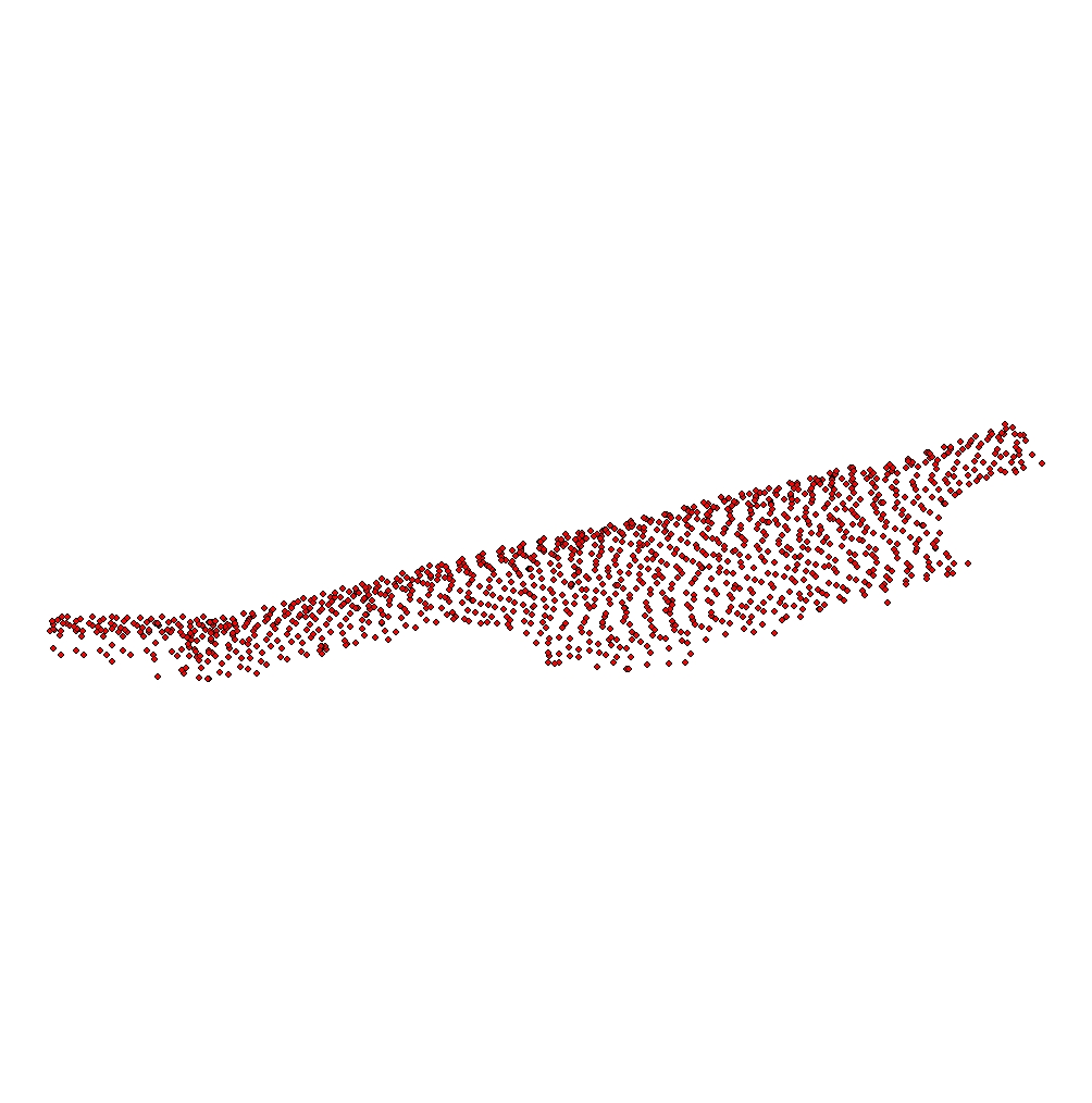
| 2014-009-FA_512i_500sht: Shot point navigation at even 500-shot intervals for the EdgeTech SB-512i chirp seismic-reflection data collected in 2014 by the U.S. Geological Survey offshore of Fire Island, NY (Esri point shapefile, CGS WGS 84). |
 |
HTML FAQ TEXT XML |
2014-009-FA_512i_500sht.zip |
| 2014-009-FA_512i_Images: PNG images of Edgetech SB-512i chirp seismic-reflection data collected in 2014 by the U.S. Geological Survey offshore of Fire Island, NY in 2014 (PNG format). |
HTML FAQ TEXT XML |
2014-009-FA_512i_Images.zip | |
Samples |
|||
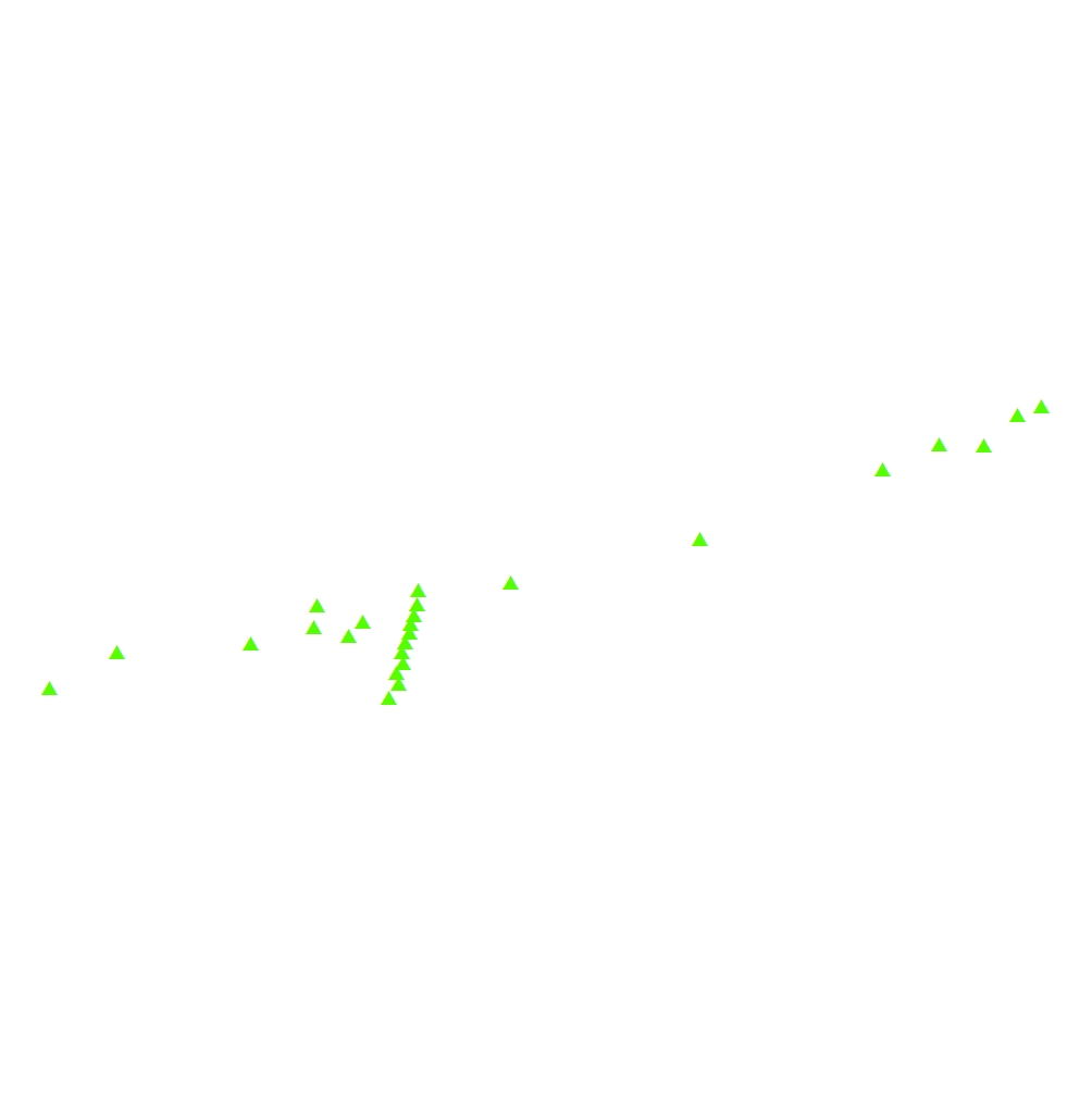
| 2014-009-FA_samples: Location and analysis of sediment samples collected in 2014 by the U.S. Geological Survey offshore of Fire Island, NY (Esri point shapefile, CGS WGS 84). |
 |
HTML FAQ TEXT XML |
2014-009-FA_samples.zip | Bottom Photographs and Video |
| 2014-009-FA_photos: Location of bottom photographs along with images collected in 2014 by the U.S. Geological Survey offshore of Fire Island, NY (JPEG images and Esri point shapefile, CGS WGS 84). |
 |
HTML FAQ TEXT XML |
2014-009-FA_photos.zip |
| 2014-009-FA_videos: Location of sea floor video tracklines along with videos collected in 2014 by the U.S. Geological Survey offshore of Fire Island, NY (MP4 video files and Esri polyline shapefile, CGS WGS 84, MP4 files). |
 |
HTML FAQ TEXT XML |
2014-009-FA_videos.zip | Navigation |
| 2014-009-FA_hypack: Text files of the navigation logged by HYPACK in 2014 during the U.S. Geological Survey offshore of Fire Island, NY (Hypack ASCII Text Files, CGS WGS 84). |
preview not available | HTML FAQ TEXT XML |
2014-009-FA_hypack.zip | Logs |
| 2014-009-FA_logbook: Acquisition log maintained in 2014 during the U.S. Geological Survey Field Activity 2014-009-FA conducted offshore of Fire Island, NY (Excel spreadsheet format). |
preview not available | HTML FAQ TEXT XML |
2014-009-FA_logbook.zip |