Post-stack migrated SEG-Y multi-channel seismic data collected by the U.S. Geological Survey in U.S. Atlantic Seaboard in 2014

Metadata also available as - [Parseable text] - [XML]

Metadata:

Identification_Information:
Citation:
Citation_Information:
Originator: U.S. Geological Survey
Publication_Date: 2017
Title:
Post-stack migrated SEG-Y multi-channel seismic data collected by the U.S. Geological Survey in U.S. Atlantic Seaboard in 2014
Edition: 1.0
Geospatial_Data_Presentation_Form: SEG-Y digital data
Series_Information:
Series_Name: data release
Issue_Identification: DOI:10.5066/F7V69HHS
Publication_Information:
Publication_Place: Woods Hole Coastal and Marine Science Center, Woods Hole, MA
Publisher: U.S. Geological Survey, Coastal and Marine Geology Program
Online_Linkage: https://doi.org/10.5066/F7V69HHS
Online_Linkage: Larger_Work_Citation:
Citation_Information:
Originator: Arsenault, M.A.
Originator: Miller, N.C.
Originator: Hutchinson, D.G.
Originator: Baldwin, W.E.
Originator: Moore, E.M.
Originator: Foster, D.F.
Originator: O'Brien, T.F.
Originator: Fortin, W.F.
Publication_Date: 2017
Title:
Geophysical data collected along the Atlantic continental slope and rise 2014, U.S. Geological Survey Field Activity 2014-011-FA, cruise MGL1407
Edition: 1.0
Series_Information:
Series_Name: data release
Issue_Identification: DOI:10.5066/F7V69HHS
Publication_Information:
Publication_Place: Reston, VA
Publisher: U.S. Geological Survey
Other_Citation_Details:
Suggested Citation:
Arsenault, M.A., Miller, N.C., Hutchinson, D.G., Baldwin, W.E., Moore, E.M., Foster, D.F., O’Brien, T.F., and Fortin, W.F., 2017, Geophysical data collected along the Atlantic continental slope and rise 2014, U.S. Geological Survey Field Activity 2014-011-FA, cruise MGL1407: U.S. Geological Survey data release, https://doi.org/10.5066/F7V69HHS.
Online_Linkage: https://doi.org/10.5066/F7V69HHS
Online_Linkage:
Description:
Abstract:
In summer 2014, the U.S. Geological Survey conducted a 21-day geophysical program in deep water along the Atlantic continental margin by using R/V Marcus G. Langseth (Field Activity Number 2014-011-FA). The purpose of the seismic program was to collect multichannel seismic reflection and refraction data to determine sediment thickness. These data enable the United States to delineate its Extended Continental Shelf (ECS) along the Atlantic margin. The same data can also be used to understand large submarine landslides and therefore assess their potential tsunami hazard for infrastructure and communities living along the eastern seaboard. Supporting geophysical data were collected as marine magnetic data, gravity data, 3.5-kilohertz shallow seismic reflections, multibeam echo sounder bathymetry, and multibeam backscatter. 
The survey was conducted from water depths of approximately 1,500 meters to abyssal seafloor depths greater than 5,000 meters. Approximately 2,761 kilometers of multi-channel seismic data was collected along with 30 sonobuoy profiles.
This field program had two primary objectives: (1) to collect some of the data necessary to establish the outer limits of the U.S. Continental Shelf, or Extended Continental Shelf, as defined by Article 76 of the United Nations Convention of the Law of the Sea and (2) to study the sudden mass transport of sediments down the continental margin as submarine landslides that pose potential tsunamigenic hazards to the Atlantic and Caribbean coastal communities.
Purpose:
These SEG-Y files represent 2761 kilometers of multi-channel seismic data collected by the U.S. Geological Survey during USGS survey 2014-04-FA. These data were collected off the U.S. Seaboard Atlantic as part of the U.S. Extended Continental Shelf project and investigations of tsunami hazards. The ECS objectives of the survey are primarily beyond 200 nm in water depths greater than 4000 m. The 2014 ECS tracks were laid out primarily parallel to the margin to map along-strike variations in sediment thickness and to test the hypothesis that oceanic fracture zones might be loci of thicker sediments
The submarine landslide objectives were along two transects that extend from the headwall of the slide near or on the slope to the distal extent of the run-out on the abyssal plain. The data were intended to image the points of failure, glide planes, relative ages of multiple smaller landslides, and relative volumnes of material displaced and redeposited. Imaging an entire submarine landslide system provides a comprehensive dataset for modeling landslide occurrence and therefore understanding the associated natural hazard.
Supplemental_Information:
For more information on the field activity, see the field activity page https://cmgds.marine.usgs.gov/fan_info.php?fan=2014-011-FA
Time_Period_of_Content:
Time_Period_Information:
Range_of_Dates/Times:
Beginning_Date: 20140823
Ending_Date: 20140911
Currentness_Reference: ground condition
Status:
Progress: Complete
Maintenance_and_Update_Frequency: None planned
Spatial_Domain:
Bounding_Coordinates:
West_Bounding_Coordinate: -76.339338
East_Bounding_Coordinate: -65.769170
North_Bounding_Coordinate: 40.064540
South_Bounding_Coordinate: 30.677010
Keywords:
Theme:
Theme_Keyword_Thesaurus: None
Theme_Keyword: U.S. Geological Survey
Theme_Keyword: USGS
Theme_Keyword: Coastal and Marine Geology Program
Theme_Keyword: CMGP
Theme_Keyword: Woods Hole Coastal and Marine Science Center
Theme_Keyword: WHCMSC
Theme_Keyword: Marine Geology
Theme_Keyword: field activity number 2014-011-FA
Theme_Keyword: seismic
Theme_Keyword: SEG-Y
Theme_Keyword: Multi-channel seismic
Theme_Keyword: LaCoste-Romberg land gravimeter
Theme_Keyword: point shapefile
Theme_Keyword: navigation
Theme_Keyword: R/V Marcus G. Langseth
Theme:
Theme_Keyword_Thesaurus: ISO 19115 Topic Category
Theme_Keyword: oceans
Theme_Keyword: geoscientificInformation
Theme:
Theme_Keyword_Thesaurus: USGS Thesaurus
Theme_Keyword: seismic reflection methods
Theme_Keyword: sub-bottom profiling
Theme_Keyword: marine geophysics
Place:
Place_Keyword_Thesaurus: None
Place_Keyword: North America
Place_Keyword: United States
Place_Keyword: Atlantic Ocean
Place_Keyword: Hudson Canyon
Place_Keyword: Caryn Seamount
Access_Constraints: none
Use_Constraints:
Public domain data from the U.S. Government are freely redistributable with proper metadata and source attribution. Please recognize the U.S. Geological Survey as the originator of the dataset.
Point_of_Contact:
Contact_Information:
Contact_Person_Primary:
Contact_Person: Nathan C. Miller
Contact_Organization: U.S. Geological Survey
Contact_Position: Geologist
Contact_Address:
Address_Type: mailing and physical address
Address: 384 Woods Hole Road
City: Woods Hole
State_or_Province: Massachusetts
Postal_Code: 02543
Country: USA
Contact_Voice_Telephone: 508-548-8700 x 2293
Contact_Facsimile_Telephone: 508-457-2310
Contact_Electronic_Mail_Address: ncmiller@usgs.gov
Browse_Graphic:
Browse_Graphic_File_Name: Browse_Graphic_File_Description:
Thumbnail image of multi-channel seismic data collected by the U.S. Geological Survey on the R/V Marcus G. Langseth in 2014.
Browse_Graphic_File_Type: JPEG
Native_Data_Set_Environment:
Microsoft Windows Vista Version 6.1 (Build 7601) Service Pack 1; ESRI ArcCatalog 9.3.1.1850
Cross_Reference:
Citation_Information:
Originator: Shearwater GeoServices Software, Inc.
Publication_Date: 2017
Title: OpenCPS Seismic Processing Software
Edition: 1.0
Geospatial_Data_Presentation_Form: document
Series_Information:
Series_Name: Journal of Coastal Research
Issue_Identification: Version 3.3.0
Publication_Information:
Publication_Place: Houston, TX
Publisher: Shearwater Geophysical
Online_Linkage: https://www.opengeophysical.com/
Cross_Reference:
Citation_Information:
Originator: Lamont-Doherty Earth Observatory
Publication_Date: 2014
Title: Rolling Deck to Repository (R2R)
Edition: 1.0
Geospatial_Data_Presentation_Form: document
Publication_Information:
Publication_Place: UNCLOS
Publisher: UNCLOS
Other_Citation_Details:
Standard data products listed on the Rolling Deck to Repository website include cruise level metadata with an expedition summary including cruise id, vessel, operator, project titles and funding awards, science party, ports, dates, survey targets, and trackline geometry. There is also quality-controlled shiptrack navigation, and scientific sampling event logs. Some post-processed geophysical trackline profiles (underway gravity, magnetics, bathymetry, etc), for vessels equipped with these instrument types; and hydrographic profiles (depth, temperature, salinity, etc from CTD).
Online_Linkage: http://www.rvdata.us/catalog/MGL1407
Cross_Reference:
Citation_Information:
Originator: Michael W. Norris, ed.
Originator: Alan K. Faichney, ed.
Publication_Date: 2002
Title: SEG Y rev 1 Data Exchange format
Edition: 1.0
Geospatial_Data_Presentation_Form: document
Publication_Information:
Publication_Place: Houston, TX
Publisher: Society of Exploration Geophysicist
Online_Linkage:
Data_Quality_Information:
Logical_Consistency_Report:
Seismic reflection data collection was the primary objective of the cruise, and data collection started on Julian Day 235 and was interupted only when absolutely necessary; Hurricane Cristobal on Julian Day JD238 and a medevac on Julian Day JD241. Although data quality was in general excellent, there are several known problems with the data, including noisy channels (up to 71 channels out of 636 in the 8-km configuration, and 65 channels out of 480 in the 6-km configuration), extreme feathering of the streamer on lines which crossed the Gulf Stream, occasional reduced source size for maintenance on the airgun strings, and one 12-minute power down for a protected species. Rough weather also produced wave noise on the streamer. Data collection ended on Julian Day 254.
The file naming convention is: SHPCCCCMCSXX.poststm-v1dcm.segy, where SHP = Ship name abbreviation; CCCC = Cruise number; MCS= Type of data; XX = Line number. The rest of the filename notes the processing (poststm = post-stack migration) and the v1dcm denotes the 1D velocity model that was applied. The SEG-Y format is noted in the file extension name.
An example would be MGL1407MCS01.poststm-v1dcm.segy; MGL = The R/V Marcus G. Langseth, 1407 = the Cruise ID, MCS = multi-channel seismic, 01 = Line 01.
Important events that contribute to the overall quality of the data were recorded in the ship logs and archived on the Rolling Deck to Repository Archive system. For a complete list of these events, the logs should be referenced on the R2R website (http://www.rvdata.us/catalog/MGL1407).
Completeness_Report:
16 multi-channel seismic lines were collected in total, and the lines are not sequentially numbered, and some lines are partitioned into A and B sections.
Positional_Accuracy:
Horizontal_Positional_Accuracy:
Horizontal_Positional_Accuracy_Report:
Navigation was acquired using the R/V Marcus G. Langseth's fully integrated multicomponent navigation system, consisting of echosounder, speedlog, Differential Global Positioning System (DGPS), gyrocompass, POS/MV Integrated Navigation System, Kongsberg Seapath 200 Inertial Navigation System and Lamont Data Systems (LDS) data logger. All survey positions use the World Geodetic System 1984 datum (WGS84), and both global and local geodetic calculations utilized the WGS84 reference ellipsoid with a semi-major axis of 6378137.0 m and an inverse flattening of 298.257224. Streamer geometry calculations were performed in Universal Transverse Mercator (UTM) northern hemisphere projection 19 North . Water bottom topography in stacked sections agrees well with multi beam bathymetry data gridded to 50 m, implying that these CMP locations are accurate to <50m.
Lineage:
Source_Information:
Source_Citation:
Citation_Information:
Originator: U.S. Geological Survey
Publication_Date: Unpublished Material
Title: Raw seismic data
Type_of_Source_Media: online
Source_Time_Period_of_Content:
Time_Period_Information:
Range_of_Dates/Times:
Beginning_Date: 20140823
Ending_Date: 20140911
Source_Currentness_Reference: ground condition
Source_Citation_Abbreviation: original raw data
Source_Contribution:
Multi-channel seismic data were acquired with a 36-element, 6600 cubic inch airgun source array, and 8-km-long solid state digital hydrophone streamer towed behind the R/V Marcus G. Langseth. The source air guns were configured in four parallel, 9-gun strings and towed at the rear of the ship at a depth of 9 meters. The Sentry Solid Streamer Sercel hydrophone cable consists of 12 hydrophones, which are summed in analog, and the spacing between the center of these groups is 12.5 m. Streamer depth was set to 9 m for all lines. Approximately 2,761 km of data were collected. Data were recorded at a 4-millisecond (ms) sample rate and in Society of Exploration Geophysicists D (SEG-D) format.
Source and receiver positions were determined by LDEO staff using Concept Systems's Spectra multichannel seismic navigation software. Source positions were logged using differential GPS antennas on three of the four source sub arrays. Receiver positions were calculated using data from Digicourse Digirange acoustic pods on the source array and on the head, middle, and tail of the streamer; depth and heading data from Digicourse depth control birds located every 300 m along the streamer; and a differential GPS on the streamer tail buoy. All survey positions use the World Geodetic System 1984 datum (WGS84), and both global and local geodetic calculations utilized the WGS84 reference ellipsoid with a semi-major axis of 6378137.0 m and an inverse flattening of 298.257224.
Process_Step:
Process_Description:
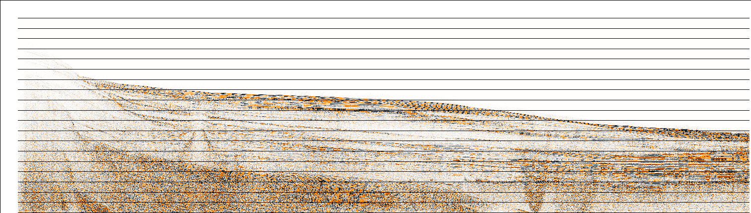
Post-stack migration processing of all MCS reflection data was done at the USGS WHMSC, and was primarily performed using OpenCPS software (version 3.3.0). Data were imported into OpenCPS from SEG-Y files, and processed through a standard sequence of trace editing, common-midpoint (CMP) sorting, bandpass filtering, deconvolution, velocity analysis, normal moveout correction, stretch muting, stacking, and post-stack time migration. Streamer geometry (true group and source locations) were applied from the P190 navigation files provided by the Langseth staff. Trace headers in these SEG-Y data include CMP number (bytes 20-22), Number of samples in a trace (bytes 115-116), Sample interval (bytes 116-117), Source Coordinates (bytes 72-74, bytes 76-78), Group Coordinates (bytes 80-82, bytes 84-86), and Trace Positions (bytes 180-182, bytes 184-186). A scalar for the geoposition is set in bytes 71-71. All coordinates are written in UTM19N, EPSG code 32619. A full text header is written to include all of the processing information:
Description: Post-stack phase shift time migration to 200 Hz using auto-picked velocities guided by a 1D velocity function hung between picked water-bottom,basement, and Moho.
Prestack gains: Spherical divergence Poststack gains: None Band: 6-200 Hz
Cruise:MGL1407 Line:MGL1407MCS01 Coordinate projection:WGS84/UTM 19N ESPG:32619 WKT:"+proj=utm +zone=19 +datum=WGS84 +units=m +no_defs" Files were written to SEG-Y format from within OpenCPS. Nathan C. Miller performed this and all subsequent process steps.
Process_Date: 2017
Process_Contact:
Contact_Information:
Contact_Person_Primary:
Contact_Person: Nathan C. Miller
Contact_Organization: U.S. Geological Survey
Contact_Position: Geologist
Contact_Address:
Address_Type: mailing and physical address
Address: 384 Woods Hole Road
City: Woods Hole
State_or_Province: MA
Postal_Code: 02543-1598
Country: USA
Contact_Voice_Telephone: 508-548-8700 x2293
Contact_Facsimile_Telephone: 508-457-2310
Contact_Electronic_Mail_Address: ncmiller@usgs.gov
Process_Step:
Process_Description:
Files were written to SEG-Y format from using OpenCPS (version 3.3.0).
Process_Date: 2017
Process_Contact:
Contact_Information:
Contact_Person_Primary:
Contact_Person: Nathan C. Miller
Contact_Organization: U.S. Geological Survey
Contact_Position: Geologist
Contact_Address:
Address_Type: mailing and physical address
Address: 384 Woods Hole Road
City: Woods Hole
State_or_Province: MA
Postal_Code: 02543-1598
Country: USA
Contact_Voice_Telephone: 508-548-8700 x2293
Contact_Facsimile_Telephone: 508-457-2310
Contact_Electronic_Mail_Address: ncmiller@usgs.gov
Spatial_Reference_Information:
Horizontal_Coordinate_System_Definition:
Planar:
Grid_Coordinate_System:
Grid_Coordinate_System_Name: Universal Transverse Mercator
Universal_Transverse_Mercator:
UTM_Zone_Number: 19N
Transverse_Mercator:
Scale_Factor_at_Central_Meridian: 0.999600
Longitude_of_Central_Meridian: -69.000000
Latitude_of_Projection_Origin: 0
False_Easting: 500000
False_Northing: 0
Planar_Coordinate_Information:
Planar_Coordinate_Encoding_Method: coordinate pair
Coordinate_Representation:
Abscissa_Resolution: 1
Ordinate_Resolution: 1
Planar_Distance_Units: meters
Geodetic_Model:
Horizontal_Datum_Name: D_WGS_1984
Ellipsoid_Name: WGS_1984
Semi-major_Axis: 6378137.0
Denominator_of_Flattening_Ratio: 298.257224
Distribution_Information:
Distributor:
Contact_Information:
Contact_Person_Primary:
Contact_Person: Nathan C. Miller
Contact_Organization: U.S. Geological Survey
Contact_Position: Geologist
Contact_Address:
Address_Type: mailing and physical address
Address: 384 Woods Hole Road
City: Woods Hole
State_or_Province: Massachusetts
Postal_Code: 02543-1598
Country: USA
Contact_Voice_Telephone: 508-548-8700 x 2293
Contact_Facsimile_Telephone: 508-457-2311
Contact_Electronic_Mail_Address: ncmiller@usgs.gov
Resource_Description:
A series of SEG-Y files representing seismic-reflection profiles collected during USGS field activity 2014-011-FA, the browse graphic, and FGDC CSDGM metadata in xml, txt and html formats.
Distribution_Liability:
Neither the U.S. Government, the Department of the Interior, nor the USGS, nor any of their employees, contractors, or subcontractors, make any warranty, express or implied, nor assume any legal liability or responsibility for the accuracy, completeness, or usefulness of any information, apparatus, product, or process disclosed, nor represent that its use would not infringe on privately owned rights. The act of distribution shall not constitute any such warranty, and no responsibility is assumed by the USGS in the use of these data or related materials. Any use of trade, product, or firm names is for descriptive purposes only and does not imply endorsement by the U.S. Government.
Standard_Order_Process:
Digital_Form:
Digital_Transfer_Information:
Format_Name: SEG-Y
Format_Version_Number: 1.0
Format_Specification: Society for Exploration Geophysics Y format
Transfer_Size: 850
Digital_Transfer_Option:
Online_Option:
Computer_Contact_Information: Access_Instructions:
Network Resource links are provided as easy shortcuts to informational resources. The first link is for a folder containing all of the data. The second link is a link to the data catalog page of the publication. The third link also goes to the data catalog page of the publication, but does so via the DOI publication number.
Fees: none
Technical_Prerequisites: These data can be viewed with any SEG-Y viewing software.
Metadata_Reference_Information:
Metadata_Date: 20170810
Metadata_Contact:
Contact_Information:
Contact_Person_Primary:
Contact_Person: Matthew A. Arsenault
Contact_Organization: U.S. Geological Survey
Contact_Position: Geologist
Contact_Address:
Address_Type: mailing and physical address
Address: 384 Woods Hole Road
City: Woods Hole
State_or_Province: MA
Postal_Code: 02534-1598
Country: USA
Contact_Voice_Telephone: 508-548-8700 x2354
Contact_Facsimile_Telephone: 508-457-2310
Contact_Electronic_Mail_Address: marsenault@usgs.gov
Metadata_Standard_Name: FGDC Content Standards for Digital Geospatial Metadata
Metadata_Standard_Version: FGDC-STD-001-1998
Metadata_Time_Convention: local time

Generated by mp version 2.9.36 on Thu Aug 10 13:44:51 2017