Scripts within SIOSEIS (version 2013.1.1) and Seismic Unix (version 4.2) were used to process SEG-Y data, create navigation files, and plot images. The processing flow and scripts used to produce swell-filtered PNG images are summarized below:
1. SIOSEIS (version 2013.1.1) was used to read SEG-Y files, renumber shots starting from one, extract the envelope-detected trace, and write out new SEG-Y files. The original shot numbers, which were assigned by SonarWiz sequentially over the duration of an acquisition session despite SEG-Y file changes, are preserved in the raw SEG-Y data.
2. The SIOSEIS script Sio_medianstk was used to minimize S-boom cross talk (when multi-channel streamer lines were recorded simultaneously: Julian day 161-168) with a two-trace median stack (trim 50 percent of the values furthest from the median amplitude) and improve water bottom picking. This script was used for all lines even after multi-channel streamer was turned off, due to the improvements made to water bottom picks.
3. The script Read512i_mstk was used to read median filtered stacked and renumbered SEG-Y files, write a Seismic Unix file, and extract SEG-Y trace header information, including shot number, longitude, latitude, year, Julian day, and time of day (UTC). Header information from each SEG-Y file was saved to text files after an AWK (no version) filter was used to maintain the first and last shots, shots at multiples of 100, 500, and shots with unique navigation coordinates. Geographic coordinates (WGS 84) were converted to UTM zone 18 N coordinates (WGS 84) using Proj (version 4.6.0). End shots and shots at multiples of 100 may not have unique navigation coordinates. Separate text files containing the first and last shots and even 500 shot intervals were also saved. A 500 shot interval was chosen because it corresponds to the annotation interval provided along the top of the seismic-reflection profile images. Read512i_mstk called a Python script 512itoSQL15001.py, written by Wayne Baldwin, which imported the CSV files to the Spatialite (version 3.0.1) enabled SQLite (version 3.7.9) database.
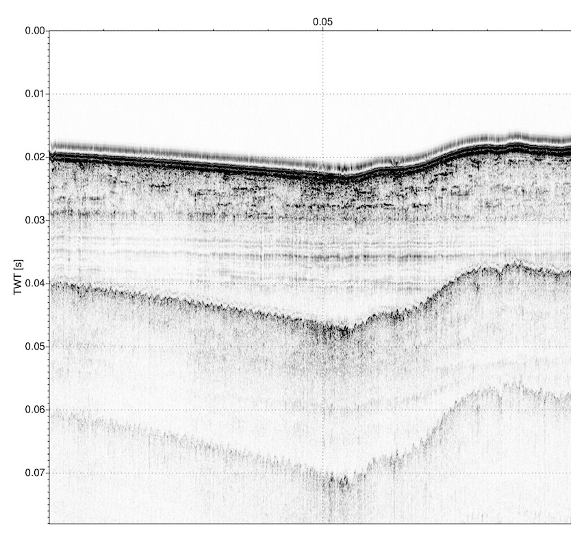
4. The SIOSEIS script siothresh_pltwbt was used to pick the water-bottom time from the median stacked SEG-Y files, apply a swell filter to smooth water-bottom time picks and shift the trace data by the difference between the smoothed and unsmoothed water bottom time before writing the shifted trace data to a new SEG-Y file.
5. The Seismic Unix script Plot512i_s creates a swell-filtered PNG image using ImageMagick (version 6.6.1) of each seismic line that is 12 inches high. Images show two-way travel time (seconds) along the y-axis (left margin) and distance along profile (in 10,000 shot intervals) on the x-axis (along top of profile).