Topographic and bathymetric data, structure from motion imagery, and ground control data collected at Head of the Meadow, Truro in February 2021, U.S Geological Survey Field Activity 2021-014-FA
| Field activity number | 2021-014-FA |
|---|---|
| Version | 1.0 |
| Area of operation | Head of the Meadow Beach, Cape Cod National Seashore |
| Dates | February 4 and 11, 2021 |
| Chief scientist | Christopher R. Sherwood |
| Contact | Jin-Si Over |
| Publication Date | January 31, 2022 |
Suggested citation: Over, J.R., Sherwood, C.R., and Traykovski, P.A., 2022, Topographic and bathymetric data, structure from motion imagery, and ground control data collected at Head of the Meadow, Truro in February 2021, U.S Geological Survey Field Activity 2021-014-FA: U.S Geological Survey data release, https://doi.org/10.5066/P9D94NZ3.
Abstract: These data map the beach and nearshore environment at Head of the Meadow Beach in Truro, MA, providing updated regional context for the 2019 CoastCam installation. CoastCam CACO-01 are two video cameras aimed at the beach that view the coast shared by beachgoers, shorebirds, seals, and sharks. These data were collected as part of field activity 2021-014-FA and a collaboration with the National Park Service at Cape Cod National Seashore to monitor the region. In February 2021, U.S. Geological Survey and Woods Hole Oceanographic Institute (WHOI) scientists conducted field surveys to re-map the field of view of the CoastCam. Aerial images of the beach for use in structure from motion were taken with a camera (Ricoh GRII) and a post-processed kinematic (PPK) system attached to a helium powered balloon-kite (Helikite). High-precision GPS targets (AeroPoints) were used as ground control points. Bathymetry was collected in the nearshore using a single-beam echosounder mounted on a surf capable self-righting electric autonomous Small Surf Vehicle (SSV). Agisoft Metashape (v. 1.7.2) was used to create a digital elevation model with the collected imagery and this was merged with the bathymetry in MATLAB (v. 2020) to create a continuous topobathy product.
Filename and description |
Preview |
Metadata |
Download |
|---|---|---|---|
Topobathy |
|||
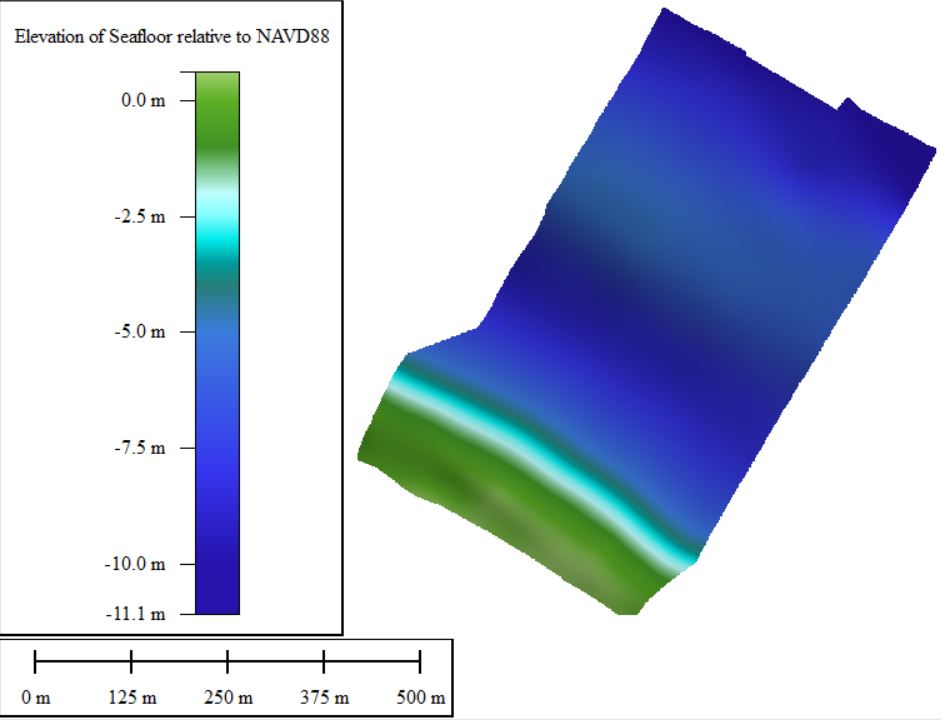
| 2021014FA_Truro_bathymetry Single-beam bathymetry taken with echosounder mounted on autonomous surface vehicle (1-meter resolution cloud optimized 32-bit float GeoTIFF, not cloud optimized, in UTM Zone 19N. Raw echosounder returns and trackline data in CSV format). |
 |
TXT XML |
2021014FA_Truro_Bathymetry.zip 2.2 MB |
| 2021014FA_Truro_DSM Digital surface model with 25-centimenter resolution made from the beach imagery using Agisoft Metashape (GeoTIFF, not cloud optimized, UTM Zone 19N 32-bit float). |
 |
TXT XML |
2021014FA_Truro_DSM_25cm.tif 9.11 MB |
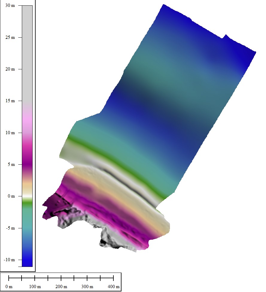
| 2021014FA_Truro_topobathy Merged 1-meter gridded bathymetry and digital elevation model. (GeoTIFF, not cloud optimized, UTM Zone 19N 32-bit float). |
 |
TXT XML |
2021014FA_Truro_topobathy_1m.tif 5.82 MB |
Imagery |
|||
| 2021014FA_Truro_f1 Images collected with camera (Ricoh GRII) attached to a helium inflated balloon-kite (Allsopp Helikite LTD) (JPEG image format, EXIF headers have been added to include navigation and time tags). |
 |
TXT XML |
2021014FA_Truro_f1.zip 1.15 GB |
| 2021014FA_Truro_f1_photolocations Post-processed navigation file, including image times and corresponding camera positions. (CSV format) |
 |
2021014FA_Truro_f1_photolocations.csv <1 MB |
|
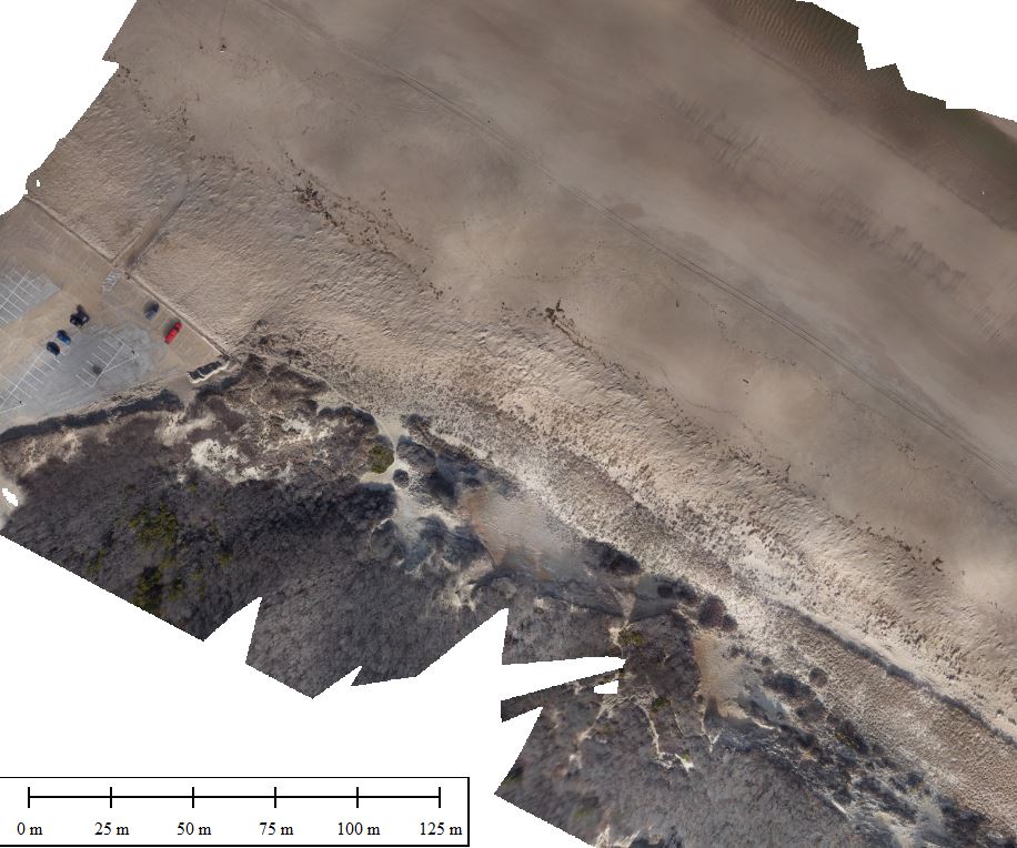
| 2021014FA_Truro_orthomosaic Orthomosaic with 10 cm resolution made from beach imagery using Agisoft Metashape (GeoTIFF, not cloud optimized, UTM Zone 19N, true-color RGB) |
 |
TXT XML |
2021014FA_Truro_ortho_10cm.tif |
Navigation |
|||
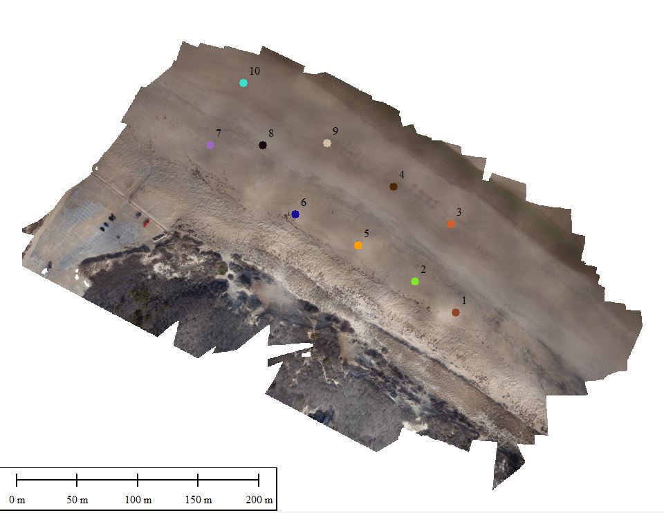
| 2021014FA_Truro_ nav_AeroPoints Post-processed kinematic (PPK) location data from deployed ground control targets (AeroPoints) (CSV format). |
 |
TXT XML |
2021014FA_Truro_nav_AeroPoints.csv |