Data Release for USGS Field Activity 2014-607-FA

Cochrane, G.R., Dartnell, P., Hemery, L.G., and Hatcher, G., 2017, Data release for USGS field activity 2014-607-FA, Oregon OCS seafloor mapping: selected lease blocks relevant to renewable energy (ver. 2.0, July 2017), U.S. Geological Survey data release, https://doi.org/10.5066/F7V40S8V.
First posted June 23, 2015
Revised July 25, 2017, ver. 2.0

Figure 1. R/V Parke Snavely on site. [Larger version]
Operations were conducted using the USGS R/V Parke Snavely (Figure 1) equipped with a Reson 7111 multibeam sonar mounted on starboard side pole and a towed high definition video sled. Sonar data were acquired using Reson PDS 2000 software. Horizontal positions for navigation and data collection were determined by using a POS M/V V5 operating in Differential GPS (DGPS) mode. The horizontal datum was Universal Transverse Mercator (UTM) Zone 10 North and the vertical datum was MLLW.
The survey was conducted using 12 hour day operations out of Charleston Harbor near Coos Bay, Oregon. The cruise plan consisted of 23 days on site split between sonar mapping and video ground truth surveying. Activities parsed out to nine days of sonar mapping, three days of video surveying, eight days of no operations due to weather, and three days mobilizing and demobilizing (Table 1). Typically the Snavely would transit out to the survey area in an hour at a speed of 20 knots. Multibeam sonar operations were conducted on north or south oriented tracklines at a speed of 4 to 5 knots depending on sea state. The optimal heading for sonar operations is isobath parallel. Video operations were conducted by deploying up drift of a target and drifting over it at speeds of 1 knot or less.
| Day | Month | Date | BOEM Participant | USGS Scientist | Operations |
|---|---|---|---|---|---|
| Tu | August | 19 | Sonar mobilization | ||
| We | August | 20 | Guy Cochrane | Sonar patch testing | |
| Th | August | 21 | Dave Pereksta | Guy Cochrane | Sonar mapping |
| Fr | August | 22 | Dave Pereksta | Guy Cochrane | Sonar mapping |
| Sa | August | 23 | Guy Cochrane | No operations due to weather | |
| Su | August | 24 | Guy Cochrane | No operations due to weather | |
| Mo | August | 25 | Guy Cochrane | No operations due to weather | |
| Tu | August | 26 | Guy Cochrane | No operations due to weather | |
| We | August | 27 | Dave Ball | Guy Cochrane | Sonar mapping |
| Th | August | 28 | Dave Ball | Guy Cochrane | Sonar mapping |
| Fr | August | 29 | Dave Ball | Guy Cochrane | Sonar mapping |
| Sa | August | 30 | Frank Pendleton | Guy Cochrane | Sonar mapping |
| Su | August | 31 | Frank Pendleton | Guy Cochrane | Sonar mapping |
| Mo | September | 1 | Kevin Smith | Peter Dartnell | Sonar mapping |
| Tu | September | 2 | Peter Dartnell | Video mobilization | |
| We | September | 3 | Peter Dartnell | No operations due to weather | |
| Th | September | 4 | Peter Dartnell | No operations due to weather | |
| Fr | September | 5 | Peter Dartnell | No operations due to weather | |
| Sa | September | 6 | Lisa Gilbane | Peter Dartnell | Video surveying |
| Su | September | 7 | Lisa Gilbane | Peter Dartnell | Video surveying |
| Mo | September | 8 | Peter Dartnell | No operations due to weather | |
| Tu | September | 9 | Peter Dartnell | Video surveying | |
| We | September | 10 | Peter Dartnell | Demobilization |
Sonar data were processed using Caris HIPS/SIPS software for the bathymetry and Fledermaus Geocoder for the backscatter intensity.
Approximately 95 square kilometers of area were mapped with multibeam sonar. The survey expanded the extent of mapping data collected by Solmar Hydro Inc. in 2013 under a contract with WindFloat Pacific. When added to the Solmar Hydro data the total area mapped is approximately 140 square kilometers (Figure 2).

Figure 2. Shaded relief image of all the available multibeam sonar bathymetry data. Small numbers are OCS lease blocks. Large numbers are depths in meters for bathymetry contours. Inset map shows location of survey as dark polygon off the State of Oregon. [Larger version]

Figure 3. Image of the multibeam sonar bathymetry data from the USGS survey. Numbers are depths in meters for bathymetry contours. [Larger version]

Figure 4. Image of the multibeam sonar backscatter intensity data from the USGS survey. Numbers are depths in meters for bathymetry contours. Rectangular patches of darker or lighter shade are artifacts of sonar equipment malfunction and data processing. [Larger version]
Mammal observations were made during multibeam operations (Table 2). The USGS voluntarily staffs its seismic and sonar ships with a trained mammal observer for seismic and sonar operations in Federal waters. The observer monitored the survey area for 30 minutes prior to the start up of the sonar system to ensure that no marine mammals were in the area. The observer called for system shut-downs when marine mammals entered the 160dB isopleth (safety zone). Whenever a marine mammal entered the safety zone the sound source was shut down until it was confirmed that the marine mammal had either left the safety zone, 15 minutes had passed after its last sighting, or the vessel transited to another trackline. The Reson 7111 multibeam sonar operates at a frequency of 213.5 kHz and has a peak source level of 213 db. The radius of the safety zone for the Reson 711 is 200 m.

Figure 5. Whale observed during video transect portion of the research cruise. [Larger version]
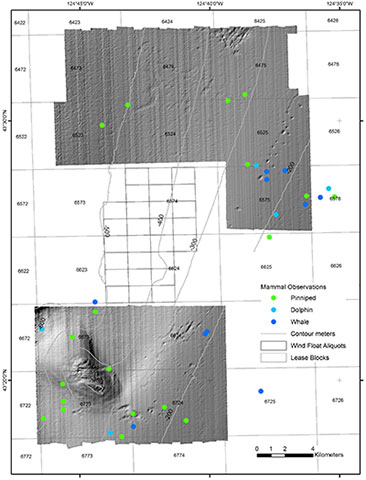
Figure 6. Location of marine mammal observations during USGS multibeam sonar operations. [Larger version]
| Date | Time | Longitude | Latitude | Log Entry |
|---|---|---|---|---|
| 8/20/14 | 18:13:43 | -124.31808 | 43.350487 | harbor seal on surface |
| 8/20/14 | 18:17:10 | -124.32232 | 43.35485 | harbor seal |
| 8/21/14 | 14:05:04 | -124.37917 | 43.369942 | dolphins, heading north |
| 8/21/14 | 14:39:26 | -124.60442 | 43.451747 | Sea lion, 10m off port, heading south |
| 8/22/14 | 13:50:17 | -124.41097 | 43.382251 | sea lion at 330 degrees - stationary |
| 8/22/14 | 14:19:08 | -124.58645 | 43.451191 | Sea lion 100 m |
| 8/22/14 | 14:27:25 | -124.64228 | 43.472003 | Sea lion |
| 8/22/14 | 16:26:28 | -124.71935 | 43.510209 | northernfur seal. 300m, 130 degrees |
| 8/22/14 | 18:47:25 | -124.7357 | 43.49717 | sea lion, 200m, basking, 20 degrees |
| 8/27/14 | 14:28:14 | -124.56894 | 43.394431 | sea lion |
| 8/27/14 | 17:45:42 | -124.66834 | 43.364503 | whale dove below headed south 200 m |
| 8/27/14 | 17:50:06 | -124.66949 | 43.363019 | Whale - Humpback - Diving 20 meters shutdown |
| 8/27/14 | 20:04:00 | -124.68174 | 43.307434 | sea lion |
| 8/27/14 | 22:33:31 | -124.69575 | 43.316124 | sea lion 200m |
| 8/27/14 | 23:15:19 | -124.61425 | 43.34958 | whale |
| 8/28/14 | 14:30:40 | -124.56534 | 43.352571 | SEA LION SWIMMING EAST 200M 40DEG |
| 8/28/14 | 19:44:55 | -124.71582 | 43.31192 | N. FUR SEAL, 300M 110DEG |
| 8/28/14 | 19:50:20 | -124.71561 | 43.303514 | POD OF PILOT WHALES? >1KM 70DEG, SWIMMING SOUTH |
| 8/28/14 | 20:08:06 | -124.72305 | 43.297155 | 4 N. FUR SEALS 270DEG 200M |
| 8/29/14 | 14:17:13 | -124.63372 | 43.326282 | whale 300m 40deg |
| 8/29/14 | 17:10:56 | -124.73133 | 43.340598 | 1 sea lion 60m 300deg |
| 8/29/14 | 17:41:02 | -124.73048 | 43.29956 | pod of dolphins 350deg 1km |
| 8/29/14 | 18:54:52 | -124.74016 | 43.377214 | 1 sea lion sleeping 500m 20deg |
| 8/29/14 | 19:00:06 | -124.74029 | 43.383568 | 1 humpback 2km 70deg breaching |
| 8/29/14 | 21:32:40 | -124.75484 | 43.361145 | 2 Fur seals sleeping 500m 340deg |
| 8/29/14 | 22:35:46 | -124.76106 | 43.33091 | 1 fur seal 500 m 340deg |
| 8/29/14 | 22:44:03 | -124.76076 | 43.319687 | 1 fur seal basking 500m 90deg |
| 8/29/14 | 22:48:24 | -124.76069 | 43.314169 | 1 fur seal basking 300m 270deg |
| 8/30/14 | 17:13:08 | -124.77351 | 43.308634 | 1 seal or sea lion dove 300 m 270deg |
| 8/30/14 | 17:58:27 | -124.77469 | 43.36634 | numerous white sided porpoise and sea lions approaching bow riding 40deg |
| 8/30/14 | 22:10:01 | -124.64403 | 43.516969 | 1 fur seal basking 50m 290deg |
| 8/30/14 | 23:25:01 | -124.59553 | 43.450814 | 2 humpback swimmingnw 1km 40deg |
| 8/31/14 | 15:56:44 | -124.63674 | 43.471274 | numerous white sided dolphin approaching, bow riding 290deg and 1 sea lion |
| 8/31/14 | 17:09:30 | -124.63009 | 43.467337 | 1 whale dove 200m 40deg |
| 8/31/14 | 17:12:59 | -124.63005 | 43.462348 | 2 blue whale swimming 2km 270deg |
| 8/31/14 | 17:43:27 | -124.62835 | 43.425318 | Fur Seal basking 200m 160deg |
| 8/31/14 | 18:07:12 | -124.62414 | 43.439729 | numerous dolphin swimming away 40deg 300m |
| 8/31/14 | 19:49:05 | -124.61835 | 43.468075 | 2 blue whales? 300m 0deg shutdown move east |
| 8/31/14 | 21:33:03 | -124.60516 | 43.446283 | 1 humpback dove 300m 30deg |
| 8/31/14 | 22:57:24 | -124.59028 | 43.456526 | numerous white sided 500m 20 deg |
| 8/31/14 | 23:01:38 | -124.55857 | 43.443094 | 2 humpback 1 km 40deg |
| 8/31/14 | 23:15:22 | -124.45578 | 43.401591 | 3 sea lions swimming 200 m 0deg |
| 9/1/14 | 16:01:06 | -124.65498 | 43.513044 | sealion 1m starboard side, jump. |
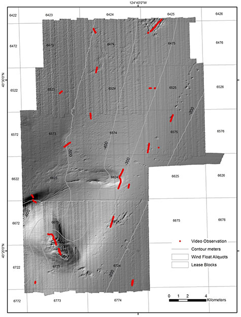
Figure 8. Locations of video transects to be used for geologic and biologic modeling. [Larger version]
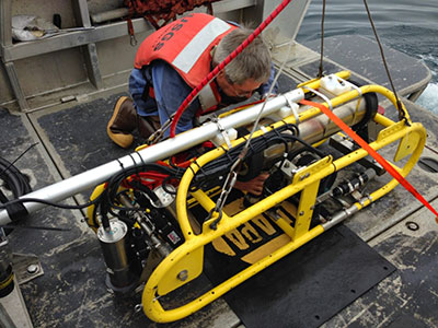
Figure 7. Towed high-definition video sled. [Larger version]
Web services were created using an ArcGIS service definition file. The ArcGIS REST service and OGC WMS service include all the data layers listed in "GIS Data Files" table. Individual web services for each GIS file are available from the main service pages provided in the links below.
ArcMap Users: Instructions to use these services in ArcMap version 10.0 or above.
OregonOCSArcMap.zip (0.5 MB) is a compressed version of the ArcMap document (.mxd) that has all the data layers loaded in the table of contents and has all the data symbolized as on the view images provided below. Download and save this ArcGIS project file to the directory you created for this GIS. Download the individual layers you want from the list below and unzip them into a subdirectory named "data".
Each GIS data file is listed below with a brief description, a small image, and links to the metadata files and the downloadable data files. The data were compiled in ArcMap (version 10.1). Raster data layers are registered TIFF images and are in the UTM Zone 10 coordinate system. Point, line, and polygon features are in shapefile format and are projected in WGS 84 coordinates. We recommend that you create a single new folder named "data" within which to unzip the files you want to use.
The downloadable data files can be unzipped with Winzip (or other tool) on Windows systems. The .zip file for a TIFF image includes the image (.tif), the world registration file (.tfw), and the text (.txt) and XML (.tif.xml) versions of the metadata. The .zip for a shapefile includes the .aux, .dbf, .shp, .shx, .sbx, and .sbn files, as well as the text (.txt) and XML (.shp.xml) versions of the metadata.
| Theme Description | View | File Format | Metadata | File Compressed | File Size |
|---|---|---|---|---|---|
| Bathymetry (12m/pixel), Oregon OCS Survey 2014-607-FA |  |
TIFF 32 bit float |
txt, xml, html, faq |
OregonOCSbathym.zip | 13 MB |
| Bathymetry Hillshade (2m/pixel), Oregon OCS Survey 2014-607-FA | 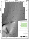 |
TIFF 8 bit integer |
txt, xml, html, faq |
OregonOCShillsh.zip | 4 MB |
| Contours, Oregon OCS Survey 2014-607-FA | 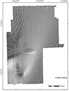 |
ESRI Shapefile (line) |
txt, xml, html, faq |
OregonOCScontou.zip | 5 MB |
| Backscatter (12m/pixel), Oregon OCS Survey 2014-607-FA | 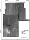 |
TIFF 8 bit integer |
txt, xml, html, faq |
OregonOCSbacksc.zip | 10 MB |
| Visual observations of geologic substrate, Oregon OCS Survey 2014-607-FA | 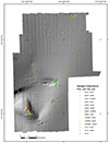 |
ESRI Shapefile (points) |
txt, xml, html, faq |
OregonOCSgeolog.zip | 2.6 MB |
| Visual observations of Marine Mammals, Oregon OCS Survey 2014-607-FA | 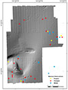 |
ESRI Shapefile (points) |
txt, xml, html, faq |
OregonOCSmammal.zip | 2.4 MB |
| Video, Oregon OCS Survey 2014-607-FA |  |
Digital Video Files (.zip) |
txt, xml, html, faq |
See Video Page for individual .zip downloads | Files range from 3.8 GB to 26 GB each |