
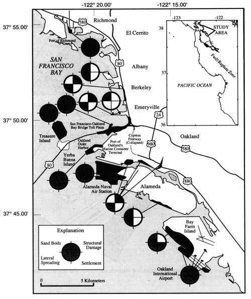
San Francisco east-bay shoreline, showing locations of sites where liquefaction-induced damage occurred from the 1989 Loma Prieta earthquake and locations of study sites where soil investigations were performed.
geotech/arias/fig1.html
contact: Robert Kayen
last modified 2018