USGS PCMSC

A Tale of Two Deltas: Potential Impacts of Cascadia-Margin Earthquakes on the
Fraser River (Vancouver) and Duwamish River Deltas (Seattle)

Index Back to home page About these web pages Conclusions Future Present Past Holocene deltas Abstract

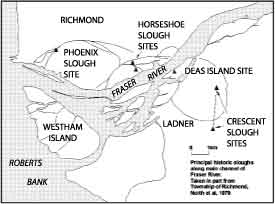
Site map of Fraser River Delta area.

The Holocene deltas of the Vancouver and Seattle-Tacoma areas underlie highly urbanized communities. On the right, the margin of the Fraser delta is home to extensive residential, commercial and port development. Historic sloughs, above, lace much of the modern delta. The Duwamish delta front is dominated by piers, industry, tourist attractions and a large marine container port.

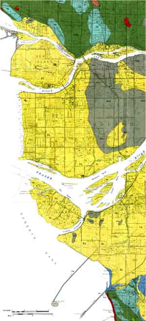
General Character of the Holocene DeltasGeologic map of the Fraser River Delta area.

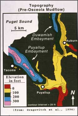
A common element of the deltas is that they fill late Pleistocene fjords (below) formed by the advance and retreat of the Strait of Georgia and Puget lobes of the cordilleran ice sheet. On the right, the former and deep Duwamish and Puyallup embayments were filled by deltas prograding northward away from Mt. Rainier, and towards the Sound.

Topography of Duwamish and Puyallup embayments.

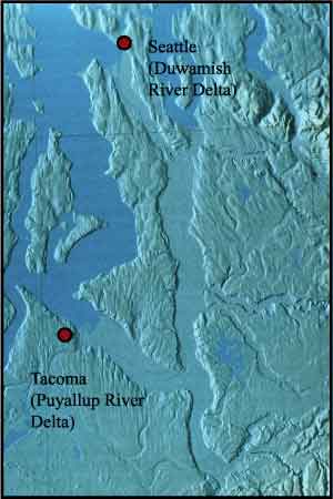
Map of Duwamish and Puyallup River Deltas.

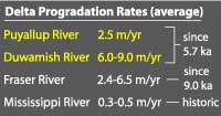
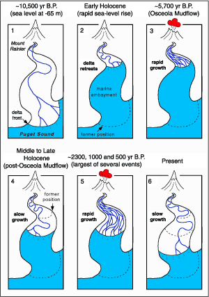
The diagram on the right depicts the convulsive and episodic advancement of the Puget Deltas during times of Holocene volcanic activity affecting the watershed. Averaged progradation rates are below.

Delta Progradation Rates.

6 models of delta progradation.

geotech/deltaposter/holocene.html
contact: Robert Kayen
last modified 2018