
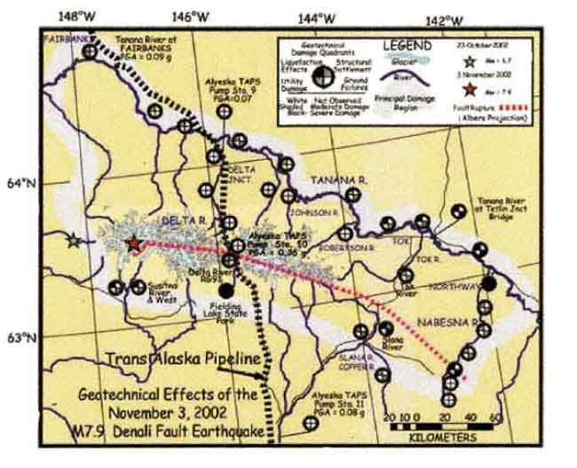
Geotechnical affects of the November 3, 2002 M7.9 Denali Fault earthquake. Peak ground accelerations are presented for Fairbanks and Alyeska Pipeline Service facilities. The region of damaged ground covered over a 500 km wide swath of central Alaska. Details of the severity of damage effects are reported in damage quadrants described in the map legend.
geotech/denaliobs/fig1.html
CONTACT: Robert Kayen
last modified 2018