
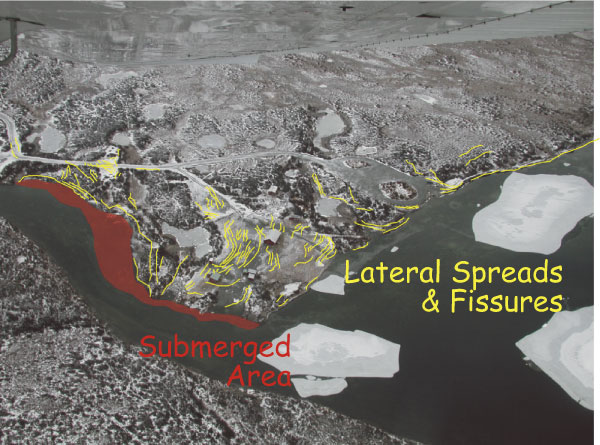
Air photo of liquefaction and lateral spreading at Fielding Lake. The fissures are marked in yellow. A portion of the northern shoreline was laterally spread and submerged.
geotech/denaliobs/fig13.html
CONTACT: Robert Kayen
last modified 2018