
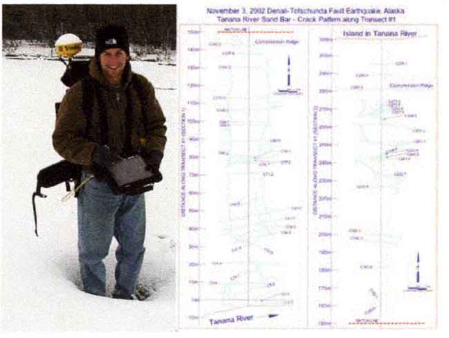
High precision (decimeter-scale) surveys were made using a portable differential GPS mapping unit. On the right is a detail map of lateral spreads on the Tanana River at Tetlin Junction (near SASW Site 588TET).
geotech/denaliobs/fig3.html
CONTACT: Robert Kayen
last modified 2018