
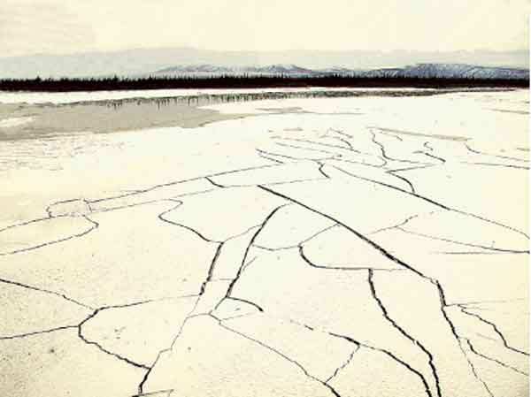
Lateral spreads on bars of the Tanana River. The crust of the bar was frozen to a depth of approximately 0.3 meters at the time of the earthquake and shattered in a polygonal pattern that was observed along several hundred miles of the river deposits (Site 588TET. Tanana River, Tetlin Bridge).
geotech/denaliobs/fig6.html
CONTACT: Robert Kayen
last modified 2018