

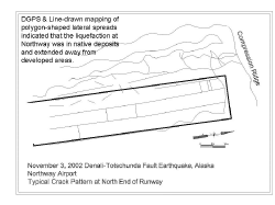


The airport at Northway was rendered unusable by lateral spreading. The frozen surface layer and pavement runway were cut by fissures, many 10-30 cm wide, some more than a meter wide. On the perimeter of the runway were large sand vents and sink holes up to 4 m in diameter and up to 1 m deep. Reports from residents describe pressurized ground water spewing out soil 2-4 m into the air. Parallel and polygon patterns similar to those observed in the Tanana River bars were observed at Northway. Away from the runway, houses and structures were unseated and tilted on their foundations, and road settlements bent and crushed drainage culverts.
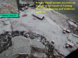
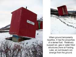
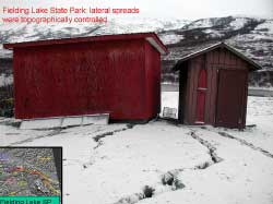
Widespread liquefaction and lateral spreading was observed at Fielding Lake, along the Richardson Highway, where the upper soil crust was not frozen during the earthquake. Seen here were classic features associated with lateral spreading along the lakeshore such as large fissures, spreading cracks, and slumping. Structures on the spreading ground were deformed and displaced, and an underground septic tank buoyed to the surface lifting a small structure.
Click on figures for larger versions
