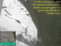
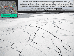
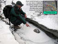

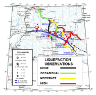
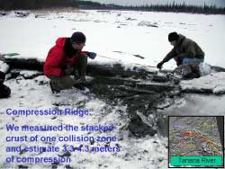
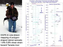
On the north side of the Alaska range in the Tanana River valley extensive liquefaction was observed where very young river deposits were capped by a thin (<0.3m) frozen surface layer at source distances of 50 to 120 km. Tanana River valley liquefaction was widespread from Fairbanks to the west, to at least several hundred km eastward. Liquefaction damage became increasingly severe to the east of Delta, even as the distances to the fault increased. In the Tok region nearly every river bar deposit appear to have failed. Further east, for many kilometers around the towns of Northway and Slana, large continuous lowland areas of liquefaction and lateral spread failures were observed. Two measured transects along the Tanana river at Tetlin bridge showed 1.6% to 3.8% of lateral extension (spreading) of sand bars across distances of 200 meters (21 fissures) and 400 meters (48 fissures). Also, compression zones occurred in some places where separate lateral spreads collided.
In some places the lateral spreads were generally parallel with the direction of extension toward the river. However, in most places the fissures in the frozen surface were sub-linear with random orientations forming networks of polygons that in places were continuous across many acres, and in some places kilometers. In total, Tanana River bar failures covered a vast area.

