
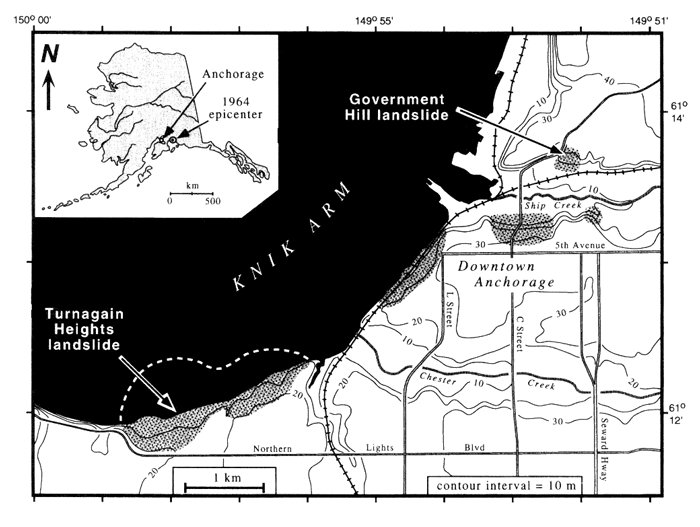
Map of downtown Anchorage with locations of major landslides shown in light gray (generalized from Hansen, 1965).
Dashed line indicates approximate seaward extent of the Turnagain Heights landslide.
geotech/radaraapg/fig1.html
contact: Robert Kayen
last modified 2018