
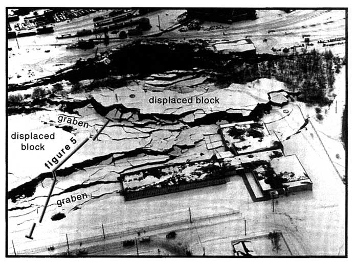
Air photograph of Government Hill landslide, March, 1964. View is to the south. Solid line indicates the profile in Figure 5.
Photographs provided by Anchorage Museum of History and Art (McCutcheon 16238)
geotech/radaraapg/fig4.html
contact: Robert Kayen
last modified 2018