
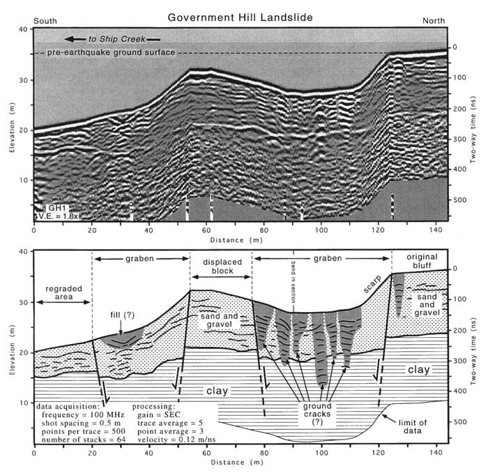
GPR profile across the Government Hill landslide. Lateral movement of slide blocks, normal faulting, and formation of
large graben deformed the flat-lying stratigraphy of original bluff. Wedge-shaped packets of strong reflections in
floor of graben and above main scarp may represent ground cracks infi ]led with poorly consolidated sediment.
Apparent reflections deep in the clay section are probably artifacts (ringing) produced by the radar system.
Depths are based on radar velocity of 0.12 m/ns, nanosecond.
geotech/radaraapg/fig5.html
contact: Robert Kayen
last modified 2018