
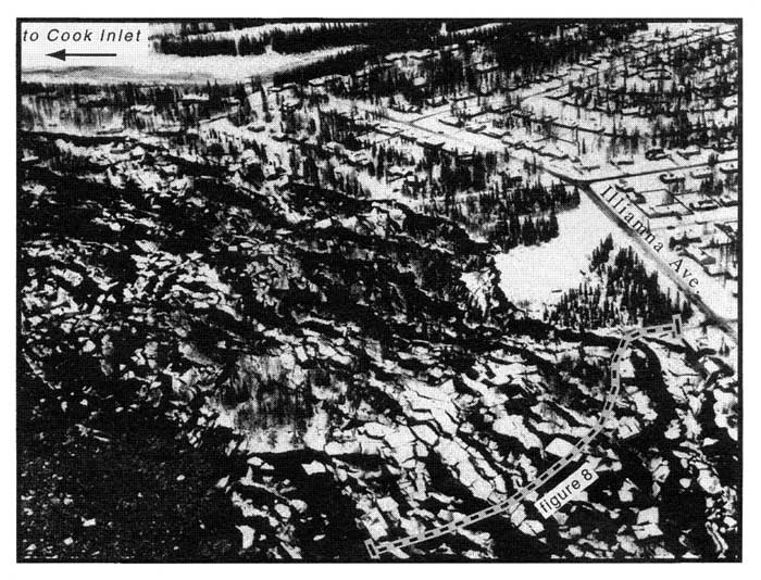
(Aerial photograph of the Turnagain Heights landslide, March, 1964. View is to the east. Dashed line indicates
location of GPR reflection profile in Figure 8. Photograph provided by Anchorage Museum of History and Art (No. B77-118- 10).
geotech/radaraapg/fig7.html
contact: Robert Kayen
last modified 2018