USGS PCMSC

The Loma Prieta, California, Earthquake of October 17, 1989—Liquefaction
Soil Liquefaction in the East Bay During the Earthquake

Figure 18

Map of Oakland Airport and Bay Farm Island.

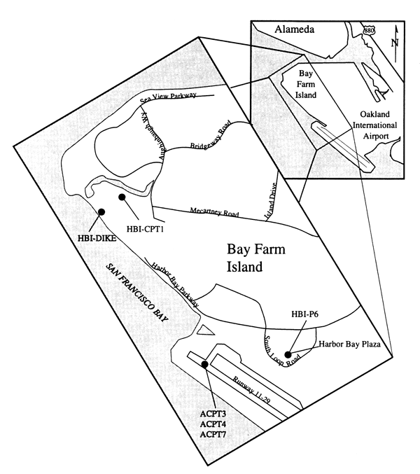
Northern part of Oakland International Airport and Bay Farm Island, showing locations of boreholes (dots).

Back arrowBack to Report

geotech/soil/fig18.html
contact: Robert Kayen
last modified 2018