
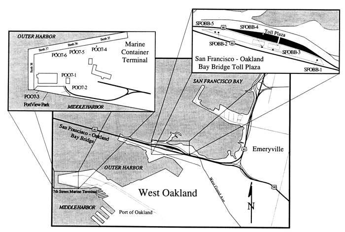
Emeryville-Oakland shoreline, showing locations of boreholes (dots) near San Francisco-Oakland Bay Bridge Toll Plaza and Port of Oakland's Marine Container Terminal at Seventh Street.
geotech/soil/fig5.html
contact: Robert Kayen
last modified 2018