The December 26, 2004 Indian Ocean Tsunami: Initial Findings on Tsunami Sand Deposits, Damage, and Inundation in Sri Lanka
Survey Site Locations and Photos:
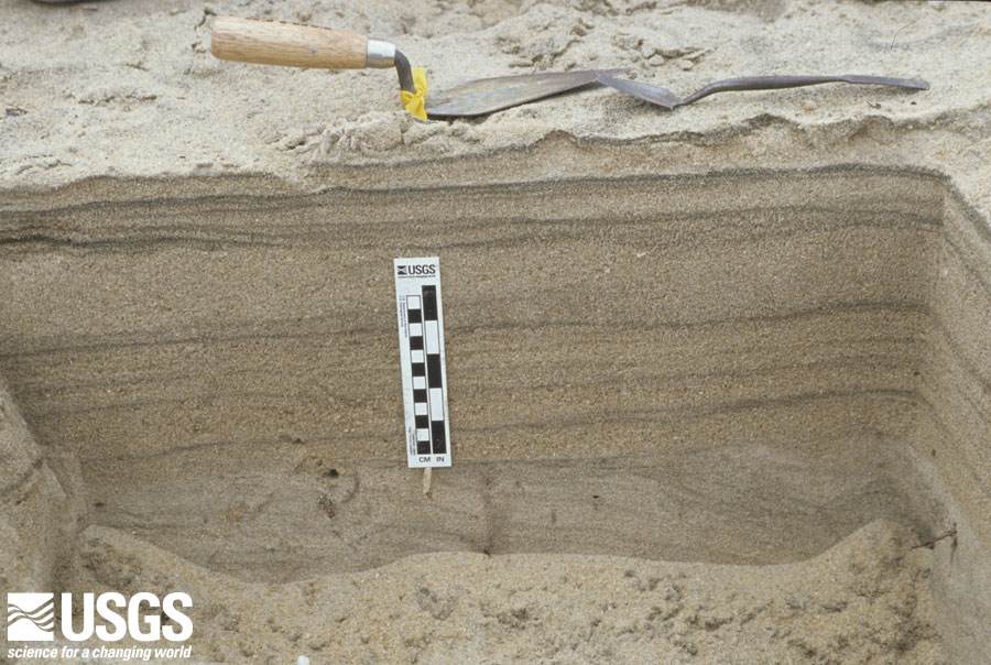
Yala
 |
All images are between 118 kb and 222 kb
Trench at Yala showing the tsunami sand deposit about 22 cm thick. The trowel sizes and orientation point to the primary, secondary, and tertiary flow directions caused by the topography. Ground elevation is about 0.5 m and flow depth was about 4.5 m at this site.