
The December 26, 2004 Indian Ocean Tsunami: Initial Findings on Tsunami Sand Deposits, Damage, and Inundation in Sri Lanka
Survey Site Locations and Photos
2 Kilometers southeast of KuchchaveliClick photo to see a larger image |
|
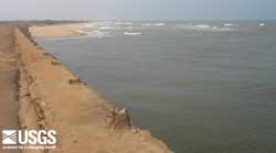
 The tsunami overtopped the bridge, which is 3.7 m above sea level, at Kuchchaveli. (larger image, 137 kb) |
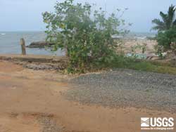
 Tsunami deposit landward of the bridge at Kuchchaveli. View is looking west. (larger image, 82 kb) |
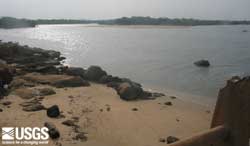
 Possible tsunami deposit at the north end of the bridge at Kuchchaveli. View is looking north. (larger image, 68 kb) |
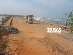
 Section of road repaired on bridge at Kuchchaveli. This road was damaged by the tsunami. The road at the north end of the bridge was washed out by the tsunami. (larger image, 148 kb) |
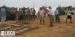 Refugee camp at Kuchchaveli. (larger image, 101 kb) |
|