Other ID: none
Status: Completed
Organization(s): USGS, Woods Hole Coastal and Marine Science Center
Funding Program(s):
Principal Investigator(s): David W. Folger, Bradford Butman
Affiliate Investigator(s):
Information Specialist(s):
Data Type(s): Visual Identification: Ground Truthing, Imagery: Photo, Time Series: Mooring (physical oceanography), Sampling: Geology
Scientific Purpose/Goals: The objective of the ATLANTIC TWIN cruise was to deploy three bottom instrument packages (#104, 105, and 106) on the mid-Atlantic continental shelf to study the frequency, rate and processes of bottom sediment transport.
Vehicle(s):
Start Port/Location: Pt. Pleasant, NJ
End Port/Location: Pt. Pleasant, NJ
Start Date: 1975-12-10
End Date: 1975-12-12
Equipment Used: Mooring tripod, Benthos model 372 camera and strobe, Current, Sediment traps
Information to be Derived: Time series data;
Summary of Activity and Data Gathered: The instrument packages consisted of a 35 mm camera and strobe (Benthos), current meter (EG&G 102), three sediment traps, acoustic release (AMF) and rope canister mounted on a tripod frame. To mark the deployment site and to reduce fishing hazards a lighted surface buoy was deployed near the tripod at two sites. Working days: 2; Ship track: 270 nm (478 km). Tripods deployed: 3 (#104 CINDY, #105 DEBBIE both recovered FA 76003 WHITEFOOT Feb. 21-27, 1976; #106 JERRY recovered FA 76001 SASSAFRAS Jan. 14-17, 1976).
Staff: Bradford Butman, David W. Folger, Phil Shea
Affiliate Staff:
Paul Cousins; Andrew Eliason (Eliason Data Services)
Notes: Original Center People field contained: Brad Butman, Dave Folger, Phil Shea, and Paul Cousins.
Location:
mid-Atlantic Bight, continental shelf, New Jersey, United States, North America, North Atlantic;
| Boundaries | |||
|---|---|---|---|
| North: 39.47059202 | South: 39.24218565 | West: -73.11945154 | East: -72.82314201 |
Platform(s):
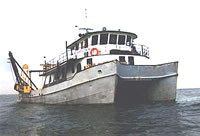 Atlantic Twin |
Butman, B., Noble, M., Folger, D.W., 1979, Long-term observations of bottom current and bottom sediment movement on the mid-Atlantic continental shelf: Journal of Geophysical Research, JGR, v. 84 no. C3, pp. 1187–1205, doi: 10.1029/JC084iC03p01187.
Moody, J.A., and Butman, B., 1980, Semidiurnal bottom pressure and tidal currents on Georges Bank and in the Mid-Atlantic Bight: U.S. Geological Survey Open-File Report 80-1137, https://doi.org/10.3133/ofr801137.
Moody, J.A., Butman, B., Beardsley, R.C., Brown, W.S., Daifuku, P., Irish, J.D., Mayer, D.A., Mofjeld, H.O., Petrie, B., Ramp, S., Smith, P., and Wright, W.R., 1984, Atlas of tidal elevation and current observations on the Northeast American continental shelf and slope: U.S. Geological Survey Bulletin 1611, https://doi.org/10.3133/b1611.
| Title | Survey Equipment | Description |
|---|---|---|
| Cruise report | (document not focused on specific equipment) | Chief Scientist's cruise report describing ship movement, personnel, equipment and data acquisition notes, daily narrative, track map including mooring locations, and equipment schematics. |
| Survey Equipment | Survey Info | Data Type(s) | Data Collected |
|---|---|---|---|
| Mooring tripod | --- | Ground Truthing | |
| Benthos model 372 camera and strobe | --- | Photo | 1975-032-FA-PH-001 (film collection of TRIPOD 105; 19751211-?) |
| Current | --- | Mooring (physical oceanography) | 1975-032-FA-OM-001 (MAB mooring data) |
| Sediment traps | --- | Geology |
