Other ID: none
Status: Completed
Organization(s): USGS, Woods Hole Coastal and Marine Science Center
Funding Program(s):
Principal Investigator(s): Bradford Butman
Affiliate Investigator(s):
Information Specialist(s):
Data Type(s): Time Series: Mooring (physical oceanography)
Scientific Purpose/Goals: The objective of the cruise was to recover one current meter mooring and deploy five current meter moorings on Georges Bank.
Vehicle(s):
Start Port/Location: Woods Hole, MA
End Port/Location: Woods Hole, MA
Start Date: 1976-03-08
End Date: 1976-03-13
Equipment Used: Bottom platform
Information to be Derived: Time series data;
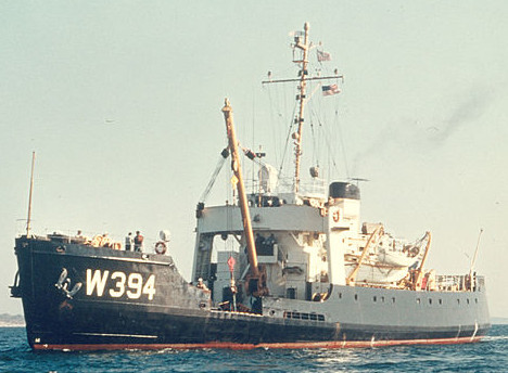
Summary of Activity and Data Gathered: Severe weather was encountered. Several Coast Guard buoys were serviced during the cruise. In addition, two days were spent in search of a drifting buoy. Two moorings were deployed (4 instruments), and one mooring recovered. The HORNBEAM was kindly made available to USGS for the mooring work. Working days: 1; Ship track (excluding CG search pattern): 750 nm (1350 km); Current meter stations: 2; XBTs: 15; Moorings deployed: 2 (#108 and 111, both recovered FA 76031 OCEANUS 13 Aug. 12-24, 1976). Moorings recovered: 1 (#102 deployed FA 75020 HORNBEAM Sep. 16-18, 1975).
Staff: Bradford Butman
Affiliate Staff:
John Vermersch (WHOI); Andrew Eliason (Eliason Data Services)
Notes:
Location:
Georges Bank, United States, North America, North Atlantic,
| Boundaries | |||
|---|---|---|---|
| North: 42.37928574 | South: 40.73061852 | West: -67.78223126 | East: -65.67122083 |
Platform(s):
 Hornbeam |
| Title | Survey Equipment | Description |
|---|---|---|
| Cruise report | (document not focused on specific equipment) | Chief Scientist's cruise report of ship movement, personnel, equipment and data acquisition, with approximate cruise track. |
| Survey Equipment | Survey Info | Data Type(s) | Data Collected |
|---|---|---|---|
| Bottom platform | --- | Mooring (physical oceanography) | 1976-006-FA-OM-001 (Georges Bank Sediment mooring data) |