Other ID: none
Status: Completed
Organization(s): USGS, Woods Hole Coastal and Marine Science Center
Funding Program(s):
Principal Investigator(s): Bradford Butman
Affiliate Investigator(s):
Information Specialist(s):
Data Type(s): Imagery: Photo, Sampling: Geology, Time Series: Mooring (physical oceanography)
Scientific Purpose/Goals: This WHITEFOOT cruise was planned in response to the ARGO MERCHANT oil spill. Objectives were to deploy 1 current meter mooring (#123) and 1 tripod (#121) to determine subsurface flow pattern over Nantucket Shoals to predict and hindcast oil spill trajectories and monitor bottom conditions, particularly to observe any oil sinking to the bottom; and to obtain bottom grab samples at several shallow locations to determine if any oil was reaching the bottom.
Vehicle(s):
Start Port/Location: Woods Hole, MA
End Port/Location: Woods Hole, MA
Start Date: 1976-12-22
End Date: 1976-12-29
Equipment Used: Van Veen grab sampler, Camera- deep sea, Current
Information to be Derived:
Summary of Activity and Data Gathered: Tripod deployed: 1 (#121 recovered FA 77009 WHITEFOOT Mar. 8 - Apr. 17, 1977); Current meter deployed: 1 (#123 recovered FA 77009 WHITEFOOT Mar. 8 - Apr. 17, 1977); Samples: 2.
Staff: Bradford Butman, David W. Folger, William J. Strahle
Affiliate Staff:
Notes: Project = ARGO MERCHANT Oil Spill, ARGO MERCHANT Oil Spill
Location:
Nantucket Shoals, Massachusetts, United States, North America, North Atlantic;
| Boundaries | |||
|---|---|---|---|
| North: 40.93518736 | South: 40.75881587 | West: -69.22455137 | East: -69.0347349 |
Platform(s):
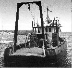
 Whitefoot |
| Title | Survey Equipment | Description |
|---|---|---|
| Cruise report | (document not focused on specific equipment) | Chief Scientist's cruise report of ship movement, personnel, equipment and data acquisition. Includes trackmap as well as a schematic of the bottom tripod. |
| Survey Equipment | Survey Info | Data Type(s) | Data Collected |
|---|---|---|---|
| Van Veen grab sampler | --- | Geology | |
| Camera- deep sea | --- | Photo | 1976-048-FA-PH-001 (film collection of TRIPOD 121; 19761228-19970417) |
| Current | --- | Mooring (physical oceanography) | 1976-048-FA-OM-001 (A moored array deployed after the ARGO MERCHANT ran aground on Nantucket Shoals designed to help understand the fate of the spilled oil) |