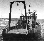
Other ID: Legs I, II, III, and IV
Status: Completed
Organization(s): USGS, Woods Hole Coastal and Marine Science Center
Funding Program(s):
Principal Investigator(s): Bradford Butman
Affiliate Investigator(s):
Information Specialist(s):
Data Type(s): Environmental Data: Conductivity, Environmental Data: Temperature, Imagery: Photo, Time Series: Mooring (physical oceanography)
Scientific Purpose/Goals: The WHITEFOOT cruises were conducted to recover and deploy oceanographic instrumentation on Georges Bank and on the New Jersey continental shelf. Due to severe winter weather and problems encountered in recovering instrumentation, four trips were required to complete the necessary work. Objectives were to: recover (#120) and deploy (#126) one tripod on Georges Bank; recover ARGO MERCHANT current meter array (moorings #123, 124 and 125); recover one tripod (#121) and surface buoy in Great South Channel (part of ARGO MERCHANT array); recover (#119) and deploy one tripod (#122) off New Jersey; and make XBT observations to determine temperature structure in the vicinity of current and tripod moorings.
Vehicle(s):
Start Port/Location: Woods Hole, MA
End Port/Location: Woods Hole, MA
Start Date: 1977-03-08
End Date: 1977-04-17
Equipment Used: XBT, Trident subsurface porewater conductivity probe, Camera- deep sea, Bottom platform
Information to be Derived: Time series data;
Summary of Activity and Data Gathered: This cruise was conducted in four legs due to weather constraints. Leg I: March 8-11, 1977; Leg II: March 14-20, 1977; Leg III: March 31 - April 5, 1977; Leg IV: April 15-17, 1977. Moorings recovered: 6 (#119 and 120 both deployed FA 76047 OCEANUS 17 Dec. 3-10, 1976; #121 and 123 both deployed FA 76048 WHITEFOOT Dec. 22-29, 1976; and #124 and 125 both deployed FA 76049 OCEANUS 20 Dec. 28-29, 1976). Moorings deployed: 2 (#122 and 126 both recovered FA 77023 OCEANUS 29 Jul. 6-13, 1977). XBTs: 41; Surface salinity samples: 41.
Staff: Bradford Butman, Charles E. Deadmon, William J. Strahle, John West
Affiliate Staff:
Notes:
Location:
Georges Bank, Great South Channel, New Jersey continental shelf, United States, North America, North Atlantic;
| Boundaries | |||
|---|---|---|---|
| North: 41.5 | South: 38.3 | West: -73.75 | East: -67.25 |
Platform(s):
 Whitefoot |
Moody, J.A., and Butman, B., 1980, Semidiurnal bottom pressure and tidal currents on Georges Bank and in the Mid-Atlantic Bight: U.S. Geological Survey Open-File Report 80-1137, https://doi.org/10.3133/ofr801137.
Moody, J.A., Butman, B., Beardsley, R.C., Brown, W.S., Daifuku, P., Irish, J.D., Mayer, D.A., Mofjeld, H.O., Petrie, B., Ramp, S., Smith, P., and Wright, W.R., 1984, Atlas of tidal elevation and current observations on the Northeast American continental shelf and slope: U.S. Geological Survey Bulletin 1611, https://doi.org/10.3133/b1611.
| Title | Survey Equipment | Description |
|---|---|---|
| Document 200 | (document not focused on specific equipment) | Chief Scientist's cruise report, equipment and data acquisition notes, track map including mooring locations. |
| Survey Equipment | Survey Info | Data Type(s) | Data Collected |
|---|---|---|---|
| XBT | --- | Temperature | |
| Trident subsurface porewater conductivity probe | --- | Conductivity | |
| Camera- deep sea | --- | Photo | 1977-009-FA-PH-001 (film collection of TRIPOD 126; 19770416-19770708) 1977-009-FA-PH-002 (film collection of TRIPOD 122; 19770402-19770710) |
| Bottom platform | --- | Mooring (physical oceanography) | 1977-009-FA-OM-001 (Georges Bank Sediment mooring data) 1977-009-FA-OM-002 (MAB mooring data) |