Other ID: Legs I and II
Status: Completed
Organization(s): USGS, Woods Hole Coastal and Marine Science Center
Funding Program(s):
Principal Investigator(s): Bradford Butman, William J. Strahle
Affiliate Investigator(s):
Information Specialist(s):
Data Type(s): Environmental Data: CTD, Environmental Data: Temperature, Imagery: Photo, Location-Elevation: Navigation, Time Series: Mooring (physical oceanography)
Scientific Purpose/Goals: 1. Recover 5 instrumented bottom tripod packages and deploy 2 tripods as part of a continuing study of currents and sediment transport on the east coast continental shelf. 2. Recover 2 current meter moorings and deploy 3 current meter moorings as part of a continuing study of currents and sediment transport. Deploy 2 current moorings for EG&G. 3. Make underway XBT observations of water temperature and structure and obtain profiles of temperature and conductivity (CTD) along selected transects running across shelf and along shelf. Measurements were designed to determine position of shelf-slope water front, to aid in interpretation of tripod and current meter data, to map distribution of cold pool water found on the shelf in summer off the New Jersey coast, and to study mixing through Great South Channel. 4. Recover, replace, and relight as necessary surface marker floats at tripod and current meter locations. Floats serve to mark instrument locations and deter fishing activity.
Vehicle(s):
Start Port/Location: Wilmington, NC
End Port/Location: Woods Hole, MA
Start Date: 1977-09-07
End Date: 1977-09-23
Equipment Used: XBT, CTD 19+ with OBS, PAR, DO, Chl, Camera- deep sea, Loran-C, Bottom platform
Information to be Derived: Time series data;
Summary of Activity and Data Gathered: LEG I: Recovered tripods: 3 (#129 and 131 both deployed FA 77023 OCEANUS 29 Jul. 6-13, 1977; #134 deployed FA 77028 ADVANCE II Aug. 5-7, 1977); XBT: 65; Surface salinity samples: 64. LEG II: Recovered moorings: 4 (#128, 130, 132, and 133 all deployed FA 77023 OCEANUS 29 Jul. 6-13, 1977); Deployed moorings: 5 (#135, 136 and 137, and 2 EG&G current meters, all recovered FA 78001 OCEANUS 38 Jan. 19-26, 1978); XBT: 65; CTD: 49; Surface salinity samples: 110; XSTD: 2.
Staff: Bradford Butman, Charles E. Deadmon, William J. Strahle, John West, Marlene Noble
Affiliate Staff:
Andrew Eliason - Eliason Data Services; R. Reynolds - EG&G
Notes: Original Center People field contained: Leg I (Sep. 7-13, 1977): William Strahle - Ch. Sci./e. eng., John West - tech.; Leg II (Sep. 15-23, 1977): Brad Butman - Ch. Sci./oceanographer, Charles Deadmon - tech., Marlene Noble - physicist, William Strahle - e. eng., John West - tech.
Location:
United States south Atlantic shelf, Mid-Atlantic Bight, Georges Bank, United States, North America, North Atlantic;
| Boundaries | |||
|---|---|---|---|
| North: 42.15 | South: 30.9 | West: -82 | East: -67.4 |
Platform(s):
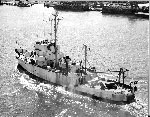
 Advance II |
Gelfenbaum, G., and Noble, M., 1993, Significant bed elevation changes related to Gulf Stream dynamics on the South Carolina continental shelf: Continental Shelf Research, v. 13 no. 4, doi: 10.1016/0278-4343(93)90057-5.
Moody, J.A., and Butman, B., 1980, Semidiurnal bottom pressure and tidal currents on Georges Bank and in the Mid-Atlantic Bight: U.S. Geological Survey Open-File Report 80-1137, https://doi.org/10.3133/ofr801137.
Moody, J.A., Butman, B., Beardsley, R.C., Brown, W.S., Daifuku, P., Irish, J.D., Mayer, D.A., Mofjeld, H.O., Petrie, B., Ramp, S., Smith, P., and Wright, W.R., 1984, Atlas of tidal elevation and current observations on the Northeast American continental shelf and slope: U.S. Geological Survey Bulletin 1611, https://doi.org/10.3133/b1611.
Noble, M.A., and Gelfenbaum, G.R., 1992, Seasonal fluctuations in sea level on the South Carolina shelf and their relationship to the Gulf Stream: Journal of Geophysical Research - Oceans, v. 97 no. C6, URL: http://europa.agu.org/?view=article&uri=/journals/jc/92JC00811.xml&t=noble.
| Title | Survey Equipment | Description |
|---|---|---|
| Cruise report | (document not focused on specific equipment) | Chief Scientist's cruise report describing ship movement, personnel, equipment and data acquisition notes, track maps, daily log, XBT and CTD station sampling procedures, and station locations. |
| Survey Equipment | Survey Info | Data Type(s) | Data Collected |
|---|---|---|---|
| XBT | --- | Temperature | |
| CTD 19+ with OBS, PAR, DO, Chl | --- | CTD | |
| Camera- deep sea | --- | Photo | 1977-032-FA-PH-001 (film collection of TRIPOD 136; 19770919-19780124) |
| Loran-C | --- | Navigation | |
| Bottom platform | --- | Mooring (physical oceanography) | 1977-032-FA-OM-001 (Georges Bank Sediment mooring data) 1977-032-FA-OM-002 (MAB mooring data) 1977-032-FA-OM-003 (SAB mooring data) |