Other ID: none
Status: Completed
Organization(s): USGS, Woods Hole Coastal and Marine Science Center
Funding Program(s):
Principal Investigator(s): Bradford Butman
Affiliate Investigator(s):
Information Specialist(s):
Data Type(s): Environmental Data: Temperature, Imagery: Photo, Time Series: Mooring (physical oceanography)
Scientific Purpose/Goals: Replace bottom tripod system (#157) deployed on ATLANTIS II 103 (FA 78031) suspected of malfunctioning; deploy additional surface marker buoy at station for additional protection from bottom trawling; attempt to recover by grappling subsurface current mooring #162. (Trawler OCEAN STATE from Pt. Judith, RI fished up entire mooring. Flotation was returned but 1 VACM-TR and release dropped to bottom when chain parted.)
Vehicle(s):
Start Port/Location: Woods Hole, MA
End Port/Location: Woods Hole, MA
Start Date: 1978-10-30
End Date: 1978-11-02
Equipment Used: XBT, Camera- deep sea, Bottom platform
Information to be Derived: Time series data; Samples and chemical analysis;
Summary of Activity and Data Gathered: Unable to recover Mooring #162 with grapple; instruments slipped from wire twice in rough seas; recovered small marker float only. Mooring recovered: 1 (#157 deployed FA 78031 ATLANTIS II Sep. 28 - Oct. 5, 1978). Moorings deployed: 2 (#166 and 167, recovered FA 79002 OCEANUS 56 Mar. 6-15, 1979). XBT stations: 4; Surface salinity samples: 4.
Staff: Bradford Butman
Affiliate Staff:
Nicholas (Nick) Lefteriou; Andrew Eliason - Eliason Data Services
Notes: Original Center People field contained: Brad Butman - Ch. Sci.; Nicholas (Nick) Lefteriou.
Location:
continental shelf south of Martha's Vineyard, Massachusetts, United States, North America, North Atlantic;
| Boundaries | |||
|---|---|---|---|
| North: 40.51809078 | South: 40.47376553 | West: -70.53720853 | East: -70.48125036 |
Platform(s):
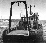
 Whitefoot |
| Title | Survey Equipment | Description |
|---|---|---|
| Cruise report | (document not focused on specific equipment) | Chief Scientist's report of personnel, objectives, and daily narrative. Includes map of of tripod and current mooring deployments. |
| Survey Equipment | Survey Info | Data Type(s) | Data Collected |
|---|---|---|---|
| XBT | --- | Temperature | |
| Camera- deep sea | --- | Photo | 1978-035-FA-PH-001 (film collection of TRIPOD 166; 19781031-19790306) |
| Bottom platform | --- | Mooring (physical oceanography) | 1978-035-FA-OM-001 (Georges Bank Sediment mooring data) |