Other ID: none
Status: Completed
Organization(s): USGS, Woods Hole Coastal and Marine Science Center
Funding Program(s):
Principal Investigator(s): Bradford Butman
Affiliate Investigator(s):
Information Specialist(s):
Data Type(s): Time Series: Mooring (physical oceanography)
Scientific Purpose/Goals: Recover a pressure mooring off Nantucket Island (mooring #256).
Vehicle(s):
Start Port/Location: Woods Hole, MA
End Port/Location: Woods Hole, MA
Start Date: 1982-05-26
End Date: 1982-05-26
Equipment Used: Bottom platform
Information to be Derived: Time series data;
Summary of Activity and Data Gathered: Release confirmed, but mooring would not release. Recovered via dragging. Float came to surface after being touched by grappling hook; pressure sensor lost. Mooring recovered: 1 (#256 deployed FA 82011 WHITEFOOT Apr. 21, 1982).
Staff: Bradford Butman, William J. Strahle
Affiliate Staff:
Frank Musialowski
Notes: Original Center People field contained: Brad Butman, Frank Musialowski, William Strahle.
Location:
6 miles south of Smith Point, Nantucket Shoals, Nantucket Island, Massachusetts, United States, North America, North Atlantic;
| Boundaries | |||
|---|---|---|---|
| North: 41.20684295 | South: 41.05835649 | West: -70.26681924 | East: -70.07805166 |
Platform(s):
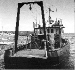
 Whitefoot |
| Title | Survey Equipment | Description |
|---|---|---|
| Cruise report | (document not focused on specific equipment) | Chief Scientist's cruise report including personnel, equipment, brief narrative and map with mooring location. |
| Survey Equipment | Survey Info | Data Type(s) | Data Collected |
|---|---|---|---|
| Bottom platform | --- | Mooring (physical oceanography) | 1982-015-FA-OM-001 (Georges Bank Sediment mooring data) |