Other ID: 149
Status: Completed
Organization(s): USGS, Woods Hole Coastal and Marine Science Center
Funding Program(s):
Principal Investigator(s): Bradford Butman
Affiliate Investigator(s):
Information Specialist(s):
Data Type(s): Electro-Magnetic: Magnetics, Environmental Data: CTD, Imagery: Photo, Location-Elevation: Navigation, Time Series: Mooring (physical oceanography)
Scientific Purpose/Goals: This cruise was part of a continuing study of currents and sediment transport on the Continental Slope. The major objectives of the cruise were: 1) to recover Slope Array II (three subsurface moorings at stations SA, SE, and SF, and a bottom tripod at T); 2) to deploy Slope Array III (five subsurface moorings at stations SA, SE, SF, SG, and SH, and one bottom tripod at station T); 3) to recover and redeploy four surface guard buoys at stations SF and T; and 4) to conduct a hydrographic survey across the outer shelf and upper slope between 68 and 71 degrees W.
Vehicle(s):
Start Port/Location: Woods Hole, MA
End Port/Location: Woods Hole, MA
Start Date: 1984-03-12
End Date: 1984-03-19
Equipment Used: Magnetometer (wh), CTD 19+ with OBS, PAR, DO, Chl, Camera- deep sea, Northstar 6000 LORAN-C, Bottom platform
Information to be Derived: Time series data;
Summary of Activity and Data Gathered: Moorings deployed: 6 (#277, 278, 279, 280, 281, and 282 recovered FA 84024 OCEANUS 159 Nov. 13-24, 1984). Moorings recovered: 4 (#273, 274, 275, and 276, all deployed FA 83011 OCEANUS 149 Oct. 17-24, 1983). All mooring work was completed as planned. Bad weather curtailed mooring operations for one full day and made work difficult during most of the cruise. A moderate CTD survey was completed. The current meter on the bottom tripod system failed after about 3 weeks, probably because of a bad connecting cable. To assure near-bottom current data, an additional subsurface mooring was deployed at station T on OCEANUS cruise 154 by M. Briscoe on May 16, 1984. Hydrography: CTD: 18; XBT: 18; Salinity: 51; Suspended sediment oxygen: 15; Suspended sediment nutrients: 34.
Staff: Michael Bothner, Bradford Butman, Mary E. Hastings, Barry Irwin, Joseph S. Newell, Carol M. Parmenter, Lawrence Poppe, William J. Strahle
Affiliate Staff:
Jay Pulliam
Cathy O'Dell; Andrew Eliason (Eliason Data Service)
Notes: Original Center People field contained: Brad Butman, Mike Bothner, Jay Pulliam, Cathy O'Dell, Joseph Newell, Carol Parmenter, Lawrence Poppe, Barry Irwin, Mary Polly Shoukimas, William Strahle.
Project = Dynamics of Currents and Sediment Transport on the Continental Shelf and Slope, Dynamics of Currents and Sediment Transport on the Continental Shelf and Slope
Location:
southern New England Shelf and slope, United States, North America, North Atlantic;
| Boundaries | |||
|---|---|---|---|
| North: 40.18333 | South: 39.75 | West: -71 | East: -68 |
Platform(s):
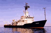
 Oceanus |
Butman, B., Moody, J.A., and Conley, S.J., 1987, Hydrography of the New England shelf and slope; data report for R/V Oceanus Cruise 149, March 12-19, 1984: U.S. Geological Survey Open-File Report 87-179, https://doi.org/10.3133/ofr87179.
| Title | Survey Equipment | Description |
|---|---|---|
| Cruise report | (document not focused on specific equipment) | Chief Scientist's report of ship movement, personnel, equipment and data acquisition notes, trackcharts, station locations, deck log and Loran log. |
| Survey Equipment | Survey Info | Data Type(s) | Data Collected |
|---|---|---|---|
| Magnetometer (wh) | --- | Magnetics | 1984-004-FA-GP-001 (Digital tape of MG data: inv. # 1018.) |
| CTD 19+ with OBS, PAR, DO, Chl | --- | CTD | 1984-004-FA-OM-002 (Digital tapes of CTD STATION DATA.) |
| Camera- deep sea | --- | Photo | 1984-004-FA-PH-001 (film collection of TRIPOD 280; 19840316-19841118) |
| Northstar 6000 LORAN-C | --- | Navigation | 1984-004-FA-LN-001 (Digital tapes of NV data: inv. # 2904 thru 2906.) |
| Bottom platform | --- | Mooring (physical oceanography) | 1984-004-FA-OM-001 (NE slope mooring data) |