Other ID: OC159
Status: Completed
Organization(s): USGS, Woods Hole Coastal and Marine Science Center
Funding Program(s):
Principal Investigator(s): Bradford Butman
Affiliate Investigator(s):
Information Specialist(s):
Data Type(s): Environmental Data: CTD, Imagery: Photo, Time Series: Mooring (physical oceanography)
Scientific Purpose/Goals: This cruise was part of a study of currents and sediment transport on the continental slope. Major objectives were: 1) to recover an array of current meters and bottom instruments deployed on the continental slope in March 1984 (Slope Array III); and 2) to conduct a hydrographic survey across the outer shelf and upper slope between 68 and 71 degrees W. OC159 was the third and last cruise associated with the long-term slope measurements.
Vehicle(s):
Start Port/Location: Woods Hole, MA
End Port/Location: Woods Hole, MA
Start Date: 1984-11-13
End Date: 1984-11-20
Equipment Used: CTD 19+ with OBS, PAR, DO, Chl, Camera- deep sea, Bottom platform
Information to be Derived: Time series data;Samples and chemical analysis;
Summary of Activity and Data Gathered: Moorings recovered: 7 (#277, 278, 279, 280, 281, and 282 all deployed FA 84004 OCEANUS 149 Mar. 12-19, 1984; #283 deployed FA 84031 OCEANUS 154 May 16-23, 1984). OC159 was the last in a series of 3 cruises conducted as part of a USGS program to study currents and sediment transport on the Continental Slope. The program is supported by the USGS and by the Minerals Management Service. Despite the weather, all major scientific objectives were accomplished. All moorings were recovered and a moderate CTD survey was completed. One section was repeated 3 times during the cruise which should illustrate temporal changes in suspended sediment during typical storm conditions. A 1-m Sea Tech transmissometer was used to make suspended sediment observations. The oxygen sensor on the CTD failed early in the cruise. Two moorings did not surface although both releases indicated that the release mechanism functioned. Both moorings were recovered by dragging. The mooring at SE was jarred free. The mooring at SA was cut above the lower current meter and release. Close inspection of the release recovered at station SE suggests that crevice corrosion in the release pin may have held the mechanism closed. 15 of 16 current meters and 1 tripod were recovered. CTD stations: 41; XBT stations: 3; Salinity samples: 65; Suspended sediment samples: 54; Nutrient samples: 24.
Staff: Dann Blackwood, Michael Bothner, Bradford Butman, Gregory DiLisio, Mary E. Hastings, John Larson, John Moody, Joseph S. Newell, Carol M. Parmenter, Richard Rendigs, William J. Strahle
Affiliate Staff:
Andrew Eliason - Eliason Data Services
Notes: Original Center People field contained: Brad Butman (Ch. Sci.), Dann Blackwood, Mike Bothner, Gregg DiLisio, John Larson, John Moody, Joseph Newell, Carol Parmenter, Richard Rendigs, Mary Polly Shoukimas, William Strahle.
Project = Currents and Sediment Transport on the Continental Slope, Currents and Sediment Transport on the Continental Slope
Location:
southern New England shelf and slope, Massachusetts, United States, North America, North Atlantic;
| Boundaries | |||
|---|---|---|---|
| North: 40.4 | South: 39 | West: -71 | East: -68.3 |
Platform(s):
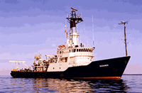
 Oceanus |
Butman, B., Moody, J.A., and Conley, S.J., 1987, Hydrography of the New England shelf and slope; data report for R/V Oceanus Cruise 159, November 13-20, 1984: U.S. Geological Survey Open-File Report 87-350, https://doi.org/10.3133/ofr87350.
| Title | Survey Equipment | Description |
|---|---|---|
| Cruise report | (document not focused on specific equipment) | Chief Scientist's report including objectives, personnel, daily narrative, cruise summary, and tabulation of information. Also includes maps of mooring locations, table of hydrographic stations locations, and the ship's Loran log and deck log. |
| Survey Equipment | Survey Info | Data Type(s) | Data Collected |
|---|---|---|---|
| CTD 19+ with OBS, PAR, DO, Chl | --- | CTD | 1984-024-FA-OM-001 (Digital tape(s) of CTD STATION DATA, ) |
| Camera- deep sea | --- | Photo | 1984-024-FA-PH-001 (USGS OC159 Scientific Party (jpeg file) Photograph of USGS scientific party aboard OCEANUS 159 mooring and hydrographic cruise, New England continental shelf and slope, November 13-20, 1984. Left to right: Polly Shoukimas, Carol Parmenter, Andy Eliason, Mike Bothner, Joe Newell, Brad Butman, Rick Rendigs, Bill Strahle, John Larson, John Moody, and Gregg DiLisio. Photo by Dann Blackwood.) |
| Bottom platform | --- | Mooring (physical oceanography) | 1984-024-FA-OM-002 (NE slope mooring data) |